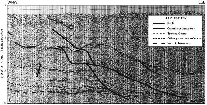
Figure 4D. Seismic-reflection profile of the West Virginia Valley and Ridge province section sketched in figure 4B. Arrows show sense of movement along faults. Profile shows seismic data collected along a line approximately 21 mi long.
This page is https://pubs.usgs.gov/bulletin/b2163/html/fig4d.html
Maintained by Eastern Publications Group Web Team
Last updated 02.15.01 (krw)