Previous Section: Box D
Next Section: Acknowledgments
Return to Table of Contents
Return to Home Page
The focus of this report has been to illustrate the importance of systematic, long-term collection of water-level data. Such data are crucial to the investigation and resolution of many complex water-resources issues commonly faced by hydrologists, engineers, water-supply managers, regulatory agencies, and the public. To ensure that adequate water-level data are being collected for present and anticipated future uses, observation-well networks and water-level monitoring programs at the local, State, and Federal level need to be evaluated periodically. In the course of these evaluations, several questions might be asked. Are data being collected from areas that represent the full range in variation in topographic, hydrogeologic, climatic, and land-use environments? Are plans to ensure long-term viability of observation-well networks and data-collection programs being made? How are the data stored, accessed, and disseminated? Who are the principal users of water-level data, and are the needs of these users being met?
To ensure that adequate water-level data are being collected for present and anticipated future uses, observation-well networks and water-level monitoring programs at the local, State, and Federal level need to be evaluated periodically.
Careful planning and design are required to ensure the collection of high-quality
water-level data over the period of time needed to compile a useful hydrologic
record of water-level changes. A further challenge is to supplement the long-term
monitoring wells as hydrologic conditions in aquifers evolve. A comprehensive
monitoring program should consider aquifers substantially affected by ground-water
pumping, areas of future ground-water development, surficial aquifers that serve
as major areas of ground-water recharge, and links with water-quality and surface-water
monitoring.
A commitment to long-term monitoring is needed to avoid data gaps resulting
from an inadequate distribution of observation wells or periods of no measurements
in a hydrologic record. Many agencies lack formalized written plans for the
design and operation of ground-water-level networks, and many agencies have
difficulty maintaining funding and program continuity necessary to ensure long-term
collection of water-level data. Disruptions in the hydrologic record provided
by water-level data collection and the gaps in data coverage can hinder the
ability of water-resources managers to make sound resource-management decisions.
Where water-level data are not available, hydrologic information needed to address
critical ground-water problems may be impossible to obtain. Much recent effort
has been made in the application of computer modeling techniques to forecast
future ground-water levels. However, the successful application of even these
advanced methods requires that sufficient water-level data are available.
More effort is needed to increase the amount of ground-water-level data stored
in electronic databases, to increase the compatibility between databases, and
to improve access to ground-water-level data on the Internet. Although some
water-level databases can be accessed in this way, detailed and complete records
of historical water-level data usually are limited or unavailable. In many agencies,
large backlogs of historical ground-water-level data have not been entered into
electronic databases, let alone made available on the Internet. Consequently,
potentially useful data are residing in paper files where accessibility and
utility are very limited.
Finally, to increase the collection and accessibility of water-level data, agencies
need to examine ways to increase interagency coordination in constructing and
maintaining observation-well networks, collecting water-level measurements,
and sharing and disseminating data. Greater interagency cooperation will help
ensure that data-collection efforts are sufficient to address issues relevant
to the greatest variety of local, State, regional, and national water-resources
issues.
In many agencies, large backlogs of historical water-level data have not been entered into electronic databases, let alone made available on the Internet. Consequently, potentially useful data are residing in paper files where accessibility and utility are very limited.
To increase the collection and accessibility of water-level data, agencies need to examine ways to increase interagency coordination in constructing and maintaining observation-well networks, collecting water-level measurements, and sharing and disseminating data.
 |
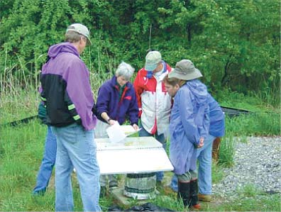
| Members of State and Federal agencies and local citizens group discuss results of ground-water-level monitoring at a landfill research site in Connecticut. Photograph by Susan Soloyanis. |
[an error occurred while processing this directive]