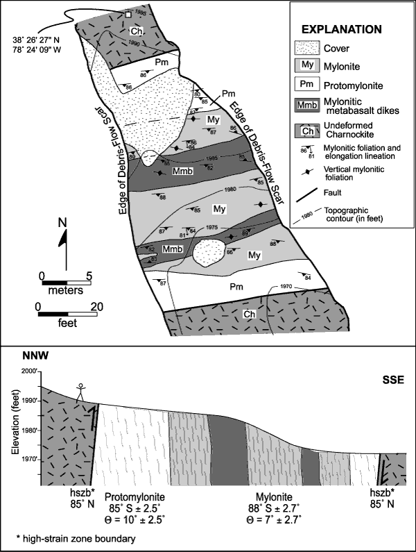
Figure 15.
Detailed geologic map showing ~30-m (100-ft)-wide high-strain zone exposed in debris-flow scar at Stop 18. Cross section shows structural relations approximately perpendicular to strike of units.
U.S. Department of the Interior
,
U.S. Geological Survey
URL: https:// pubsdata.usgs.gov /pubs/circ/2004/1264/html/trip2/fig15.html
For more information, contact
Richard Tollo
Maintained by
Reston Publications Service Center
Last modified: 12:24:09 Wed 23 Nov 2016
Privacy statement
|
General disclaimer
|
Accessibility