U.S. Geological Survey: Science for a Changing World - USGS visual identifier and link to main Web site at http://www.usgs.gov/

Regional map showing the location of the field trip area, the distribution of Jurassic dikes in a part
   of the Shenandoah Valley, Va., and the middle Eocene igneous rocks in the
   central Appalachian Valley and Ridge province. For a more detailed explanation, contact Jonathan Tso at jtso@radford.edu.
 
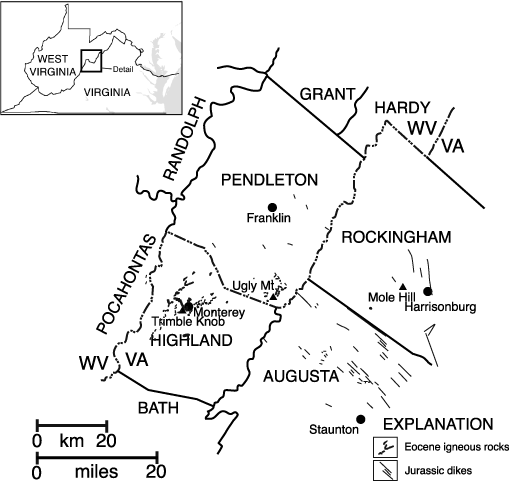
Figure 1. Regional map showing the location of the field trip area (in the central box in the upper left inset), the distribution of Jurassic dikes in a part of the Shenandoah Valley, Va., and the middle Eocene igneous rocks in the central Appalachian Valley and Ridge province (modified from Southworth and others, 1993).

U.S. Department of the Interior, U.S. Geological Survey
URL: https:// pubsdata.usgs.gov /pubs/circ/2004/1264/html/trip4/fig1.html
For more information, contact Jonathan Tso
Maintained by Reston Publications Service Center
Last modified: 12:24:18 Wed 23 Nov 2016
Privacy statement | General disclaimer | Accessibility