|
| | | |
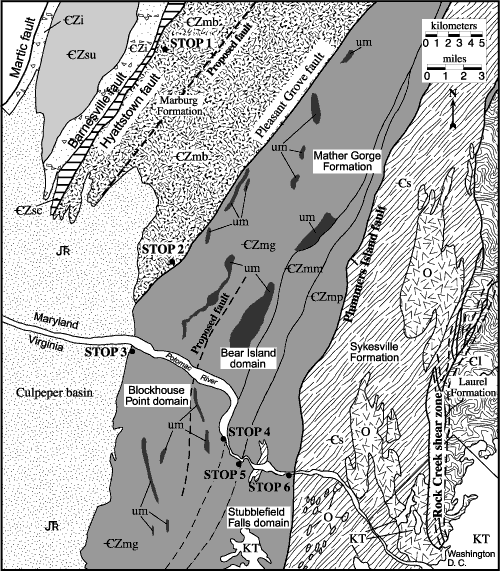
Figure 2. Geologic map of parts of the Westminster and Potomac terranes, Maryland, Virginia,
and Washington, D.C. The Pleasant Grove fault separates the Westminster
terrane on the west from the Potomac terrane on the east. Geologic map-unit
symbols are as follows: CZmg, Mather Gorge Formation; CZmp, chlorite-sericite
phyllonite of the Mather Gorge Formation; CZmm, migmatitic Mather Gorge
Formation; CZi, Ijamsville Phyllite; CZmb, Marburg Formation; CZsc, Sams Creek
Formation;
CZsu, undifferentiated metasiltstone, phyllite, quartzite, and metagraywacke;
Cs, Sykesville Formation; Cl, Laurel Formation; O, Ordovician plutons; um,
ultramafics; JTR , Late Triassic and Early Jurassic rocks; KT, Cretaceous
and Tertiary Coastal Plain deposits. Faults are as indicated and are dashed
where inferred. Modified from Davis and others (2002). |
