U.S. Geological Survey: Science for a Changing World - USGS visual identifier and link to main Web site at http://www.usgs.gov/

Index map of the Eastern United States showing the location of the field trip (star) near Great Falls of the Potomac River. For a more detailed explanation, contact Paul Bierman at pbierman@zoo.uvm.edu.

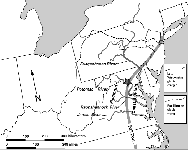
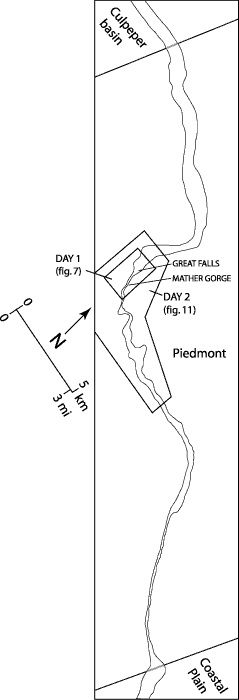
Figure 1. A (above), Index map of the Eastern United States showing the location of the field trip (star) near Great Falls of the Potomac River. Regional features include the Fall Zone, separating the Piedmont and Coastal Plain provinces, and the Pleistocene glacial borders north of the Potomac River drainage basin. B (right), Location map of the Potomac River in the vicinity of Great Falls, showing the areas to be visited on Days 1 and 2 of this field trip.

Location map of the Potomac River in the vicinity of Great Falls, showing the areas to be visited on Days 1 and 2 of this field trip. For a more detailed explanation, contact Paul Bierman at pbierman@zoo.uvm.edu.

U.S. Department of the Interior, U.S. Geological Survey
URL: https:// pubsdata.usgs.gov /pubs/circ/2004/1264/html/trip6/fig1.html
For more information, contact Paul Bierman
Maintained by Reston Publications Service Center
Last modified: 12:24:39 Wed 23 Nov 2016
Privacy statement | General disclaimer | Accessibility