U.S. Geological Survey: Science for a Changing World - USGS visual identifier and link to main Web site at http://www.usgs.gov/

Photograph of Black Pond. For a more detailed explanation, contact Paul Bierman at pbierman@zoo.uvm.edu.
 
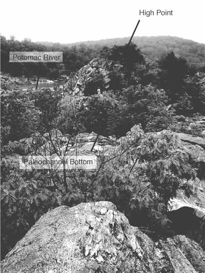
Figure 15. At Black Pond, paleochannels are exposed including the high points and the channel bottoms. Photograph taken from a high point looking toward another high point. Main channel of present-day river is in distance. Looking toward Maryland from the Virginia side of the river. Person for scale in upper center of photo.


U.S. Department of the Interior, U.S. Geological Survey
URL: https:// pubsdata.usgs.gov /pubs/circ/2004/1264/html/trip6/fig15.html
For more information, contact Paul Bierman
Maintained by Reston Publications Service Center
Last modified: 12:24:47 Wed 23 Nov 2016
Privacy statement | General disclaimer | Accessibility