
|
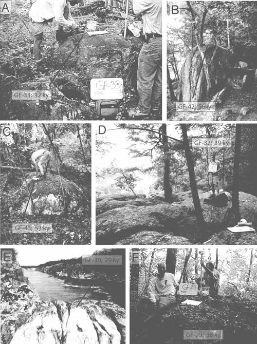
Figure 19. Sample sites on the Bear Island strath terrace surface, downstream of Great Falls. A, GF-33 was collected from an isolated outcrop less than 1 m (3 ft) high. B, GF-42 was collected from a tall outcrop within 10 m (33 ft) of GF-43. C, GF-43 was collected from a shorter outcrop adjacent to GF-42. D, GF-32 was collected from a broad expanse of rock. E, GF-30 is topographically lower than the other pictured samples and overlooks Mather Gorge. This outcrop was submerged during the peak flooding of Hurricane Isabel (~165,000 ft3/s). F, GF-29 was collected from an isolated outcrop of rock farther downstream than the other samples. |