U.S. Geological Survey: Science for a Changing World - USGS visual identifier and link to main Web site at http://www.usgs.gov/

Longitudinal profile of Potomac River water surface at Great Falls. For a more detailed explanation, contact Paul Bierman at pbierman@zoo.uvm.edu.
 
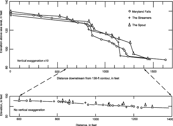
Figure 3. Longitudinal profile of Potomac River water surface at Great Falls (Zen, 1997a). From east to west, the three strands are Maryland Falls, The Streamers, and The Spout. Upper profile, vertical exaggeration 10x. Lower profile, expanded view of the main drop, no vertical exaggeration.


U.S. Department of the Interior, U.S. Geological Survey
URL: https:// pubsdata.usgs.gov /pubs/circ/2004/1264/html/trip6/fig3.html
For more information, contact Paul Bierman
Maintained by Reston Publications Service Center
Last modified: 12:24:40 Wed 23 Nov 2016
Privacy statement | General disclaimer | Accessibility