
A |
B |
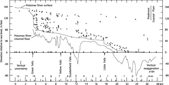
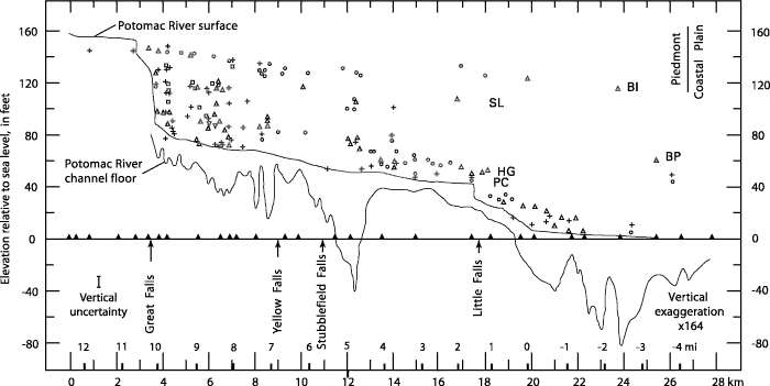
| Figure 5. Composite record of strath elevations along the Potomac River gorge complex, Great Falls to tidewater. Kilometer scale is measured from Gladys Island. Miles scale is measured from Chain Bridge, as originally used by Reed and others (1980). Vertical uncertainty refers to the uncertainty in location of individual outcrops during mapping. A, Data: circles, rock summits; crosses, channels and scour ponds; up-pointing triangles, rock benches; down-pointing triangles, outlets of plunge pools; squares, lateral potholes. Profile of channel floor based on sounding by J.C. Reed, Jr. (written commun., 1993). B, Interpretation of data as strath levels (Zen, 1997a), not including Glade Hill and Matildaville straths that are higher than the Bear Island level. BI, Bear Island; SL, Sandy Landing; BP, Black Pond; HG, Hidden Gorge; PC, Plummers Channel. |