
|
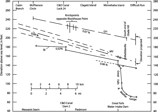
| Figure 6. Comparison of the profiles for Glade Hill (GH), Matildaville (MV) (screened area represents vertical uncertainty), and Bear Island (BI) straths with the modern river channel. Solid lines designate BI and the modern river channel above the Great Falls Water Intake Dam. Projection of modern river channel is indicated by dashed line. Circled points and vertical bars show selected data (Zen, 1997b). The elevations at Difficult Run are projected (Zen, 1997a). The BI profile drops 6 ft at the dam because below this point the elevations refer to the rock floor but above this point they refer to the water surface. +, water surface elevations; x, channel floor elevations. Distances are measured along the river. Vertical exaggeration 328×. |