Circular 1301
 The heavy sediment load and large amounts of floating
debris generated by the constantly caving banks of the Missouri River was documented in the first written description
of the river by Father Jacques Marquette in 1673 as he approached the mouth of the Missouri River from the upper Mississippi River:
The heavy sediment load and large amounts of floating
debris generated by the constantly caving banks of the Missouri River was documented in the first written description
of the river by Father Jacques Marquette in 1673 as he approached the mouth of the Missouri River from the upper Mississippi River:
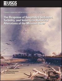
"[We]" heard the noise of a rapid, into which we were about to run. I have seen nothing more dreadful. An accumulation of large and entire trees, branches, and floating islands, was issuing from the mouth of the river Pekitanoui (Missouri River), with such impetuosity that we could not without great danger risk passing through it. So great was its agitation that the water was so very muddy, and could not become clear." However, large changes in suspended sediment and turbidity in the lower Missouri River below Gavins Point Dam have occurred in response to extensive structural changes that have been imposed on the Missouri River and its watershed during the last two centuries. Efforts to shape the channel, remove snags and sawyers, dredge shallows, and stabilize banks for navigation began as early as 1838 ( http://www.lewis-clark.org/ri_mo-snagboats.htm , Chittenden, 1903). However, bank stabilization efforts were sporadic and scattered in comparison to large scale changes that occurred after 1929. In the early 1930s the numerous small channels were combined into a single-fixed channel with 4,745 stone and wood-pile dikes, 3,371 dike extensions, streambank protection works on concave banks, man-made cutoffs, the closing of chutes with dikes, the removal of snags, and dredging (Keown and others, 1981). The resulting navigation channel was 6-ft (feet) deep by 200-ft wide and was expanded to 9 by 300 ft in the 1950s and early 1960s. Construction of six dams was started in 1933 and their reservoirs were filled by 1967. Three of these reservoirs are among the five largest in the United States. Nearly one-third of the Missouri River is now submerged below these massive reservoirs. Since 1967, hydrologic changes have been relatively minor. In the early 1970s, the U.S. Geological Survey (USGS) began the long-term, systematic collection of suspended-sediment and water-quality data that continues to the present (2006). Because changes in the channel configuration and hydrologic character of the river have been small compared to the changes before 1973, all samples collected after that time are referred to in this report as modern samples. These modern samples compose a large data set that are compared to samples collected before the pervasive hydrologic and channel-stabilizing changes that began in the early 1930s and to the qualitative and semiquantitative observations of the explorers in the early nineteenth century. |
Posted February 2007 Download report (2.7 MB) |

![]() U.S. Department of the Interior | U.S. Geological Survey
U.S. Department of the Interior | U.S. Geological Survey
URL: http://pubsdata.usgs.gov/pubs/circ/2006/1301/index.html
Questions or Assistance: Contact USGS
Last modified: Wednesday, 23-Nov-2016 12:16:29 EST
