The earliest geological surveys were made in support of agriculture, which was the basic occupation in the United States in the early 1800's. Manufacturing was then of importance only in a few areas, and mining was a quite insignificant part of the economy. Farmland in the Eastern and Southern States, however, was beginning to lose its fertility, and farmers were abandoning their holdings and moving westward. The westward migration increased to enormous proportions after the War of 1812. In the summer of 1820, Stephen Van Rensselaer, president of the Agricultural Society of New York, using funds appropriated by the State Legislature, employed Amos Eaton, who had studied under Silliman at Yale, to make a geological survey of Albany County to aid in the improvement of agriculture. In the following year, Eaton made a geological and agricultural survey of the neighboring Rensselaer County. After two surveys in aid of agriculture, Eaton proposed and obtained approval to make a survey of the district adjoining the Erie Canal, one of a vast number of internal improvements that had been begun to link eastern markets and the newly settled regions beyond the Allegheny Mountains. A year earlier, Denison Olmsted, Professor of Chemistry, Mineralogy, and Geology at the University of North Carolina, also a former student of Professor Silliman, had approached the North Carolina State Board of Internal Improvements with the idea of making a geological and mineralogical survey of the State, but the General Assembly in North Carolina, to which the Board had referred Olmsted's request, had instead authorized the Board of Agriculture to make such a survey in 1823.
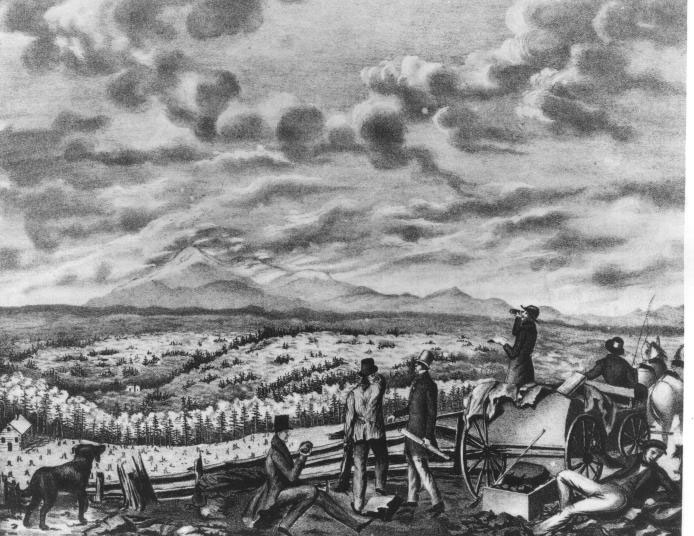
Figure 1. Gentlemen engaged in geological pursuits, 1836.
In 1824, as the number and scope of internal improvements increased, Federal policy was changed as a matter of practical necessity. Congress authorized the Army Engineers to make engineering surveys to prepare estimates for roads and canals for national military, commercial, or postal purposes. Science in general, and geology in particular, however, remained almost exclusively the province of the States or private individuals for another decade.Olmsted's first report, published in 1824, provided the inspiration for establishment of geological surveys on another basis. Olmsted devoted several pages of his report to the gold mines of North Carolina and in 1825 published a paper on the gold deposits in Silliman's American Journal of Science and Arts. Gold-bearing rock in place was discovered in North Carolina that very year and later in Virginia, South Carolina, and Georgia as well. The more practical-minded geologists seized upon the gold discoveries in the Southeastern States as a better means of promoting the establishment of geological surveys than either the improvement of agriculture or the need for internal improvements. During the early 1830's, several of the Eastern and Central States established State surveys "to examine the geological structure, mineral resources, and products"4 of their part of the national domain.
In 1834, just a year before the Geological Survey of Great Britain was established, Congress authorized the first Federal examination of the geological structure, mineral resources, and products of the public lands by permitting the Topographical Bureau of the U.S. Army to use $5,000 of its appropriation for geological investigations and the construction of a geological map of the United States. The head of the Bureau, Colonel J.J. Abert, had based his request for funds on the importance of mineral resources, stating that "few subjects connected with the duties of this bureau open so many and so important national advantages, or are adapted to redound more to internal commercial prosperity" as the "development of these great resources of wealth and commercial intercourse, which now lie inert and buried in the bowels of the earth."5 The geologist employed, however, proved a little too impractical for the Engineers and the survey was discontinued after 2 years.
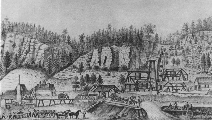
Figure 2. Copper mining in Michigan, 1849.
In 1839, the Federal Government for the first time called on a geologist to classify public lands as Congress made plans to authorize the sale of the mineral lands in the Upper Mississippi Valley. David Dale Owen organized a force that made a survey of 11,000 square miles in a little more than 2 months, which led the Commissioner of the General Land Office to propose that "an officer skilled in the sciences of geology and mineralogy"6 be appointed to explore all the public lands and thus enable the Commissioner to discriminate between agricultural and mineral lands before putting them on the market. That idea came to nought, but in 1847, when Congress authorized the sale of mineral lands in the Lake Superior Land District in Michigan and the Chippewa Land District in the Territory of Wisconsin, it specified that geological examinations be made prior to the sale.The change in the Federal attitude toward geology was part of a change in the Federal view of science in general. The Federal Government was not yet ready to accept science for its own sake but there was a growing realization that certain economic purposes could be aided by science, or, from the perspective of the first Commissioner of Patents in 1836, that the scientific activities of the Government should serve the great economic interests of the country. This same attitude was evident when Congress in 1836 authorized the United States Exploring Expedition, which had the backing of some of the country's most influential scientists, as an aid to commerce. Perhaps of even greater importance for the future of Federal geology was the establishment in 1838 of the Corps of Topographical Engineers to explore and map the continent. Americans were already beginning to feel it was their manifest destiny to overspread and possess the whole continent, and the Topographical Engineers for more than 2 decades provided geologists with opportunities to study the West.
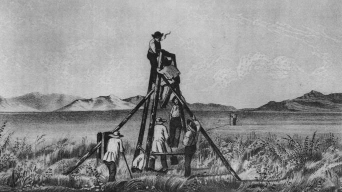
Figure 3. Mapping the region around the Great Salt Lake, 1849.
America's manifest destiny was also to become a great industrial nation but that was not so apparent in the 1840's. Coal and iron were the basic elements of industrial development, but toward the end of that decade iron production had begun to decline and the mineral industry, except for coal, began to experience difficulties. The discovery of gold in California on January 24, 1848, altered the situation. In December 1848, President James Polk asked Congress to provide for a geological and mineralogical examination of the region where gold had been discovered and to take steps to preserve the mineral lands, especially those containing the precious metals, for the United States, or to dispose of them in such a manner as to secure a large return of money to the Treasury. The lameduck Congress took no action on these recommendations but in the closing days of the session established a new executive department, the Interior Department, which would include the General Land Office, the Pension Office, the Office of Indian Affairs, and the Census.The discovery of gold gave great impetus to mining endeavors throughout the country, and this increased activity, combined with the prosperity after the Mexican War, interested several States in the South and the Midwest in establishing State geological surveys. It also made the development of better means of communication and transportation between the Eastern States and the western territories more urgent. In 1853, Congress appropriated $150,000 for surveys to ascertain the most practical and economical route for a railroad from the Mississippi River to the Pacific Ocean and authorized the Secretary of War to employ the Corps of Topographical Engineers to make the explorations and surveys. The Congress also took action on the mineral lands in California, excluding them from the General Land Office surveys, settlement or location on them.
During the 1850's, while the Topographical Engineers explored four routes for the transcontinental railroad, the industrialization of the Nation quickened. In 1859, for the first time, the value of the products of U.S. industry exceeded the value of agricultural products. In that same year, gold was discovered in Colorado, silver was discovered at the Comstock lode in western Nevada to begin the era of silver mining in the West, and the first oil well in the United States was successfully drilled in northwestern Pennsylvania. By that time, the relationship between geological surveys and mineral resources was sufficiently clear that when gold mining in California became difficult and costly, the State Legislature established a Geological Survey, on April 21, 1860, to make an accurate and complete geological survey of the State.
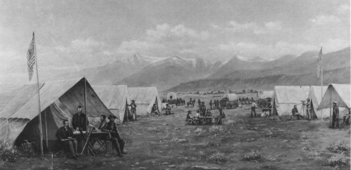
Figure 4. The Geological Exploration of the Fortieth Parallel (King survey), ca. 1869.
The Civil War had a pronounced effect on science and on the industrial development of the United States. It brought to an end the second era of State surveys--only the California Geological Survey survived. It checked or halted the western mining frontier in some areas but allowed continued expansion in others. The usefulness of science for economic purposes was recognized on May 15, 1862, when the 37th Congress established the Department of Agriculture "to acquire and diffuse * * * useful information on subjects connected with agriculture" and for the first time authorized "practical and scientific experiments"7 to obtain this information. The industrialization advanced significantly during the war. At the start of the war, American iron fabrication was inferior to that of Europe, but A.S. Hewitt of Cooper Hewitt iron manufacturers went to England in 1862 and learned the secret of the British process so well that in 1863 the Secretary of War boasted that American iron was superior to that obtained abroad. Alexander Holley, an American metallurgist, also visited England in 1862 and obtained the American rights to the Bessemer process for making steel; in 1865, he began to produce steel by that process in the United States.

![]() U.S. Department of the Interior |
U.S. Geological Survey
U.S. Department of the Interior |
U.S. Geological Survey
URL: http://pubsdata.usgs.gov/pubs/circ/c1050/before.htm
Page Contact Information: GS Pubs Web Contact
Page Last Modified: Monday, 30-Sep-2019 16:57:34 EDT