Hog Island, Virginia
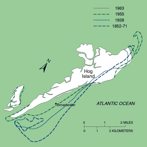
In the late 1800's, at least five lavish hunting and fishing clubs were established on Virginia's barrier islands; one of the largest was in the town of Broadwater, on Hog Island. The town, located in a pine forest near the middle of the island, at its height had a population of about 300 and contained 50 houses, a lighthouse, a school, and a church and cemetery. Erosion destroyed the lighthouse before 1930, and in 1933 a hurricane inundated all of Hog Island, destroying much of the town and killing the protective pine forest. By the early 1940's, all inhabitants had left the island. The former site of the town is now under several meters of water and hundreds of meters from the shore.
(Modified from Rice, Niedoroda, and Pratt, The coastal processes and geology: Virginia barrier islands, vol. 1 (Ecosystem description), part B, of Virginia Coast Reserve Study conducted by the Nature Conservancy.)
