USGS scientists use a helicopter-borne electromagnetic device to conduct rapid and economical surveys of aquifer quality where ground access is difficult; these surveys determine ground-water salinity by mapping changes in electrical resistivity of shallow subsurface rocks. The surveys have demonstrated an abrupt increase in resistivity 5-10 km (3-6 miles) inland from Florida Bay, corresponding to the infiltration of seawater beneath the Everglades (fig. 12). In addition to mapping saltwater intrusion, these surveys monitor changes in subsurface conditions and help constrain regional flow models. The imprint of human activity is dramatically apparent at several locations within the park, particularly along old roads and canals. This information is contributing to strategies that the NPS is using to protect living resources in the endangered Everglades ecosystem.
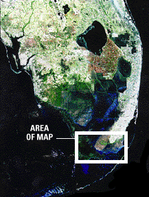
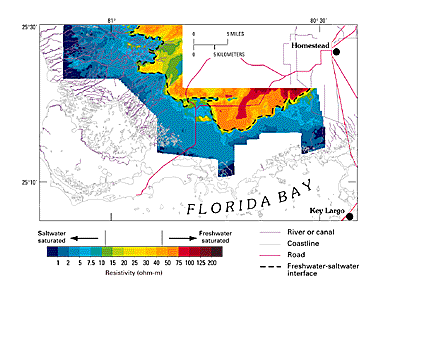
Figure 12. Satellite image showing mapped area and map showing saltwater intrusion beneath the Everglades. Ground-water salinity can be determined by mapping changes in electrical resistivity of subsurface rocks. Increases in resistivity (measured in ohm-meters) correspond to the incursion of seawater beneath the Everglades. From Fitterman (1996).