
Water Quality in the Western Lake Michigan Drainages, Wisconsin and Michigan, 1992-95
ENVIRONMENTAL SETTING AND HYDROLOGIC CONDITIONS FIGURES
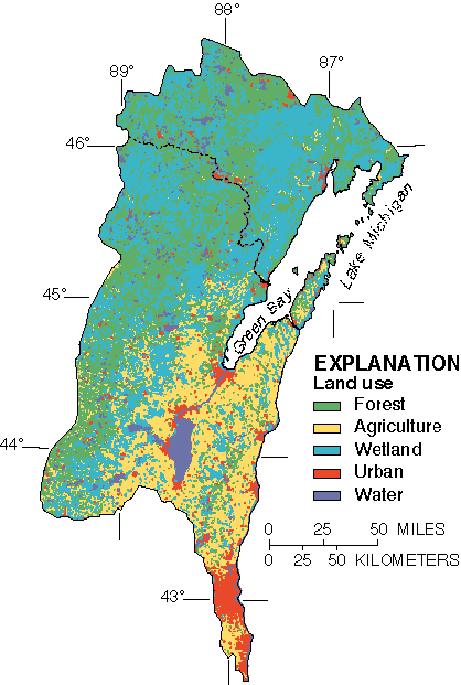
Land use ranges from forests in the north to agriculture and urbanized land in the southern and eastern parts of the study area.
Return to Environmental Settings and Hydrologic Conditions
This page is a subpage of URL: <http://water.usgs.gov/pubs/circ1156>
Last modified: Thu Jul 2 07:29:33 1998