![]()
The Rio Grande is the only river I ever saw that needed irrigation.
--Will Rogers
A discussion of water-quality issues, results, or findings in the Rio Grande Valley Study Unit (fig. 1) necessarily emphasizes the historical importance of surface water in this arid to semiarid environment. Surface water has been the "lifeblood of the Rio Grande Valley." Records from the sixteenth-century Spanish expeditions into the area report that irrigated agriculture was in use by some of the indigenous peoples. Where surface water and springs existed, people could exist. As European colonization of the area occurred, the introduction of new crops, such as wheat, barley, and oats, required the expansion of irrigation systems. As a result, settlements were established on the flood plains of the streams where agricultural land could be irrigated. Only when technological developments facilitated access to water in deep aquifers did settlements begin to appear throughout the Study Unit.
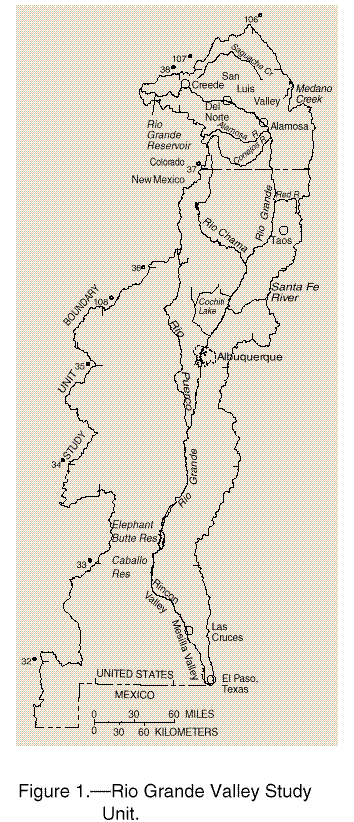
Figure 1.--Rio Grande Valley Study Unit.
For the people living in the Rio Grande Valley, the importance of water--both quantity and quality--is an ongoing issue. Water-resource issues of a local or regional nature appear in the news virtually everyday. As competition for the limited water resource intensifies, major economic decisions, both locally and regionally, will be controlled by the availability of usable quantities of ground and surface water.
The objective of the NAWQA Program is to assess the status of and trends in the Nation's water quality. In the Rio Grande Valley Study Unit, a series of interrelated but separate study components were conducted during 1992-95 to assess the quality of ground and surface water (fig. 2). The primary focus was along the Rio Grande flood plain. Limited work also was conducted on tributary and nontributary streams in the northern part of the Study Unit. The only exception was an agricultural land-use study component assessing shallow ground water in basin-fill deposits in the San Luis Valley located primarily outside the flood plain. For a discussion of the objectives, a brief description, and the water-quality measures of these study components, see the Study Design and Data Collection section (page 26). Selected results and interpretations based on these study components are discussed in the following sections. Detailed data interpretation for selected study components is reported in individual reports (see References section, page 34).
The following discussion includes interpretation of data collected for analysis of pesticides, nutrients, radon, volatile organic compounds, dissolved solids, and trace elements and results of ecological studies of biological communities and stream habitat. Where applicable, these constituents are compared to EPA maximum contaminant levels (MCLs), secondary maximum contaminant levels (SMCLs), or health advisories (HAs) for public water systems (U.S. Environmental Protection Agency, 1996a). For ambient water, the EPA, National Academy of Sciences, and Environment Canada have established water-quality criteria or guidelines for aquatic organisms. These criteria may be used by State agencies to establish local ambient criteria. The FWS has reported median values for organochlorine compounds and polychlorinated biphenyls as part of their National Biomonitoring Program (Schmitt and others, 1985, 1990; Schmitt and Brumbaugh, 1990).
Not all data collected as part of the NAWQA Program have been compiled in reports. These data have been collected at specific sites throughout the Study Unit and are available in project files. For example, ground-water data were collected at two sites in Albuquerque and at one site in the Mesilla Valley to determine the age of ground water with depth. Biological community surveys conducted at selected surface-water sites include quantitative and qualitative sampling methods for algae and benthic invertebrates; habitat characterization including stream-reach characterization, instream and bank vegetation species, density, and species dominance along transects perpendicular to the stream; and stream meandering, gradient, elevation, and water-management features (dams, bridges, canals, or diversions).
Figure 2.--Land-use studies, aquifer subunit survey, and surface-water sites.
|
Site number | Station name |
|---|---|
|
Rio Grande above mouth of Trinchera Creek, near Lasauses, Colo. |
|
|
Rito de los Frijoles in Bandelier National Monument, N. Mex. |
|
The Study Unit, approximately 45,900 square miles, contains diverse hydrologic and climatological regimes. Altitudes range from peaks exceeding 14,000 feet in the northern part of the Study Unit to approximately 3,700 feet at the lower basin boundary. The climate in the high mountain headwater areas of the Rio Grande and its northern tributaries is alpine tundra where average annual precipitation may exceed 50 inches; most of this precipitation is in the form of snow. Annual runoff in mountainous areas may exceed 30 inches. In contrast, 750 miles downstream near the lower basin boundary of the Study Unit, the Rio Grande flows through a portion of the Chihuahuan Desert where average annual precipitation is less than 8 inches; most of this precipitation is in the form of summer thunderstorms. Annual runoff is less than 0.01 inch. In the mountainous headwater areas, annual potential evaporation is less than 70 percent of annual precipitation, whereas in the southern part of the Study Unit, annual potential evaporation may exceed 1,000 percent of annual precipitation.
The existence of a reliable source of surface water in the southern part of the Study Unit is the result of human alteration of the river system by the construction of reservoirs to control runoff. The storage of runoff in the springtime allows for a dependable source of water to support irrigation needs throughout the long growing season. This alteration of the river system has affected the water quality of the Rio Grande.
Within the Study Unit, two ground-water land-use studies and one aquifer subunit survey focused on the flood plain of the Rio Grande from Cochiti Lake in New Mexico, to El Paso, Texas. One land-use study was conducted in the basin-fill deposits in the San Luis Valley in Colorado. Only when the hydrologic system along the Rio Grande is understood can the complexity of the many influences that affect water quality throughout the Study Unit be appreciated. A detailed discussion of the ground-water system in the Study Unit is presented in Ellis and others (1993). The following is a brief description of the ground-water system to aid in understanding the following water-quality discussions.
Complex interactions occur between ground water and surface water in the Rio Grande flood plain. A system of canals distributes surface water for agricultural irrigation and a system of drains intercepts shallow ground water and returns it to the Rio Grande. Surface water leaks from the Rio Grande and canals to recharge the shallow ground-water system. In places, deeper ground water flows upward to recharge the shallow ground-water system and/or to contribute flow to the Rio Grande. In addition, excess applied irrigation water infiltrates and recharges the shallow ground-water system. Evapotranspiration losses from vegetation, land, and water surfaces, can have a major effect on the quality of ground water.
Two land-use studies, in the Albuquerque area and in the Rincon Valley, focused on the upper 10-15 feet of ground water in the flood-plain alluvium (referred to as shallow ground water in this report). This water generally is not used for domestic supply. However, because of the interaction with surface water and, in isolated areas, because declines in the water level in the deeper aquifer have caused the shallow aquifer to be a recharge source in some areas, knowing the quality of the shallow ground water is important in making management decisions.
The aquifer subunit survey, from Cochiti Lake to El Paso, focused on deeper water underlying the flood-plain (referred to as deeper ground water in this report). This water is used for domestic supply in some areas.
The land-use study in the San Luis Valley was not entirely in the Rio Grande flood plain. Most of the area is in the San Luis Closed Basin, which is both a ground-water and surface-water closed basin. Neither ground water nor surface water flows out of the Closed Basin. The shallow ground water is in unconsolidated basin-fill deposits. The water in these basin-fill deposits is used extensively for irrigation and, on a limited basis, for domestic supply. However, these wells generally tap several tens of feet of the aquifer. The study wells were completed in the upper 10-15 feet of the saturated basin-fill deposits.
Rio Grande Reservoir, in the headwaters of the Rio Grande, is used to store runoff for irrigation at surface-water diversions in the San Luis Valley (photograph by Sherman R. Ellis, U.S. Geological Survey).
Historically, streamflow in the Rio Grande was caused by spring snowmelt (April through June) and summer monsoon thunderstorms (July and August). This natural streamflow pattern has been altered and regulated by the construction of reservoirs on the main stem and tributaries that impound and store water for later use, primarily irrigation.
All surface water in the Rio Grande is appropriated by various compacts, treaties, and individual water rights. Appropriated surface-water rights on the Rio Grande in Colorado and New Mexico usually exceed the annual mean flow of the river (Ellis and others, 1993).
As the discussion of the water-quality data is presented, it is important to realize that 89 percent of water use in the Study Unit in 1990 was for irrigation, 8 percent for public supply, and 3 percent for all other uses. The effect that irrigation and urban use has on the quality of surface water is related to the processes to which the water is subjected as it moves downstream. It is repeatedly diverted, applied to fields, returned to the Rio Grande directly or through drains, impounded in reservoirs, lost to evapotranspiration, or consumptively used. Urban areas contribute wastewater and anthropogenic organic chemicals such as volatile organic compounds and pesticides; agricultural areas contribute chemicals from fertilizers and pesticides; mining areas contribute trace elements; atmospheric deposition contributes chemicals such as nitrate and phosphorus; and the use and reuse of water increases dissolved-solids concentrations because of evapotranspiration. All of these processes can contribute to deterioration in surface-water quality of the Rio Grande as it moves through the basin.