This circular is intended for Federal, State, and local water professionals and anyone who has an interest in the water-quality conditions of the South Platte River Basin. All of us have a stake in our water resources, and perhaps more important, we have an interest in maintaining the resources for future residents of the basin.
The physical and cultural (land use) characteristics of the South Platte River Basin are quite diverse. The headwaters of the basin begin at an altitude of more than 14,000 feet along the Continental Divide. The population in the forested mountain areas lives primarily in single-family residences and small residential communities; however, rapid growth in these areas has occurred. This area exhibited a 22-percent increase in population during 1990-93 (Denver Regional Council of Governments, 1997). Between the mountains and the plains is a transition zone where the largest population centers of the basin are located, including Denver (2.2 million in 1997 in the Denver metropolitan area). The basin extends eastward across the Great Plains where agriculture is the predominant land use and water is used primarily for irrigation of crops. On the plains, the topography of the basin continues to slope gently to the mouth of the basin at North Platte, Nebr., at an altitude of 2,788 feet, thus resulting in an altitude change of slightly more than 11,000 vertical feet.
The physical and cultural diversity has a profound effect on water-quality conditions within the basin. The goal of data-collection activities and information from studies presented in this report is to characterize, in a consistent manner, the broad scale geographic and seasonal distributions of water-quality conditions in relation to major contaminant sources and background conditions (Gilliom and others, 1995). These activities and studies also serve as the basis for the design of future assessments of long-term water-quality trends and changes in the basin.
|
Future demands on the water resources within the basin likely will be high; some of the issues include: (1) Allocating water between urban and agricultural demands; (2) managing growth without deterioration of water quality; (3) restoring degraded riparian habitat and fisheries in the plains; (4) developing future water supplies without affecting the environment; and (5) protecting existing drinking-water supplies. The pressures of growth present challenges that we need to be ready to address. By knowing the current water-quality conditions and identifying environmental factors that affect those conditions, we can meet the challenges of the future. Sufficient knowledge can help us (individually or collectively) make the right decisions. We can prepare now for the future if we can coordinate water-quality activities among agencies at all levels to create an integrated approach to problem resolution. Information exchange and coordination help ensure that the water-quality information produced is relevant to all interests.
 (55,862 bytes)
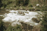
Recreational water use in mountain areas of the basin.
This circular summarizes the results of the occurrence and distribution assessment (high-intensity sampling phase) of the National Water-Quality Assessment (NAWQA) Program's South Platte River Basin Study Unit investigation. The circular presents: (1) Information on the environmental setting and the hydrologic conditions during 1992-95; (2) a summary of major water-quality issues and findings; (3) a comparison of local water-quality results with national NAWQA findings; (4) a description of water-quality data-collection sites; and (5) tables summarizing the analysis and detections of compounds determined during the course of the study. The primary emphasis of NAWQA data collection is to provide information needed for an integrated assessment of water quality. Results presented in this circular and data available on the internet will provide information that can foster collaborative efforts within the water-resources community and continued evaluation and critical review of status and trends in water quality in the South Platte River Basin.