|
|
||
 |
 |
 |
|
|
||
|
|
||
 |
||
|
|
||
|
|
||
|
|
||
|
The U. S. Geological Survey Energy Resources Teams Organic Geochemistry Laboratory is a research laboratory devoted to the investigation of the origin and occurrence of organic fossil fuels. Although it is not a service laboratory, many of the analytical results from the laboratory could prove useful in future petroleum geological and geochemical studies. In order to archive these results, the USGS developed an Alaskan Organic Geochemical Data Base (AOGDB) in 1978 to house the data from not only the USGS involvement in the project, but also the data accumulated from a variety of sub-contracting laboratories. The accumulated data resided in a flat text file entitled PGS and was maintained by Petroleum Information Corporation. The information provided here is a distillation of ASCII tables that originated in the master flat files of the relational AOGDB files. Tabular Data Click
here for documentation on the database and table relationships. Additional
information can be obtained in Geology and Exploration of the National
Petroleum Reserve in Alaska, 1974-1982, USGS Professional Paper 1399,
pgs 478-481 and 545-549. Questions
regarding this data should be directed to Mr. Charles
Threlkeld, AOGDB Database Administrator, Central Region Energy Team.
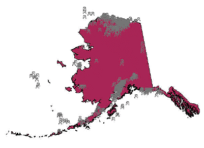
In addition to the eleven GIS layers listed above, three basemap layers obtained from the Internet are included
to provide reference. |
||||||||||||||||||||||||||||||||||||
This data was extracted from a Compact Disc-Read Only Memory (CD-ROM) publication that was prepared by an agency of the United States Government. Neither the United States Government nor any agency thereof, nor any of their employees, makes any warranty, expressed or implied, or assumes any legal liability or responsibility for the accuracy, completeness, or usefulness of any information, apparatus, product, or process disclosed in this report, or represents that its use would not infringe privately owned rights. Reference therein to any specific commercial product, process, or service by trade name, trademark, manufacturer, or otherwise does not necessarily constitute or imply its endorsement, recommendation, or favoring by the United States Government or any agency thereof. Although all data and software published on this CD-ROM have been used by the USGS, no warranty, expressed or implied, is made by the USGS as to the accuracy of the data and related materials and (or) the functioning of the software. The act of distribution shall not constitute any such warranty, and no responsibility is assumed by the USGS in the use of this data, software, or related materials. | ||||||||||||||||||||||||||||||||||||

![]() U.S. Department of the Interior | U.S. Geological Survey
U.S. Department of the Interior | U.S. Geological Survey
URL: http://pubsdata.usgs.gov/pubs/dds/dds-059/index.html
Page Contact Information: Central Energy Data Management
Questions or Assistance: Contact USGS
Last modified: Thursday, 23-Sep-2021 12:23:31 EDT