 Click here to view screen-resolution image - 45K
Click here to view screen-resolution image - 45K
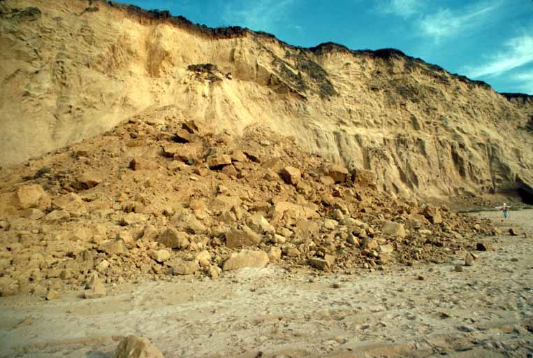
Click here to view screen-resolution image - 45K31. Cliff failure just south of San Gregorio Beach. Slide is 18.3 m (60 ft) high and displaces approximately 6881 cubic meters (9,000 cubic yards) of material. Large boulders are 1 m (3 ft) across. [D.M. Peterson, U.S. Geological Survey]
 Click here to view screen-resolution image - 45K
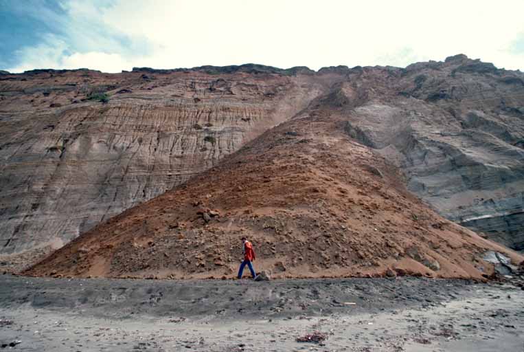
32. Cliff failure north of Tunitas Creek. This face continued to slide for a few days after the earthquake. The event in progress exposed dark cliff material. [D.M. Peterson, U.S. Geological Survey]
 Click here to view screen-resolution image - 45K
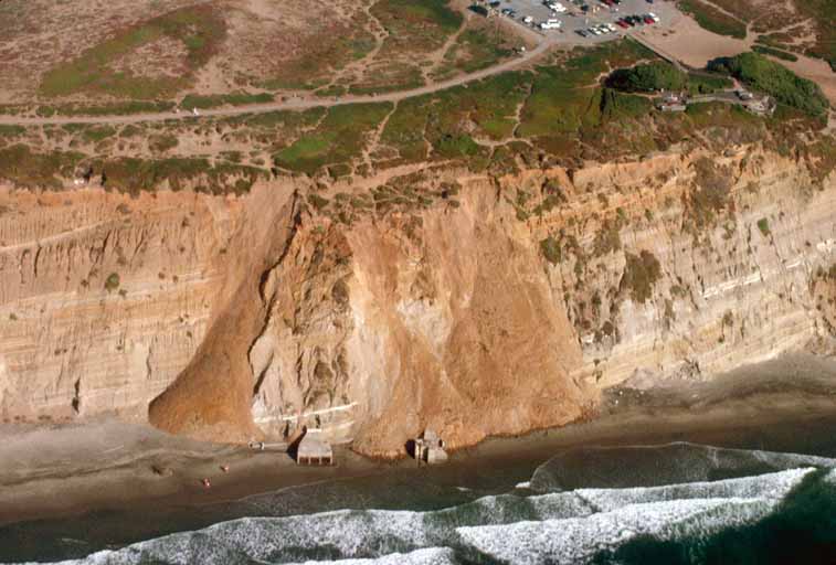
33. Landslide north of Fort Funston. Slide mass contains approximately 2,830 cubic meters (3,700 cubic yards) and is 30 m (100 ft) high. Photo 35 provides an aerial view of this slide. [D.M. Peterson, U.S. Geological Survey]
 Click here to view screen-resolution image - 45K
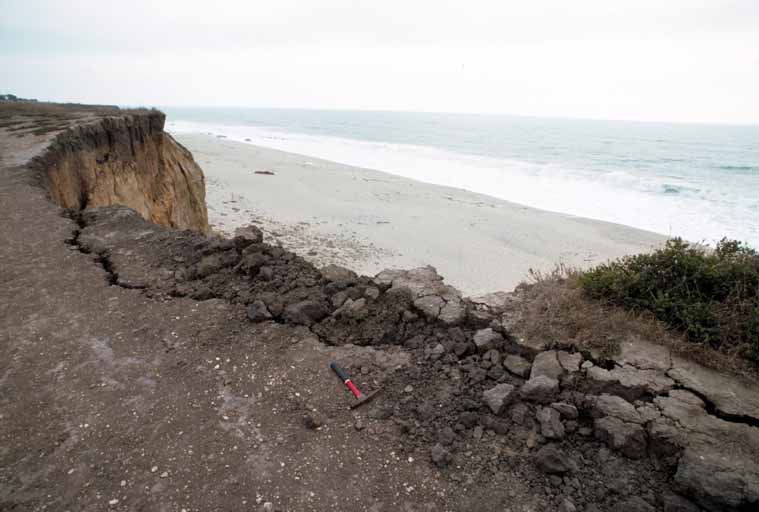
34. Headscarp of small slide at Redondo Beach. Scale is provided by the red-handled rock hammer, which is 30.5 cm (12 in.) long. [D.M. Peterson, U.S. Geological Survey]
 Click here to view screen-resolution image - 45K
35. Aerial view of large slides north of Fort Funston. A ground perspective of this slide is shown in photo 33. [S.D. Ellen, U.S. Geological Survey]
 Click here to view screen-resolution image - 45K
36. Aerial view of slide at Daly City. This is the largest slide triggered by the earthquake in San Mateo County, displacing approximately 36,700 cubic meters (48,000 cubic yards) of material. The base is about 152 m (500 ft) across at its widest point. [S.D. Ellen, U.S. Geological Survey]