 Click here to view screen-resolution image - 45K
Click here to view screen-resolution image - 45K
Click here to view screen-resolution image - 45K84. Liquefaction in recent deposits of the Pajaro River formed these sand volcanoes along extensional fissures in a field prepared for autumn planting near Pajaro, across the Pajaro River from Watsonville. Furrows are spaced about 1.2 meters (4 feet) apart. [J.C. Tinsley, U.S. Geological Survey]
 Click here to view screen-resolution image - 45K
85. Vent of sand volcano produced by liquefaction is about 4 feet across in strawberry field near Watsonville. Strip spanning vent is conduit for drip irrigation system. Furrow spacing is about 1.2 meters (4 feet) on center. [J.C. Tinsley, U.S. Geological Survey]
 Click here to view screen-resolution image - 45K
86. Liquefaction in recent deposits of the Pajaro River formed sand volcanoes along a fissure 6-7 meters (19.7-23 feet) in length. Variation in grain size and partial erosion of the conical deposits of sand show that venting of the slurry of sand and water was a complex series of depositional and erosional events triggered by the main shock and renewed in some instances by principal aftershocks. [J.C. Tinsley, U.S. Geological Survey]
 Click here to view screen-resolution image - 45K
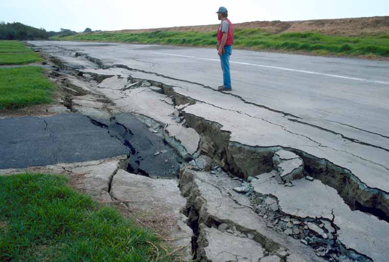
87. Ground shaking triggered liquefaction in a subsurface layer of sand, producing differential lateral and vertical movement in a overlying carapace of unliquified sand and silt, which moved from right to left towards the Pajaro River. This mode of ground failure, termed "lateral spreading", is a principal causet of liquefaction-related earthquake damage. [S.D. Ellen, U.S. Geological Survey]
 Click here to view screen-resolution image - 45K
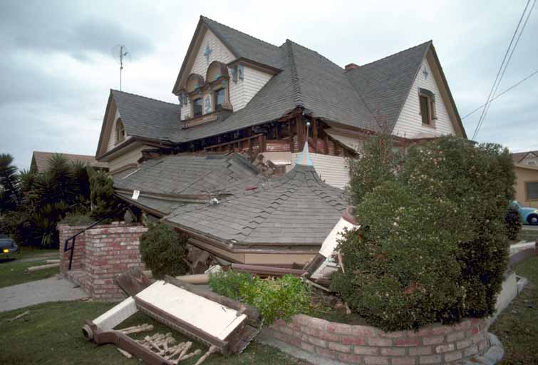
88. Crack down front of Ford's Department Store, downtown Watsonville. Although this fracture appears minor, the building suffered significant damage. [H.G. Wilshire, U.S. Geological Survey]
 Click here to view screen-resolution image - 45K
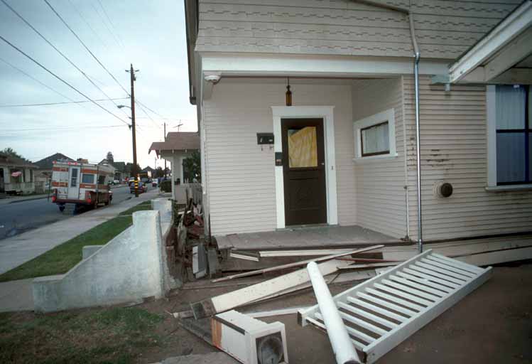
89. Houses not bolted down securely were easily dislodged from their foundations in downtown Watsonville. [J.K. Nakata, U.S. Geological Survey]
 Click here to view screen-resolution image - 45K
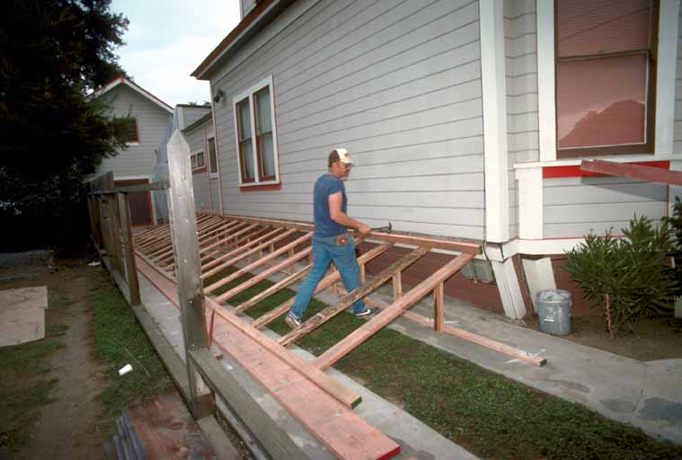
90. Many homeowners buttressed their foundations to prevent further damage from aftershocks in downtown Watsonville. [J.K. Nakata, U.S. Geological Survey]
 Click here to view screen-resolution image - 45K
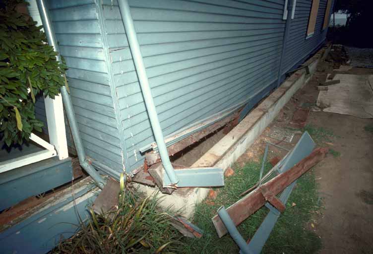
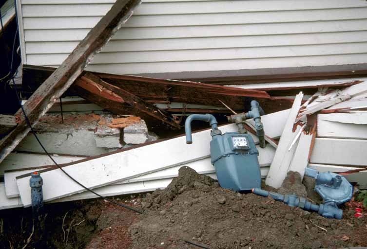
91. Broken utility lines in house that shifted off its foundation, downtown Watsonville. [H.G. Wilshire, U.S. Geological Survey]
 Click here to view screen-resolution image - 45K
92. Collapsed porch in downtown Watsonville. [J.K. Nakata, U.S. Geological Survey]
 Click here to view screen-resolution image - 45K
93. This house was dislodged from its foundation and moved 0.75 meters (2.5 feet) from the cement stairway in downtown Watsonville. [J.K. Nakata, U.S. Geological Survey]
 Click here to view screen-resolution image - 45K
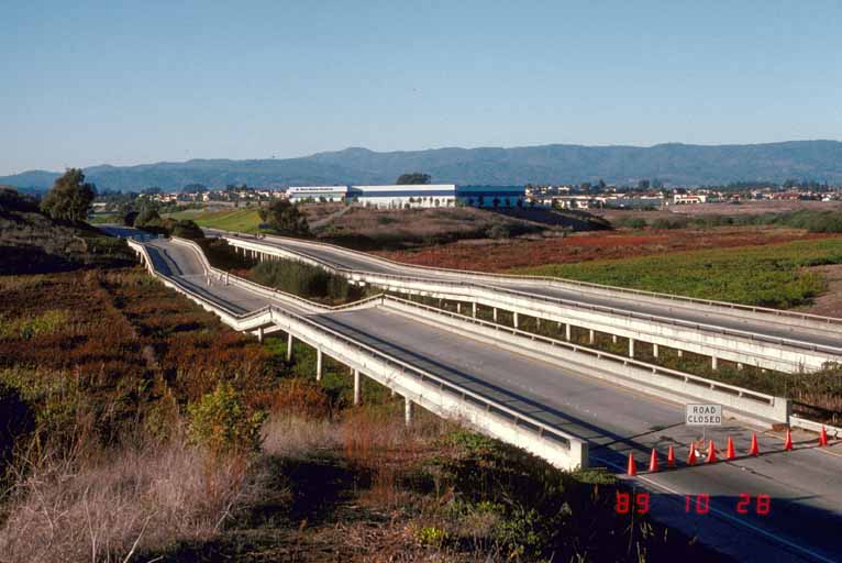
94. Structural failure of twin bridges carrying Highway 1 across Struve Slough, near Watsonville. [J.C. Tinsley, U.S. Geological Survey]
 Click here to view screen-resolution image - 45K
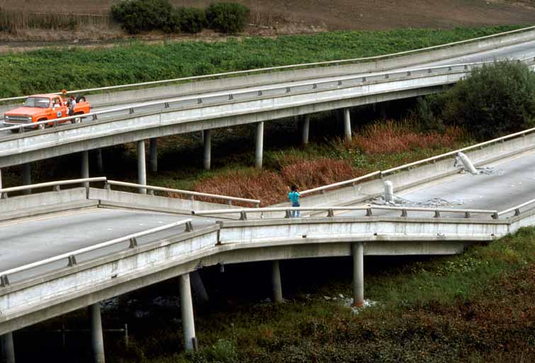
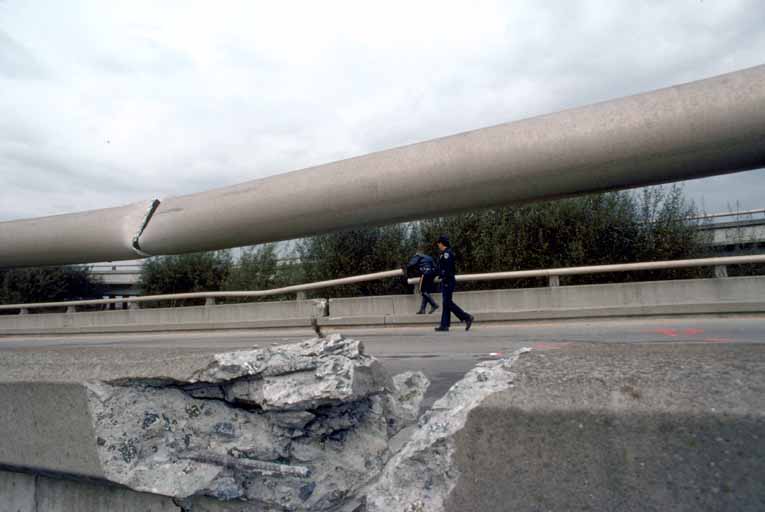
95. Close-up of collapsed bridge section on Highway 1 at Struve Slough. [J.K. Nakata, U.S. Geological Survey]
 Click here to view screen-resolution image - 45K
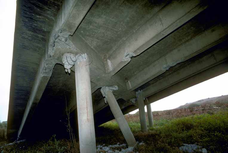
96. Failure at the joist/columns interface contributed to the collapse of elevated road bed on Highway 1. [J.K. Nakata, U.S. Geological Survey]
 Click here to view screen-resolution image - 45K
97. Support columns of Highway 1 bridge across Struve Slough protrude through road bed. This resulted from collapse of the road bed after the effects of lateral shaking shown in photo 98. [H.G. Wilshire, U.S. Geological Survey]
 Click here to view screen-resolution image - 45K
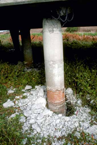
98. Support column of bridge across Struve Slough, Highway 1. Enlargement of hole where support enters the ground is an effect of lateral shaking. which caused the concrete to break up where the column joined the bridge and was instrumental in the roadbed collapse. [H.G. Wilshire, U.S. Geological Survey]
 Click here to view screen-resolution image - 45K
99. A fracture cuts the road bed, curbs and railings on the collapsed portion of Highway 1 at Struve Slough. [J.K. Nakata, U.S. Geological Survey]