Mount Douglas | | Kaguyak Volcano
Katmai Caldera | | Trident Volcano
Novarupta | | Valley of Ten Thousand Smokes
Mount Griggs | | Mount Mageik
Mount Martin | | Ukinrek Maars
Peulik Volcano | | Ugashik Caldera
Chiginagak Volcano | | Yantarni Volcano
Aniakchak Caldera | | Black Peak
Veniaminof Volcano | | Pavlof Sister and Pavlof Volcanoes
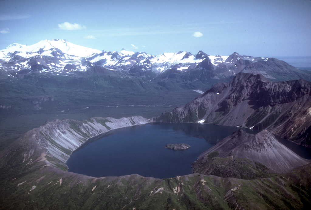
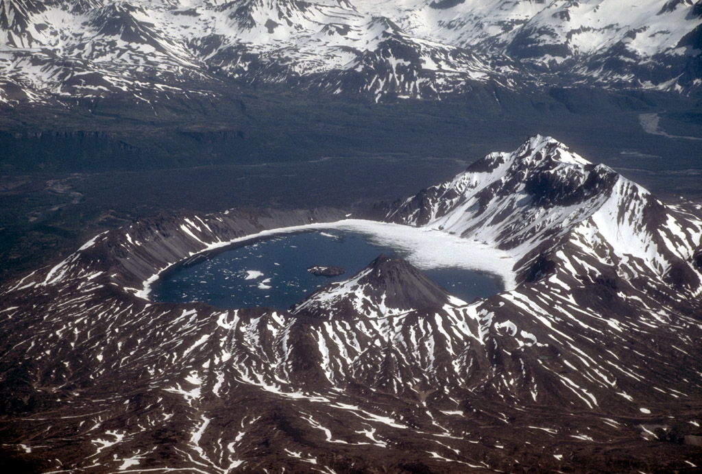
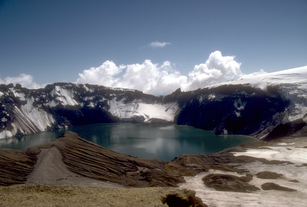
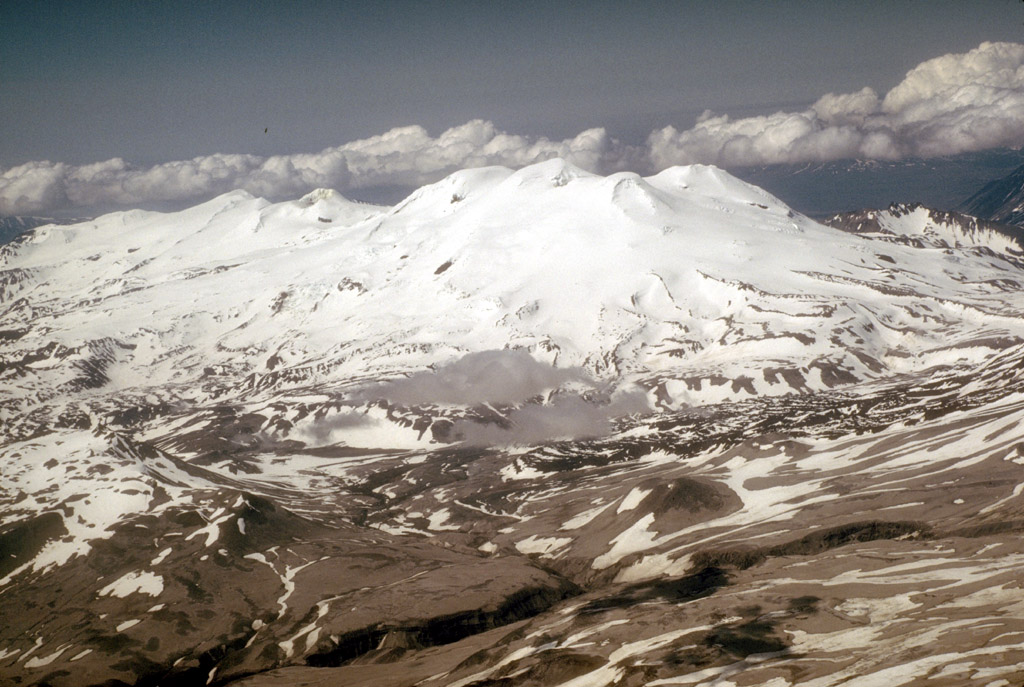
Emmons Lake Caldera | | Mount Dutton Volcano
Cold Bay Volcano | | Shishaldin Volcano
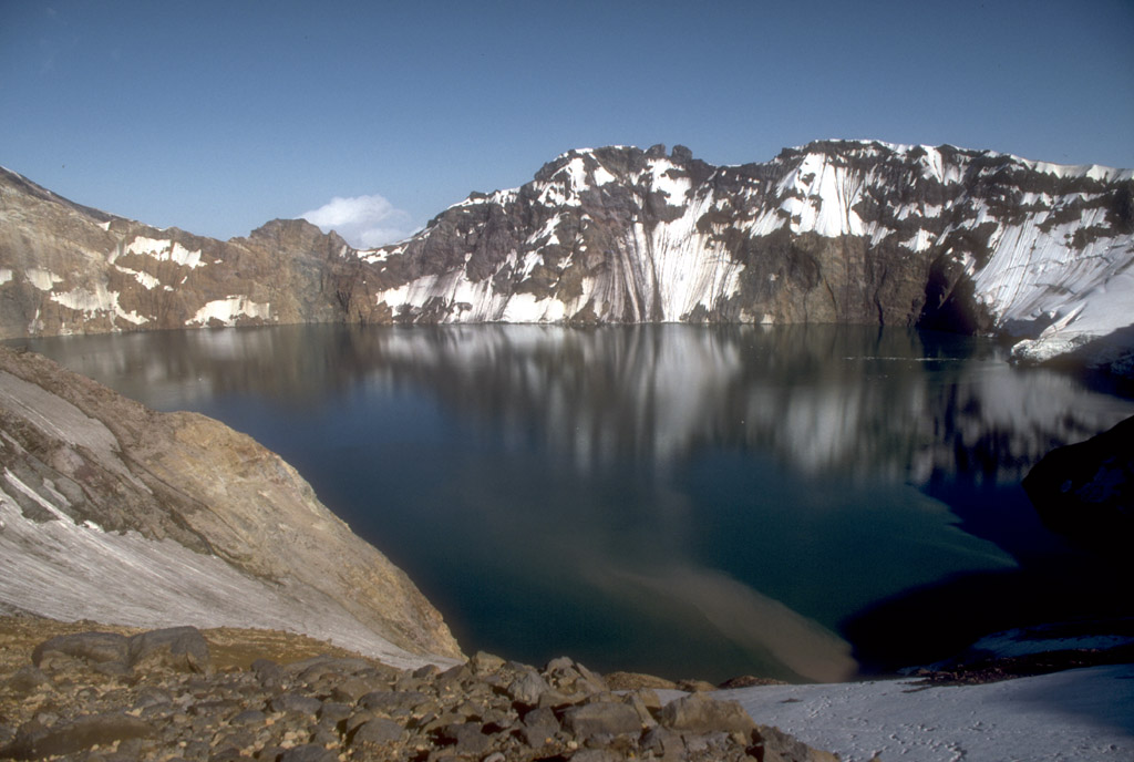
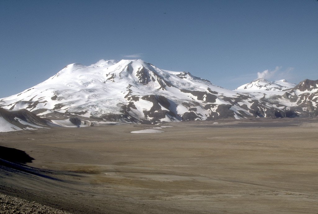
Fisher Caldera | | Westdahl Volcano
Mount Gilbert | | Akutan Volcano
Makushin Volcano | | Bogoslof Island
Okmok Caldera | | Mount Recheshnoi
Mount Vsevidof | | Mount Cleveland
Carlisle Volcano | | Seguam Island
Kanaga Volcano
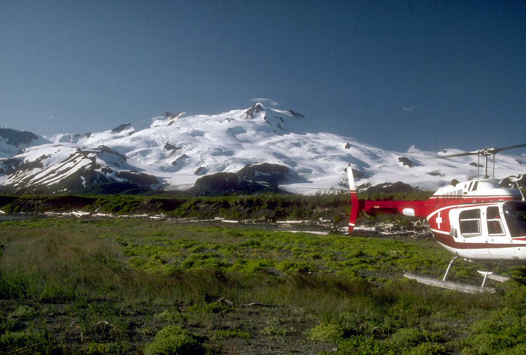
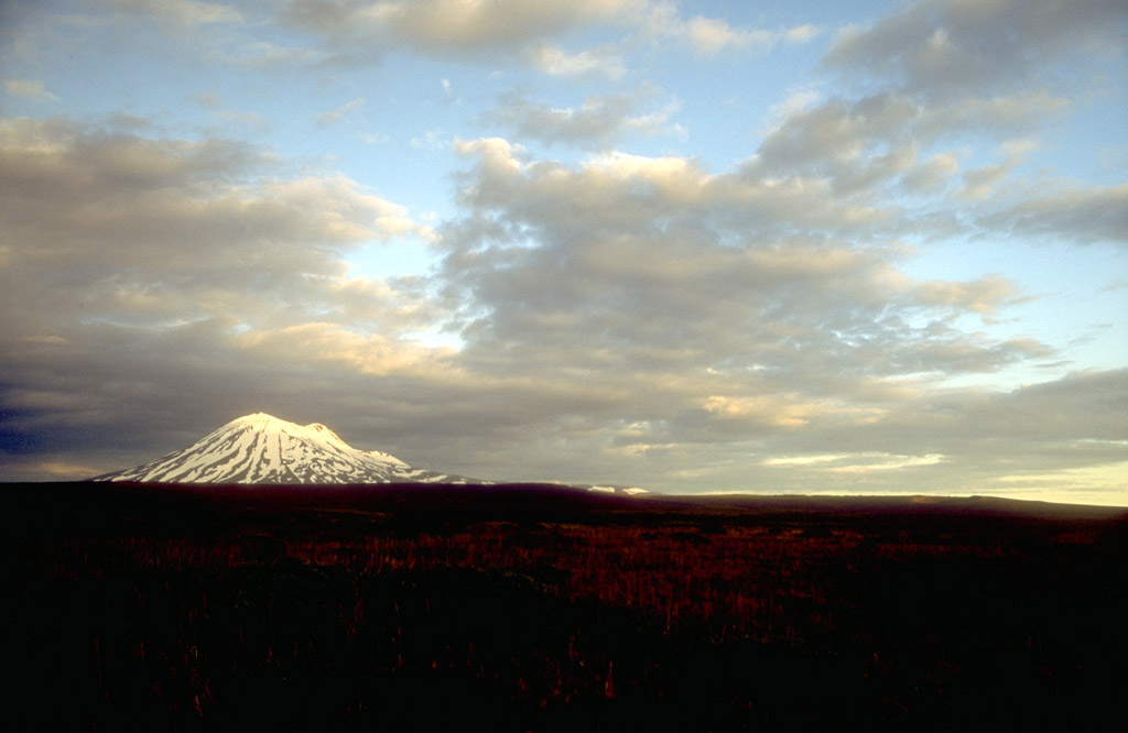
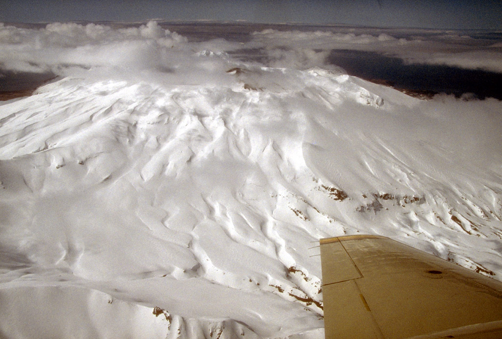
2. At the summit of 2,135-m (7,005 ft)-high Mount Douglas
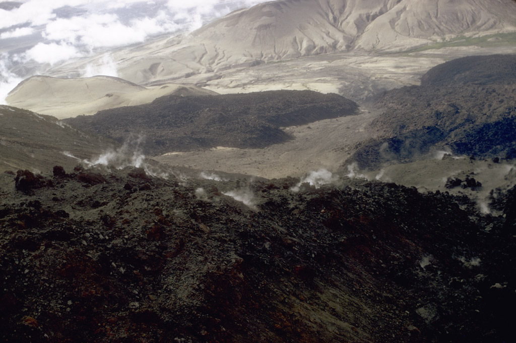
volcano on the northeastern tip of the Alaska Peninsula is
a warm and highly acidic crater lake approximately 160 m
(525 ft) wide. Photograph by C. Neal, U.S. Geological
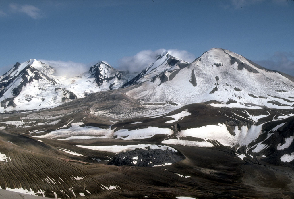
Survey, June 4, 1990.
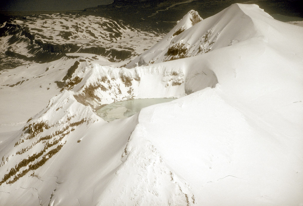
3. Steam rises from active fumaroles on the north side of
the crater lake (left center) at Mount Douglas volcano on
the northeastern tip of the Alaska Peninsula. In 1992, the
lake had a pH of 1.1 and a temperature of 21 degrees C (70
degrees F). Photograph by C. Nye, Alaska Division of
Geological and Geophysical Surveys, August, 1982.
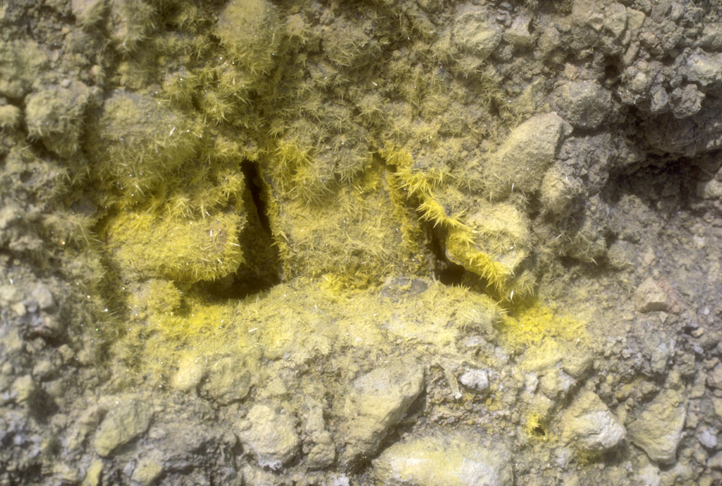
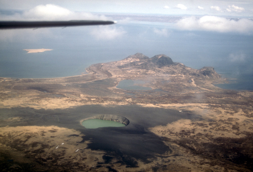
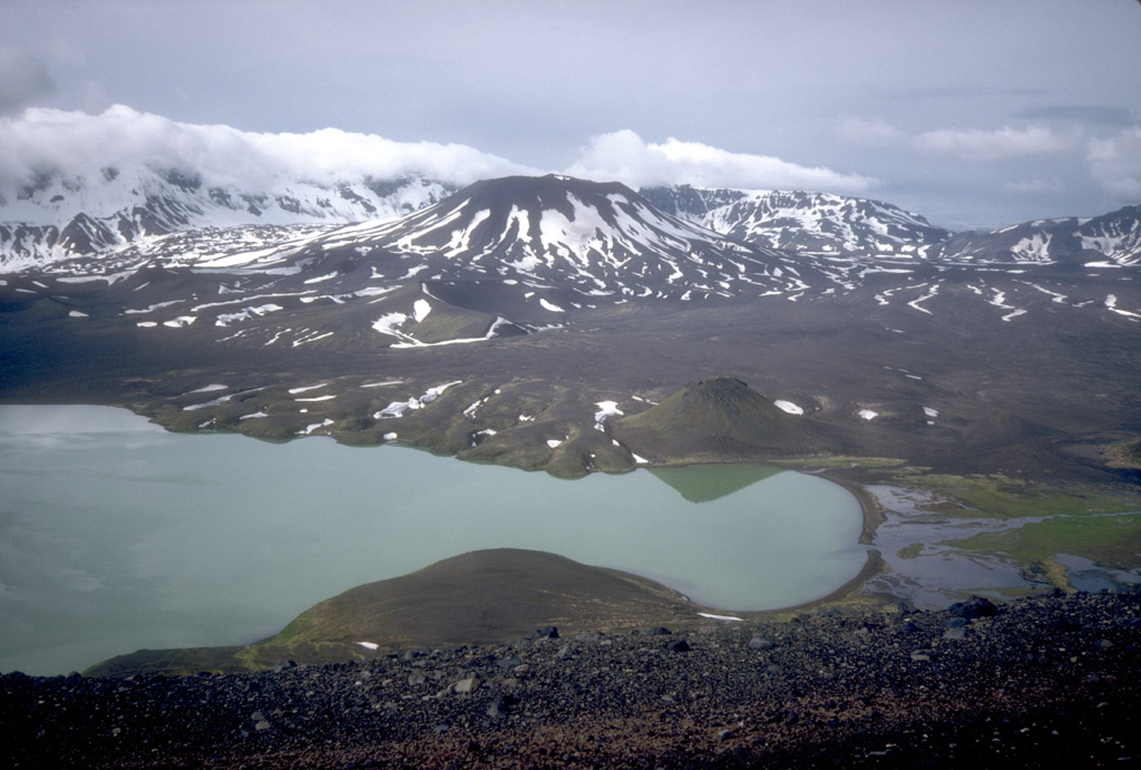
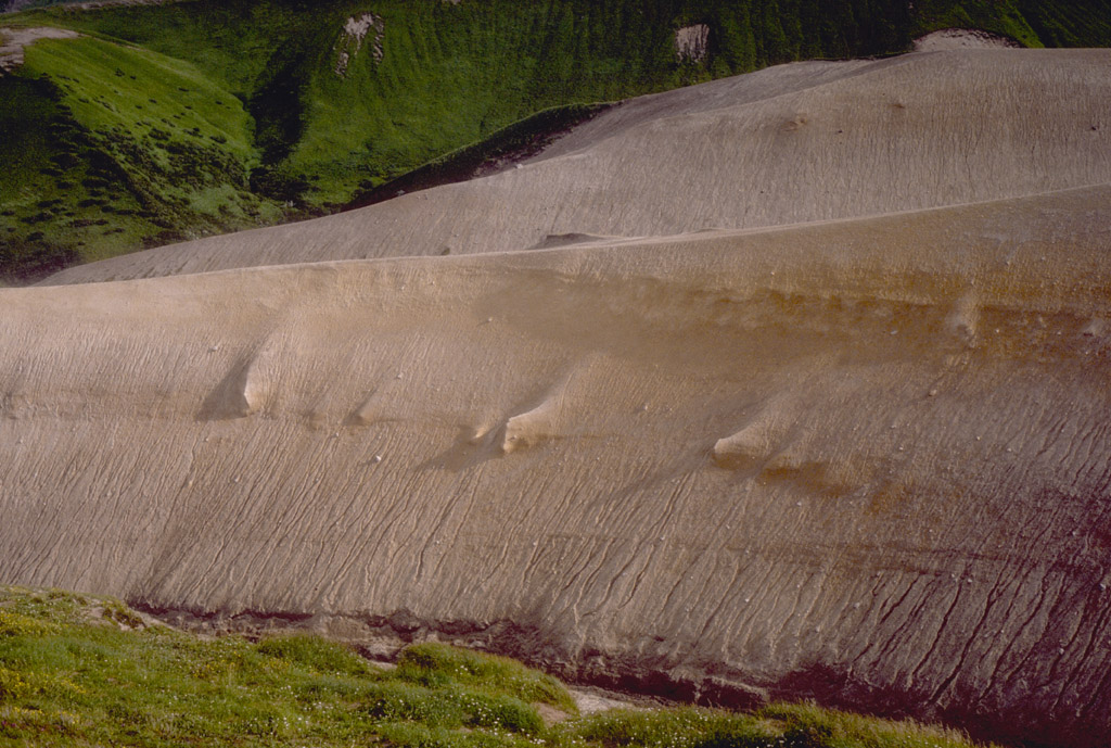
4. Active fumaroles deposit sulfur near the margin of the
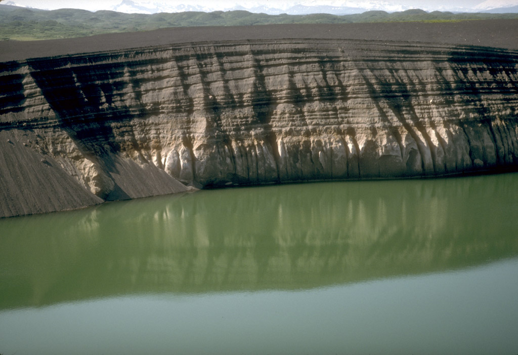
crater lake at Mount Douglas volcano on the northeastern
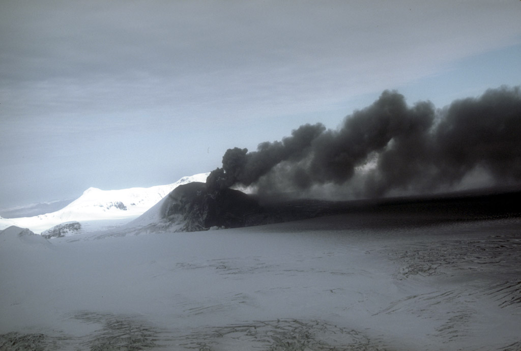
tip of the Alaska Peninsula. Area of view is approximately
20 cm (8 in) across. Photograph by C. Nye, Alaska Division
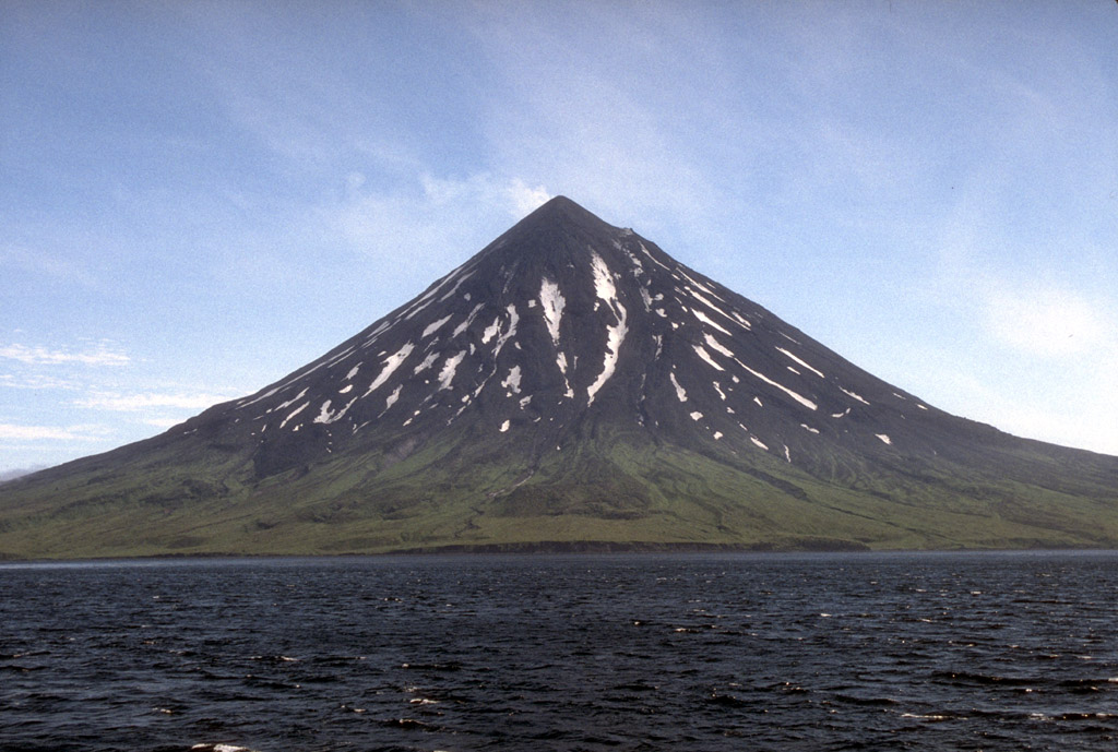
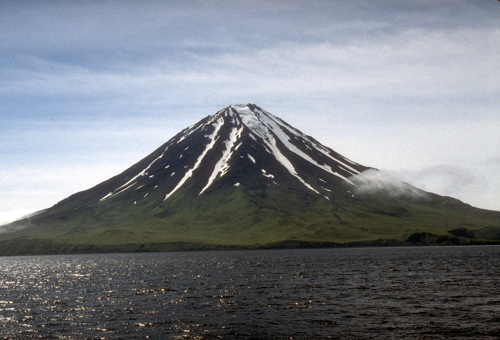
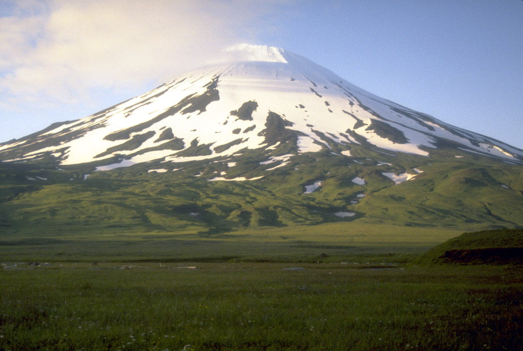
of Geological and Geophysical Surveys, August, 1982.
Back to top

6. Kaguyak volcano is lake-filled caldera, 2.5-km (1.5 mi)
in diameter, that truncates a former stratovolcano.
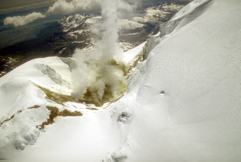
Postcaldera lava domes form a prominent peninsula and a
small island. Fourpeaked Mountain, a little-studied
volcano, is on the skyline at left. Photograph by C. Nye,
Alaska Division of Geological and Geophysical Surveys,
August, 1982.
7. Kaguyak volcano is lake-filled caldera, 2.5-km (1.5 mi)
in diameter, that truncates a former stratovolcano.
Postcaldera lava domes form a prominent peninsula (center)
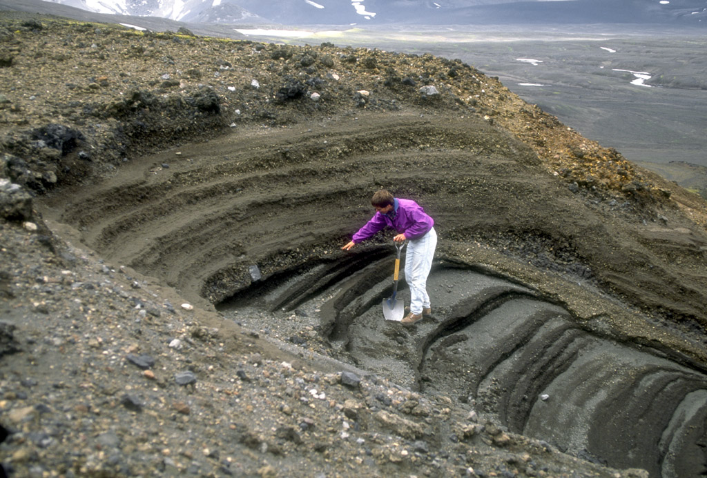
and a small island. Photograph by C. Neal, U.S. Geological
Survey, June 4, 1990.
Back to top
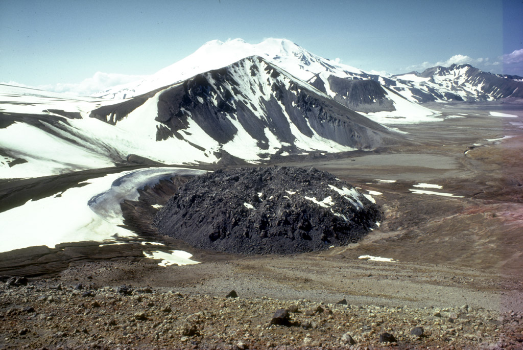
9. Katmai Caldera, a collapse feature that formed during
the catastrophic eruption of nearby Novarupta volcano in
June, 1912, is a steep-walled, 1.5-km (1 mi)-diameter
crater which truncates a formerly 2,290-m (7,513 ft)-high
stratovolcano. The caldera is partially filled by a blue-
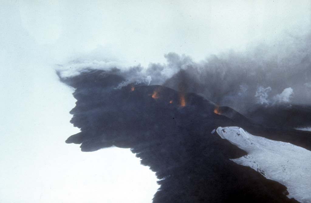
green lake about 250 m (820 ft) deep. The lake level was
still rising when last measured in the mid-1970's.
Photograph by C. Neal, U.S. Geological Survey, June 4,
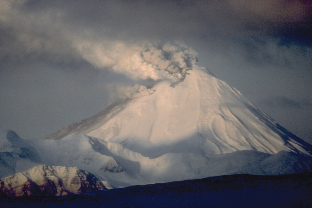
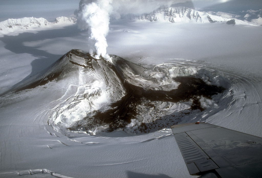
1990.

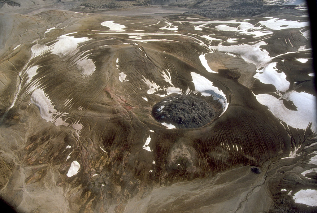
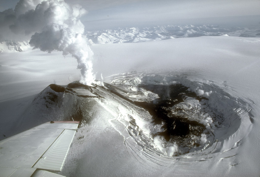
10. Katmai Caldera, a collapse feature that formed during
the catastrophic eruption of nearby Novarupta volcano in
June, 1912, is a steep-walled, 1.5-km (1 mi)-diameter
crater that truncates a formerly 2,290-m (7,513 ft)-high
stratovolcano. The caldera is partially filled by a blue-
green lake about 250 m (820 ft) deep. The lake level was
still rising when last measured in the mid-1970's. The
multiple peaks of Trident Volcano are at top left. The lava
dome of Novarupta volcano, which marks the site of the 1912
eruption, is visible at top, center. Photograph by C. Neal,
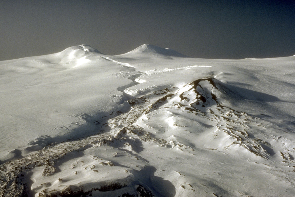
U.S. Geological Survey, June 4, 1990.
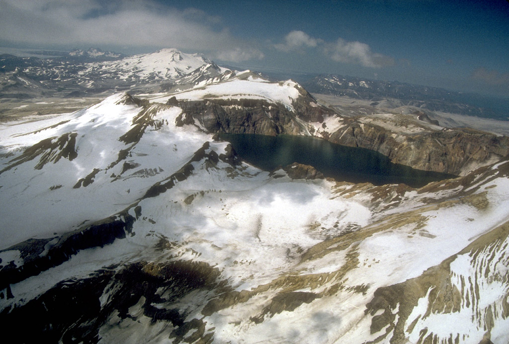
11. View from the north rim of Katmai Caldera, a collapse
feature that formed during the catastrophic eruption of
nearby Novarupta volcano in June, 1912. Katmai Caldera is a
steepwalled, 1.5-km (1 mi)-diameter crater that truncates a
formerly 2,290-m (7,513 ft)-high stratovolcano. The caldera
is partially filled by a blue-green lake about 250 m (820
m) deep. The lake level was still rising when last measured
in the mid-1970's. The south interior wall of the caldera
is visible in this view. Photograph by R. McGimsey, U.S.
Geological Survey, July 16, 1990.
12. View from the west rim of Katmai Caldera, a collapse
feature that formed during the catastrophic eruption of
nearby Novarupta volcano in June, 1912. Katmai Caldera is a
steepwalled, 1.5-km (1 mi)-diameter crater that truncates a
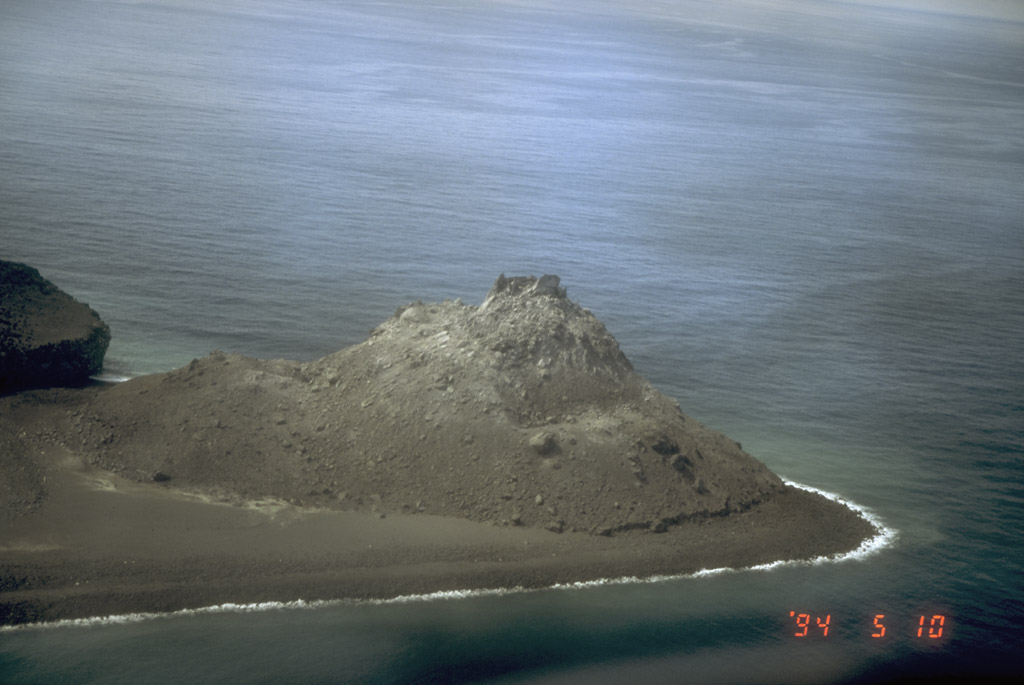
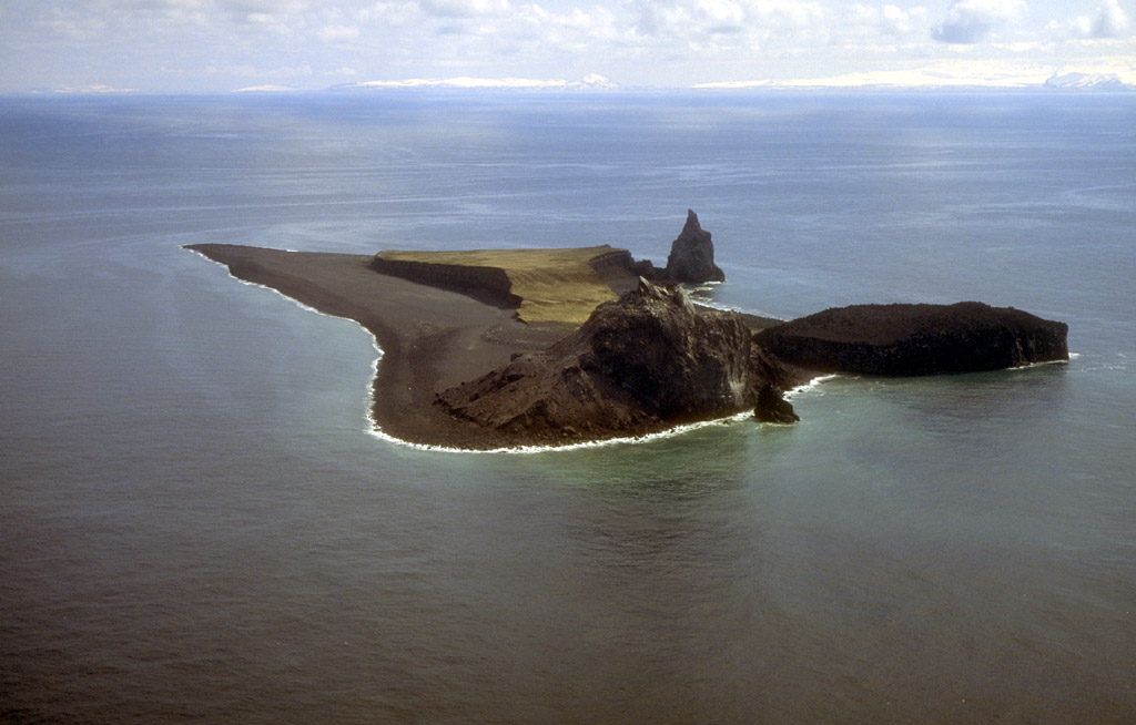
formerly 2,290-m (7,513 ft)-high stratovolcano. The caldera
is partially filled by a blue-green lake about 250 m (820
ft) deep. The lake level was still rising when last
measured in the mid-1970's. The east interior wall of the
caldera is visible in this view. Photograph by R. McGimsey,
U.S. Geological Survey, July 16, 1990.
Back to top
14. These blocky andesite lava flows from Trident Volcano
were emplaced during an extended eruptive period between
1953 and the mid-1960's. Trident Volcano is composed of a
cluster of andesite and dacite cones and is the only Katmai
group volcano other than Katmai and Novarupta to have had
historical activity. Photograph by T. Miller, U.S.
Geological Survey, July, 1974.
Back to top
16. Aerial view of 80-m (260 ft)-high Novarupta, a blocky
rhyolite lava dome that marks the vent for the 1912
eruption that created the Valley of Ten Thousand Smokes in
Katmai National Park and Preserve, Alaska. This eruption
was the most voluminous on Earth in the 20th century,
ejecting nearly 30 cubic kilometers (7 cubic miles) of
material in 60 hours. Surrounding the dome is an oval-
shaped ring of coarse tephra that accumulated during the
waning explosive phases of the 1912 eruption. Photograph by
C. Nye, Alaska Division of Geological and Geophysical
Surveys, August, 1991.
17. View from Mount Katmai of Novarupta lava dome (dark,
rounded feature in center), which is surrounded by
(clockwise from upper left) Falling, Baked, and Broken
Mountains. The Valley of Ten Thousand Smokes (upper right),
Katmai National Park and Preserve, Alaska, was created by
the 1912 eruption of Novarupta volcano. Photograph by C.
Nye, Alaska Division of Geological and Geophysical Surveys,
August, 1991.
Back to top
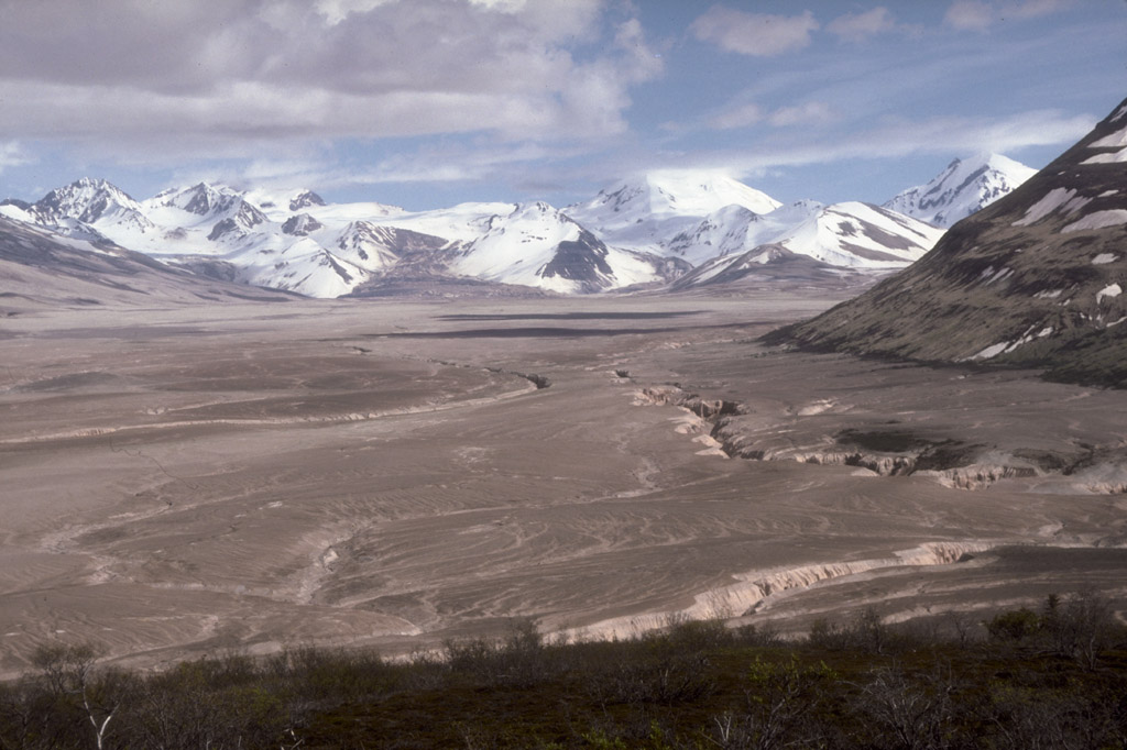
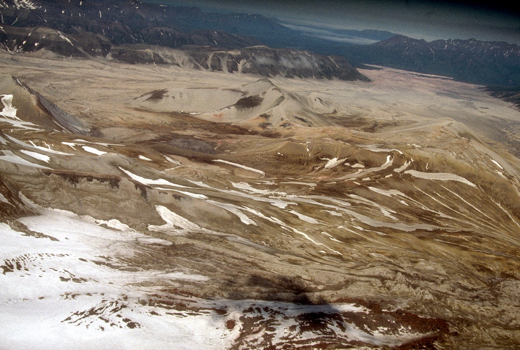
19. View southeast up the Valley of Ten Thousand Smokes
from the Overlook Cabin in Katmai National Park and
Preserve, Alaska. The valley is filled with up to 200 m
(660 ft) of ash-flow deposits from the 1912 eruption of
Novarupta volcano. The rim of Katmai Caldera is on the
skyline at left. Photograph by R. McGimsey, U.S. Geological
Survey, June 10, 1991.

20. View southeast up the Valley of Ten Thousand Smokes
from the Overlook Cabin in Katmai National Park and
Preserve, Alaska. The valley has been filled with up to 200
m (660 ft) of ash-flow deposits from the 1912 eruption of
Novarupta volcano. The rim of Katmai Caldera is on the
skyline at left. Photograph by R. McGimsey, U.S. Geological
Survey, June 8, 1991.
Back to top
22. Mount Griggs volcano, 2,317-m (7,602 ft)-high, here
seen from the west rim of Katmai caldera, lies 10 km (6 mi)
behind the volcanic arc defined by other Katmai group
volcanoes. Although no historic eruptions have been
reported from Mount Griggs, vigorously active fumaroles
persist in a summit crater and along the upper southwest
flank. The slopes of Mount Griggs are heavily mantled by
fallout from the 1912 eruption of Novarupta volcano. View
is to the northwest. Photograph by R. McGimsey, U.S.
Geological Survey, July 16, 1990.
23. Geologists walk toward 2,317-m (7,602 ft)-high, Mount
Griggs volcano from the base of Knife Creek Glacier at the
base of the northwest flank of Mount Katmai. Mount Griggs
volcano lies 10 km (6 mi) behind the volcanic arc defined
by other Katmai group volcanoes. Although no historical
eruptions have been reported from Mount Griggs, vigorously
active fumaroles persist in a summit crater and along the
upper southwest flank. The slopes of Mount Griggs are
heavily mantled by gray fallout from the 1912 eruption of
Novarupta volcano. View is to the north. Photograph by R.
McGimsey, U.S. Geological Survey, July 16, 1990.
Back to top
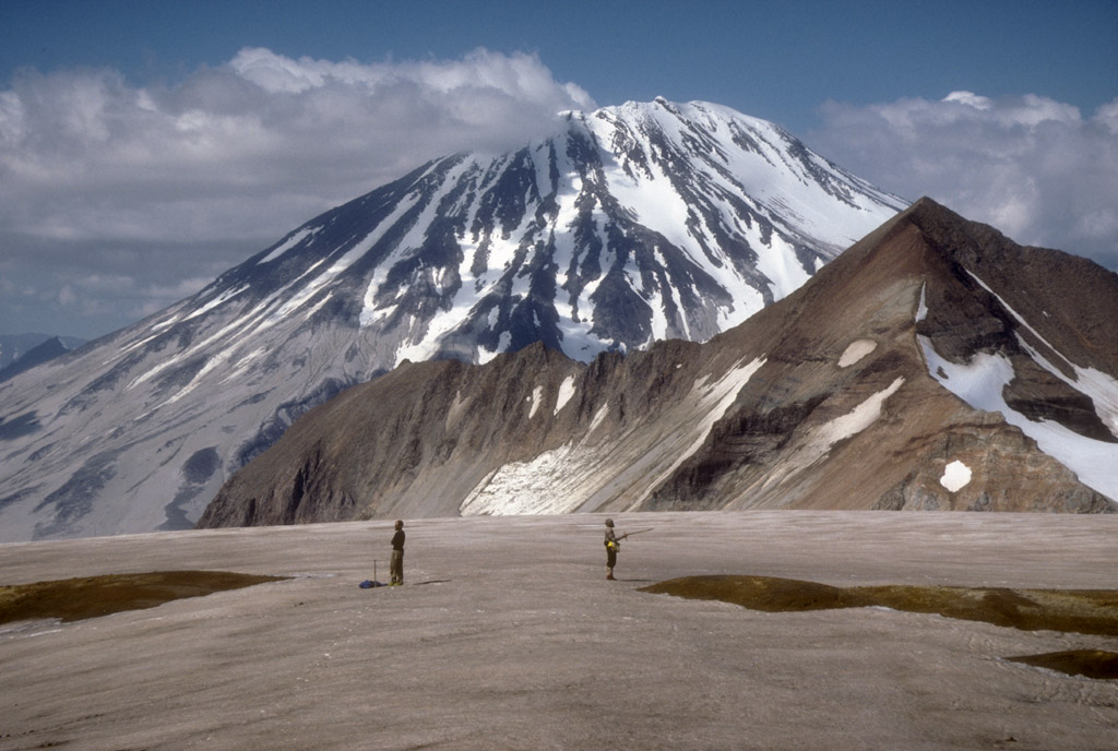
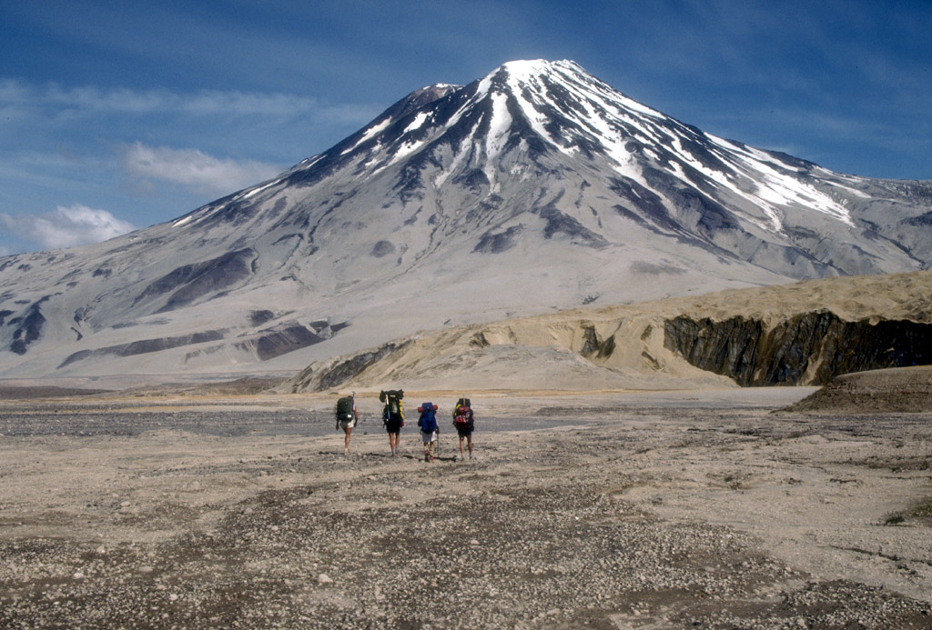
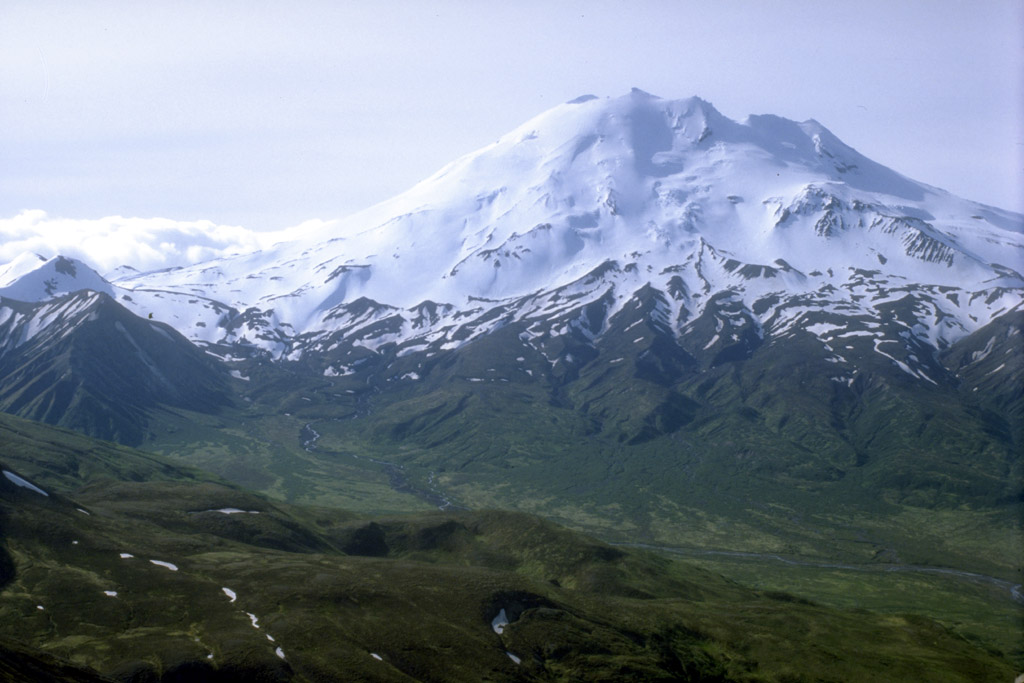
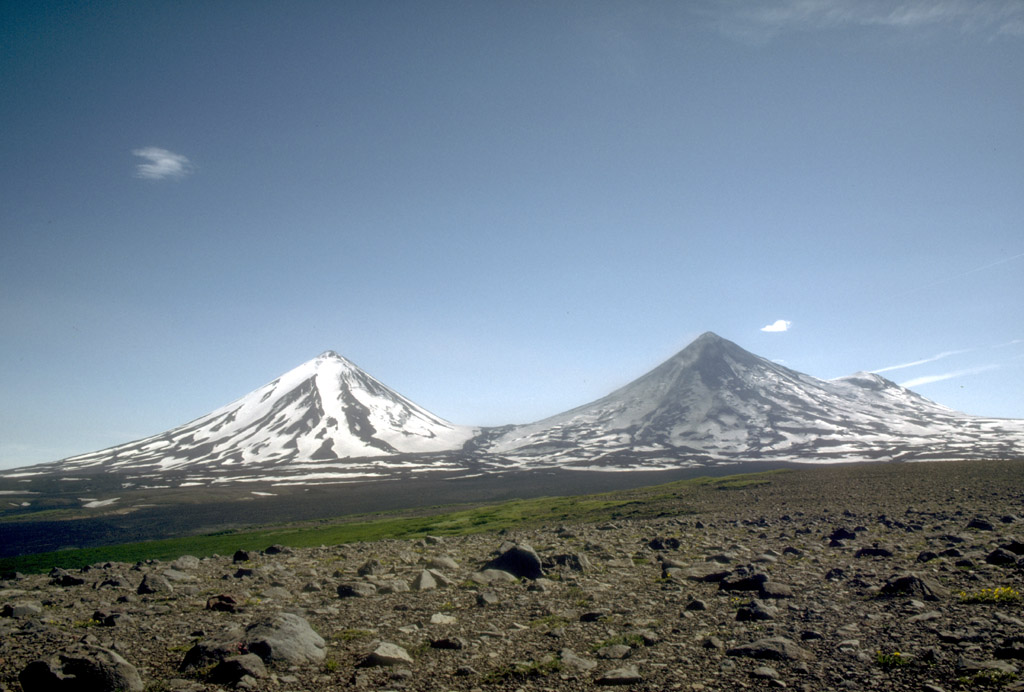
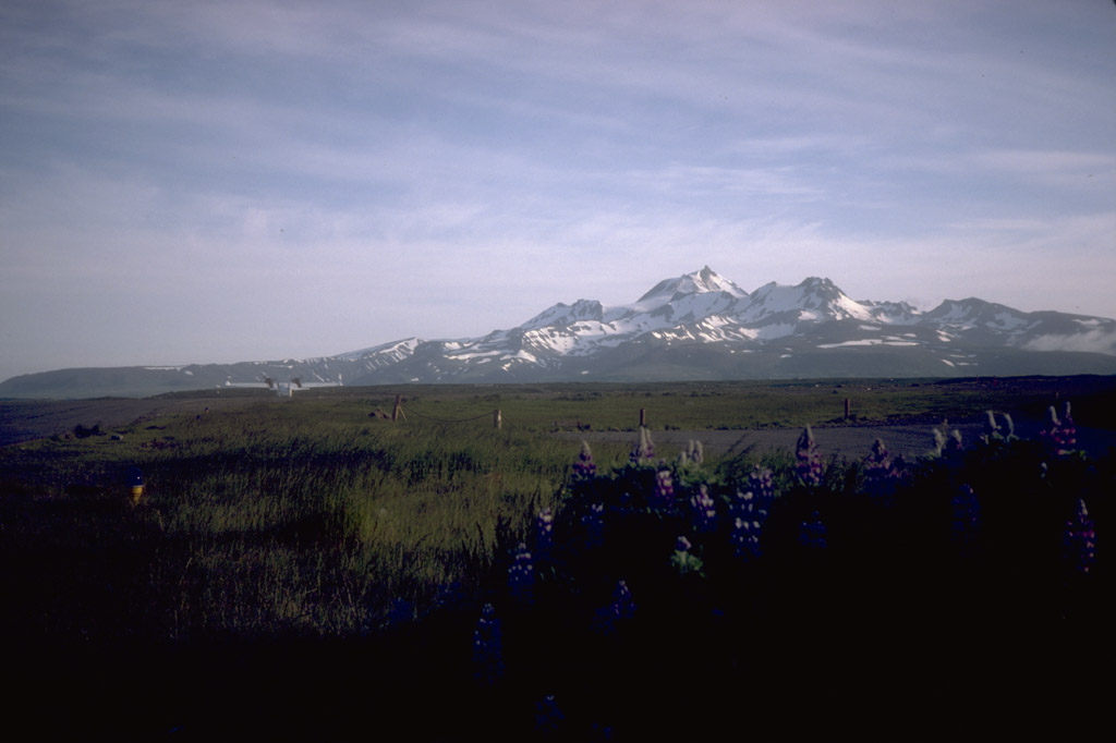
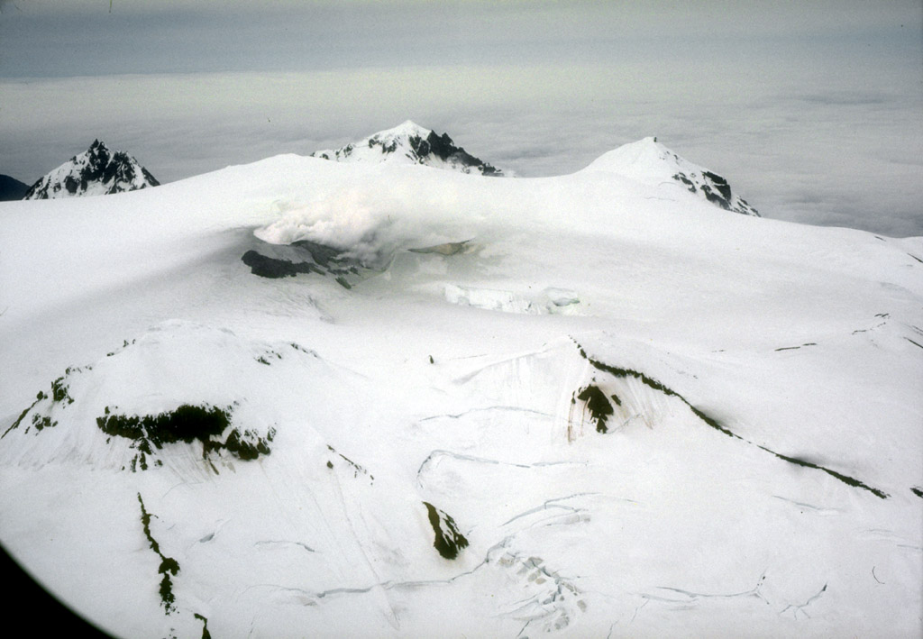
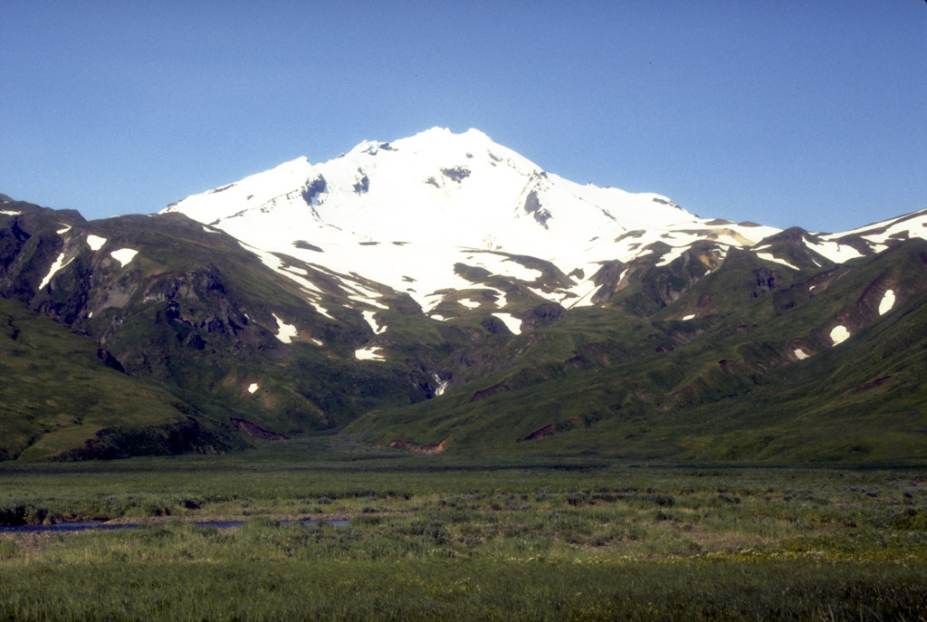
25. Mount Mageik (2,165 m [7,103 ft] high) and Mount Martin
(1,863 m [6,112 ft] high; on skyline at right) volcanoes,
both emitting steam plumes from their summits, as viewed to
the southwest from across the Valley of Ten Thousand
Smokes, Katmai National Park and Preserve, Alaska.
Photograph by R. McGimsey, U.S. Geological Survey, July 15,
1990.
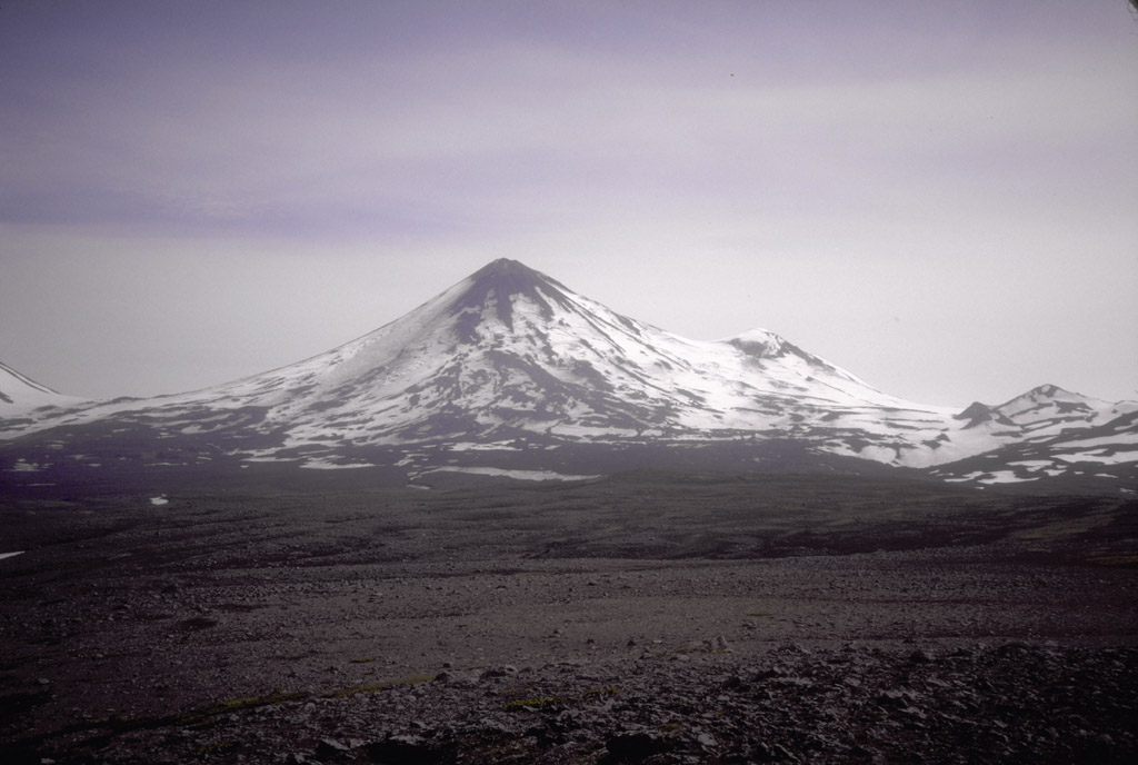
26. Nestled within a summit depression of 2,165-m (7,103
ft)-high Mount Mageik volcano is an acidic, hot (70 ºC [158
ºF]) crater lake. Persistent, vigorous fumaroles are
present. No historical eruptions from Mount Mageik have
been confirmed. Photograph by C. Neal, U.S. Geological
Survey, June 4, 1990.
Back to top

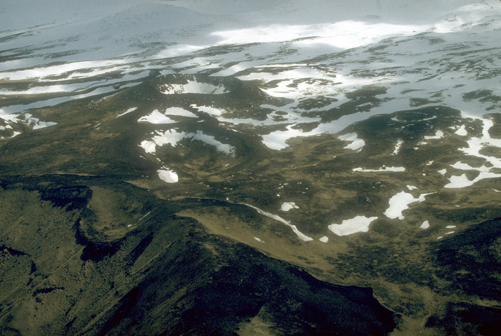
29. Near-vertical view of the east Ukinrek Maar crater, 300
m (980 ft) across, that formed in 1977 during a 10-day
phreatomagmatic eruption. Part of smaller west Ukinrek Maar
crater is visible at upper left. Photograph by D. Dewhurst,
U.S. Fish and Wildlife Service, July 8, 1990.
30. Southeast wall of the eastern Ukinrek Maar crater. The
rhythmically layered, dark gray material visible in the
wall consists of more than 15 m (50 ft) of phreatomagmatic
tephra. The 1977 tephra sits on an exposure of glacial till
capping ash-flow deposits from Ugashik Caldera. The lake
has filled the original crater to a depth of more than 30 m
(100 ft). In the distance at very top of photograph are
debris-avalanche hummocks from an unknown source near the
current site of Peulik volcano. Photograph by C. Neal, U.S.
Geological Survey, June 4, 1990.
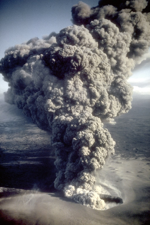
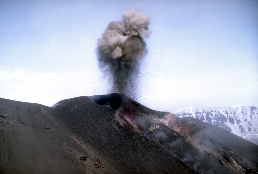
31. Phreatomagmatic eruption column rising from the east
Ukinrek Maar crater at about 5:00 PM on April 6, 1977. View
is to the southeast. Photograph by R. Russell, Alaska
Department of Fish and Game, April 6, 1977.
Back to top
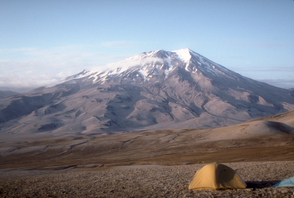
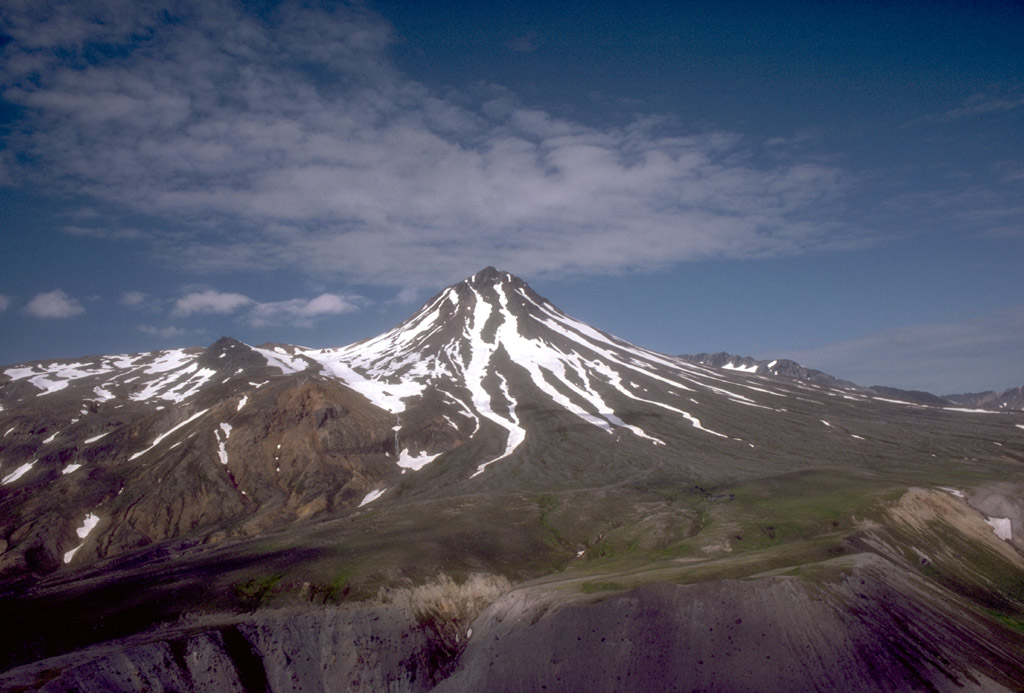
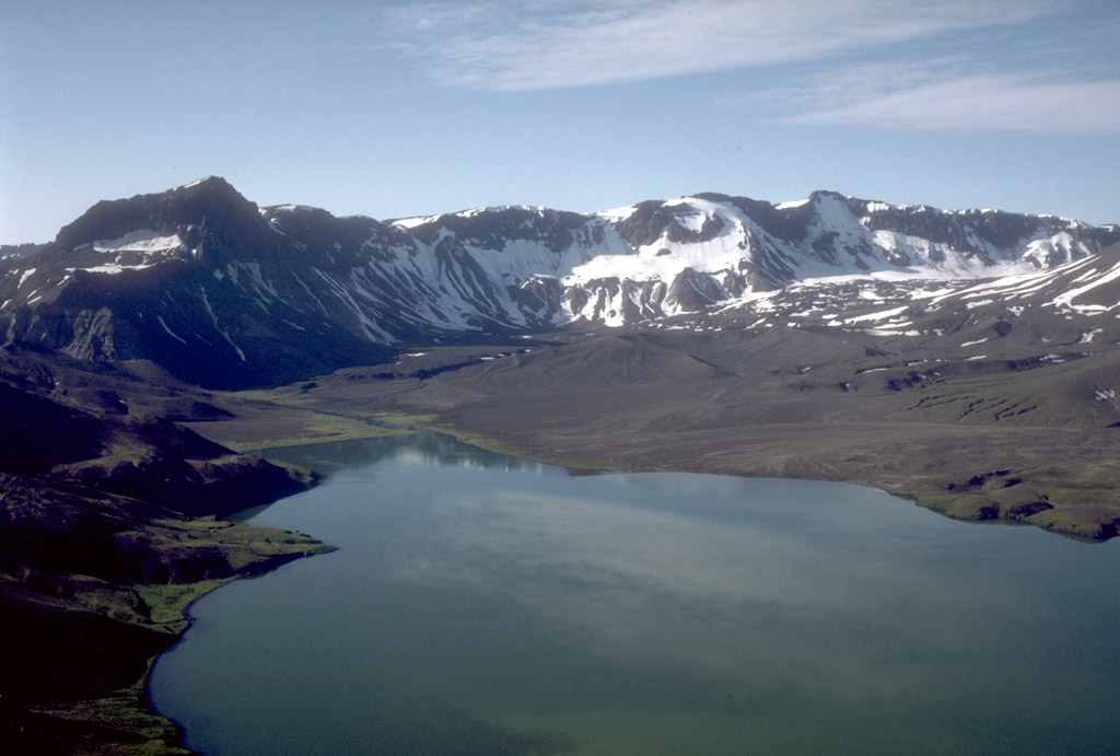
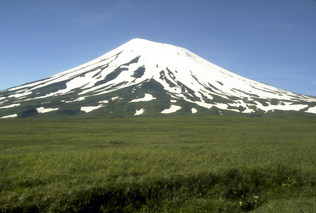
33. Peulik volcano, a 1,474-m (4,836 ft)-high
stratovolcano, as viewed at sunset from the south shore of
Becharof Lake on the Alaska Peninsula. Photograph by C.
Neal, U.S. Geological Survey, June, 1993.

34. Peulik volcano, a 1,474-m (4,836 ft)-high
stratovolcano, as viewed from the Ukinrek Maars on the
south shore of Becharof Lake on the Alaska Peninsula. In
the middle distance is hummocky ground that probably
represents debris-avalanche deposits from an older Peulik
stratovolcano. Photograph by C. Neal, U.S. Geological
Survey, June 25, 1993.
Back to top


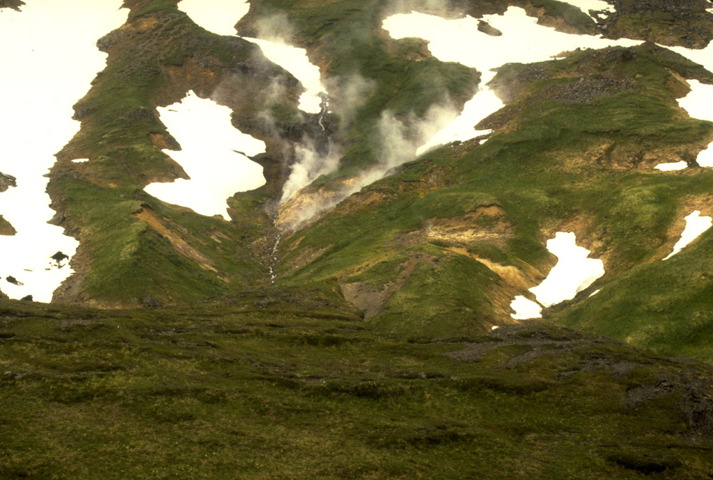
37. Aerial view of a vigorous fumarole at about 1,600 m
(5,249 ft) elevation on the north flank of 2,067-m (6,781
ft)-high Chiginagak volcano. Steam emitted from this
fumarole commonly produces a small plume and may be the
source of the few questionable reports of historical
eruptions from this volcano. Photograph by C. Nye, Alaska
Division of Geological and Geophysical Surveys, May 9,
1994.
Back to top
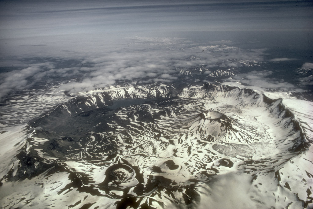
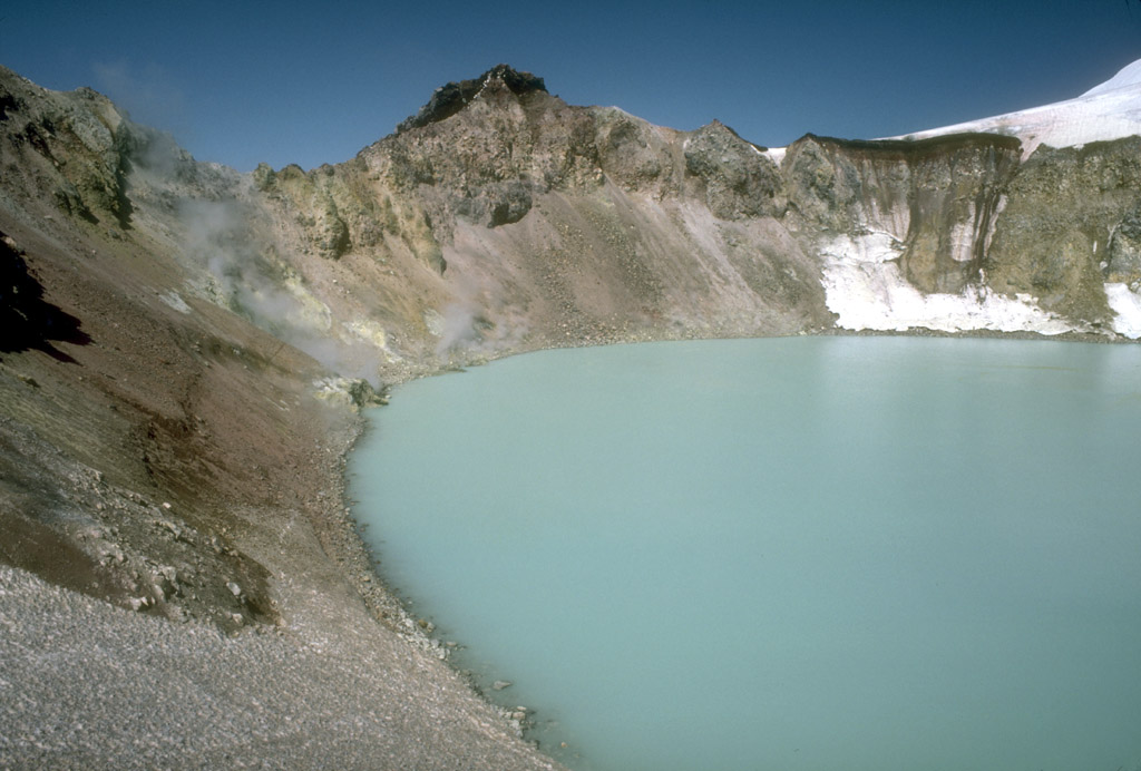
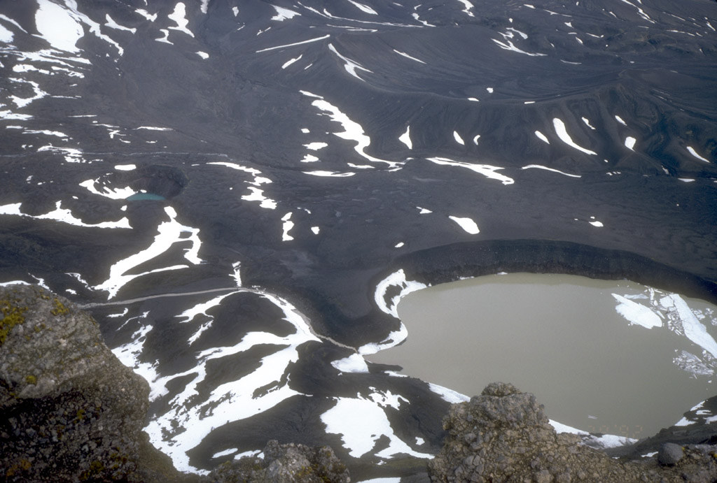
40. View, looking southwest, into Aniakchak caldera from
its north rim. Surprise Lake, which drains into the
Aniakchak River, is visible on the caldera floor. The
prominent steepsided intracaldera stratovolcano in the
distance is Vent Mountain. Photograph by C. Neal, U.S.
Geological Survey, June 29, 1992.
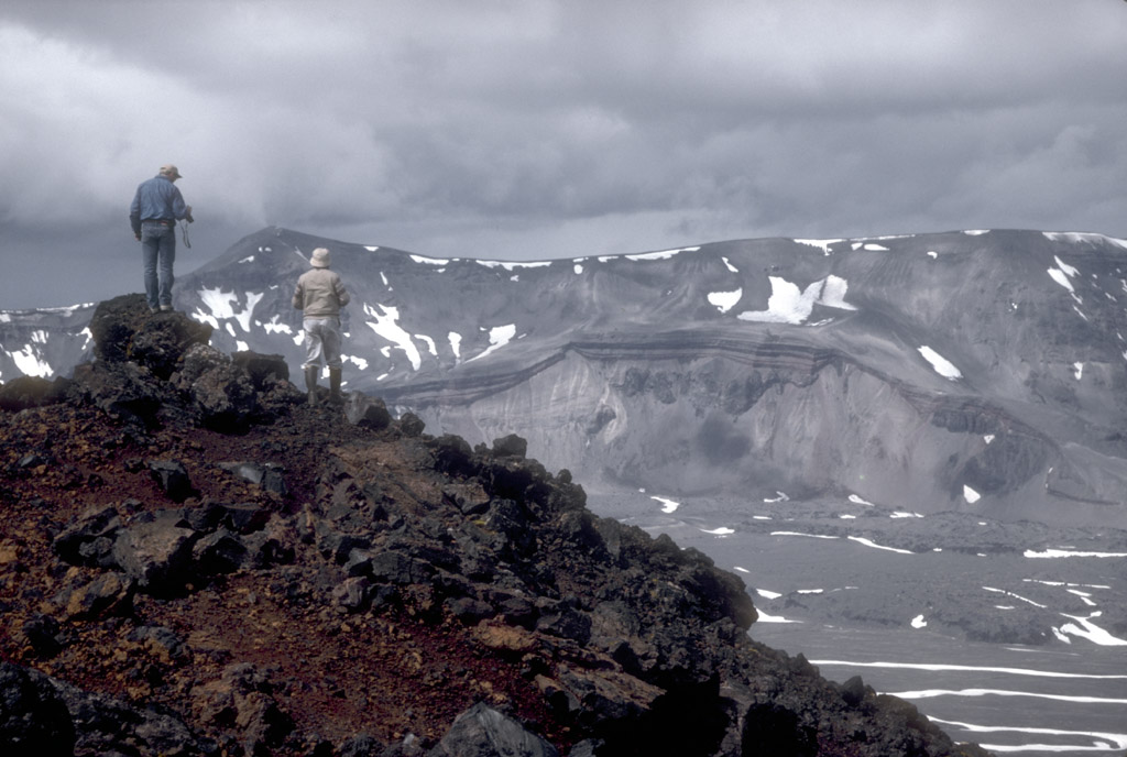
41. Geologists on the rim of Vent Mountain, an intracaldera
stratovolcano, look northwest towards Half Cone, a
prominent vent on the caldera floor and the source of the
most explosive postcaldera eruptions at Aniakchak caldera.
Photograph by C. Neal, U.S. Geological Survey, June 23,
1992.
42. View, looking south, across Aniakchak caldera from its
north rim. Surprise Lake and its outlet are visible at
upper left. The prominent dark peak on the left skyline is
Black Nose, a high standing remnant of precaldera
volcaniclastic rocks. Hummocky ground in the distance
against the caldera wall is a pumice-covered glacier and
associated moraine. Photograph by T. Miller, U.S.
Geological Survey, August, 1985.
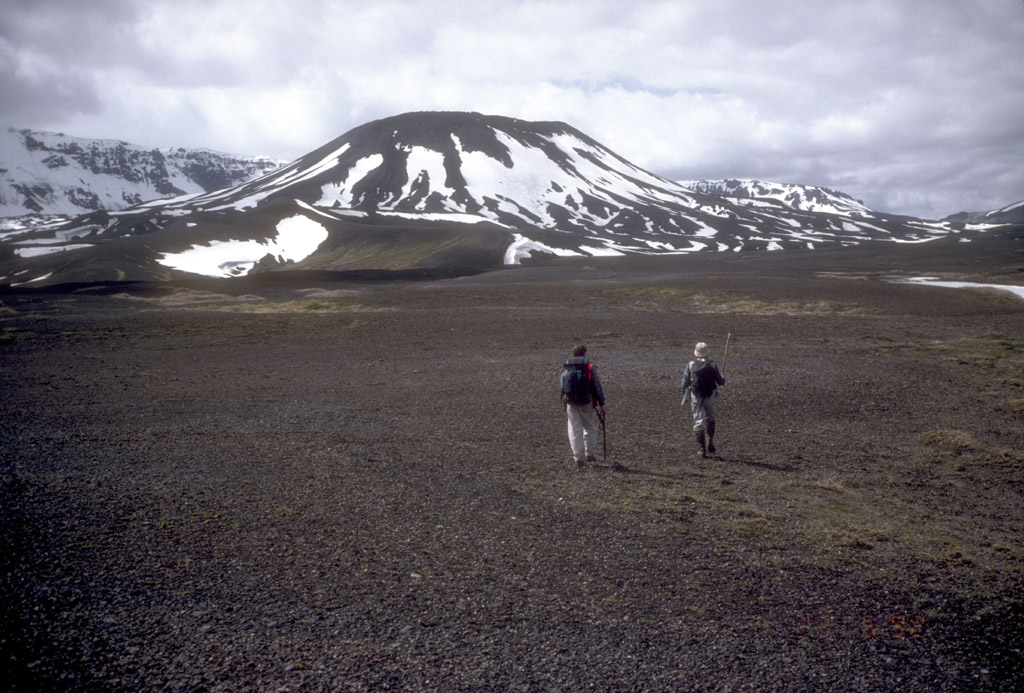
43. Geologists walking across the pumice-covered floor of
Aniakchak caldera en route to Vent Mountain, a prominent
intracaldera stratovolcano. In the middle ground is a
breached tuff cone informally known as "Surprise Cone."
Photograph by R. McGimsey, U.S. Geological Survey, June 23,
1992.

44. The Gates, a v-shaped notch in the eastern wall of
Aniakchak caldera, is the outlet for Surprise Lake, which
is visible at left. This view is from within the caldera
looking northeast. Photograph by C. Neal, U.S. Geological
Survey, July 19, 1994.
45. Geologist examining pyroclastic deposits (above hand)
from a violent eruption of Half Cone less than 500 years
ago. The deposits unconformably overlie dark gray
phreatomagmatic material (below hand) from Surprise tuff
cone in Aniakchak caldera. Photograph by R. McGimsey, U.S.
Geological Survey, July 23, 1993.

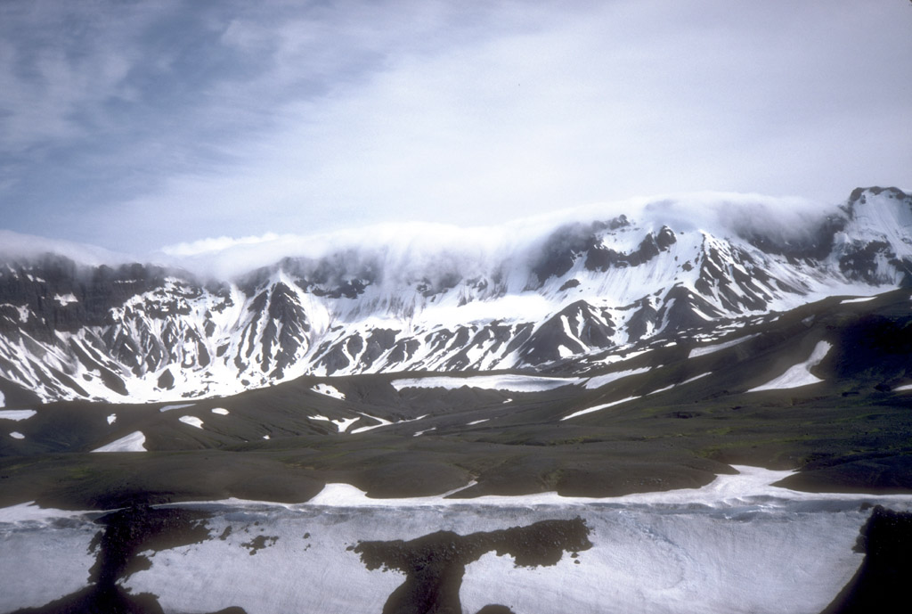
46. Jet contrails over Aniakchak caldera. The proximity of
explosive volcanoes of the Aleutian volcanic arc to North
Pacific air routes is one of the principal hazards
associated with volcanoes in Alaska. View is to the south.
Photograph by C. Neal, U.S. Geological Survey, July 19,
1994.
47. View onto the floor of the caldera from the southeast
rim of Aniakchak caldera. Two explosion craters (maar
craters) partially filled with seasonal meltwater are
visible. The craters were formed by explosions through
older lava flows from Vent Mountain, an intracaldera
stratocone. Photograph by R. McGimsey, U.S. Geological
Survey, June 29, 1992.

48. View, looking northeast, of the primary site of the
1931 eruption. The site is at the base of the northwest
caldera wall. This crater, about 600 m (1970 ft) across,
was the site of intermittent explosions of pumice-lithic
tephra over the course of several weeks in May and June,
1931. During the final phases of the eruption, a small lava
flow and spatter field formed in the bottom of the crater.
Photograph by R. McGimsey, U.S. Geological Survey, June 30,
1992.
49. Weather clouds cascade over the south wall of Aniakchak
caldera, a common occurrence that can portend bad weather.
Photograph by C. Neal, U.S. Geological Survey, July 3,
1992.
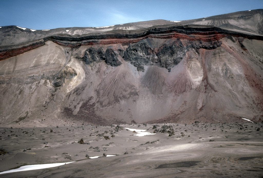
50. View of the cross section of Half Cone, a postcaldera
vent now exposed against the north wall of Aniakchak
caldera. Within this cliff face are recorded several
episodes of lava flows (dark rock outcrops), plinian
eruption (lighter colored deposits at left), and
spatterfed- flow accumulation (reddish layers). Photograph
by R. McGimsey, U.S. Geological Survey, July 1, 1992.
Back to top

53. Strombolian burst of incandescent lava fragments from
the intracaldera cinder cone at Veniaminof volcano on the
Alaska Peninsula. Veniaminof volcano is a 2,507-m (8,225
ft)- high stratovolcano with a summit caldera that formed
about 3,700 years ago. The caldera is now ice-filled. View
is to the northwest. Photograph by M.E. Yount, U.S.
Geological Survey, July 13, 1983.
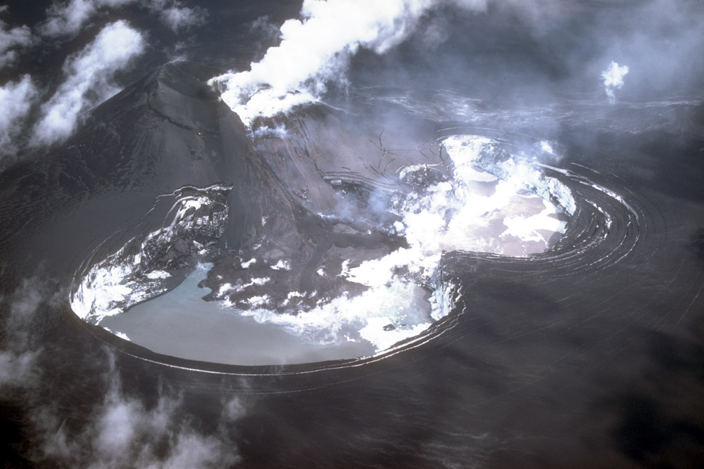
54. Eruptive activity from the intracaldera cinder cone at
Veniaminof volcano melted about 0.15 km3 (0.04 mi3) of the
summit ice-cap. View is to the northeast. Photograph by
M.E. Yount, U.S. Geological Survey, July 26, 1983.
55. Incandescent lava flows down the flank of the
intracaldera cinder cone at Veniaminof volcano on the
Alaska Peninsula. Photograph by M.E. Yount, U.S. Geological
Survey, October 7, 1983.
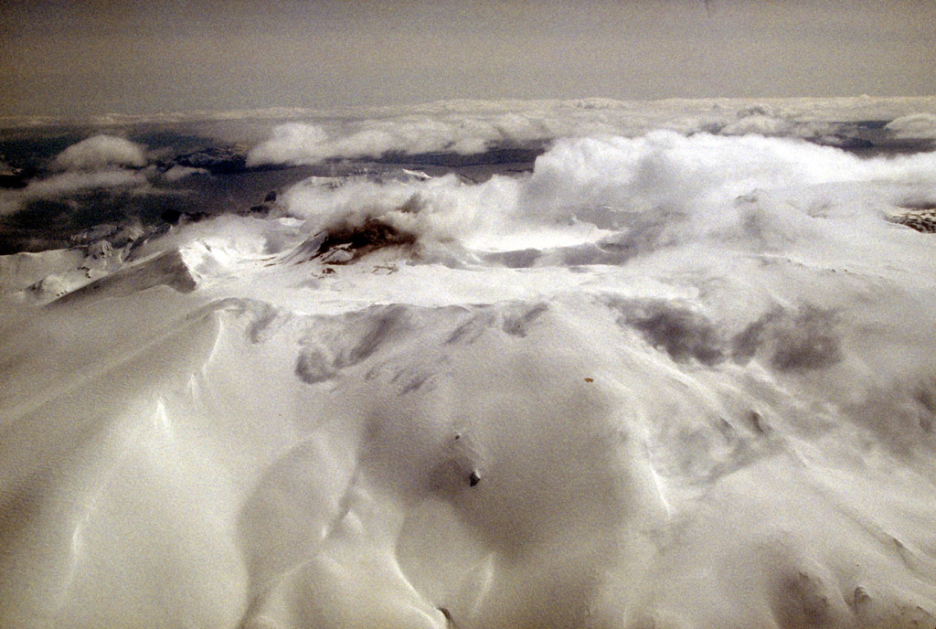
56. A pulsing, gray ash plume rising from the intracaldera
cinder cone at Veniaminof volcano on the Alaska Peninsula.
View is to the north. Photograph by M.E. Yount, U.S.
Geological Survey, October 7, 1983.
57. Steam rising from the intracaldera cinder cone at
Veniaminof volcano in the waning stages of the 1983 to 1984
eruption. Cooling lava flows fill a pit about 2.3x1.0 km
(1.4x0.6 mi) that has been melted in the summit ice cap.
Aerial view looking northeast. Photograph by M.E. Yount,
U.S. Geological Survey, January 23, 1984.
58. Steam rising from the intracaldera cinder cone at
Veniaminof volcano in the waning stages of the 1983 to 1984
eruption. Cooling lava flows fill a pit about 2.3x1.0 km
(1.4x0.6 mi) that has been melted in the summit ice cap.
View is to the southeast. Photograph by M.E. Yount, U.S.
Geological Survey, January 23, 1984.
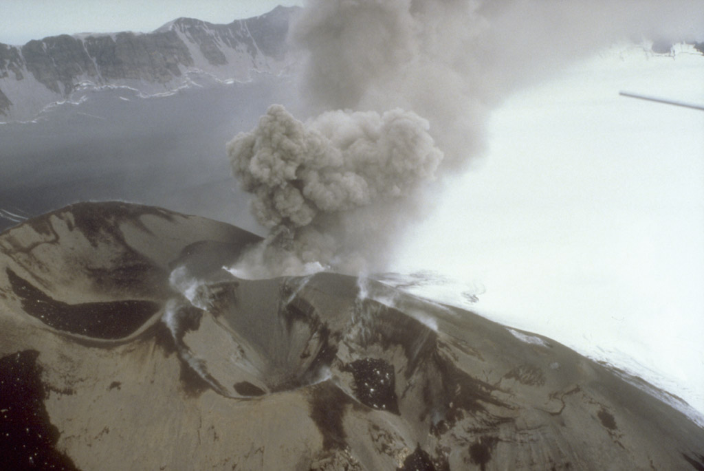
59. A burst of gray ash rising from the intracaldera cinder
cone at Veniaminof volcano on the Alaska Peninsula.
Photograph by D. Sellers, Alaska Department of Fish and
Game, August 3, 1993.

60. A new lava flow accumulates at the base of the
intracaldera cinder cone (obscured by steam at right) at
Veniaminof volcano on the Alaska Peninsula. View is to the
south. Photograph by C. Nye, Alaska Department of
Geological and Geophysical Surveys, May 9, 1994.

61. A new lava flow accumulates at the base of the
intracaldera cinder cone at Veniaminof volcano on the
Alaska Peninsula. View is to the west. Photograph by C.
Nye, Alaska Department of Geological and Geophysical
Surveys, May 9, 1994.
Back to top

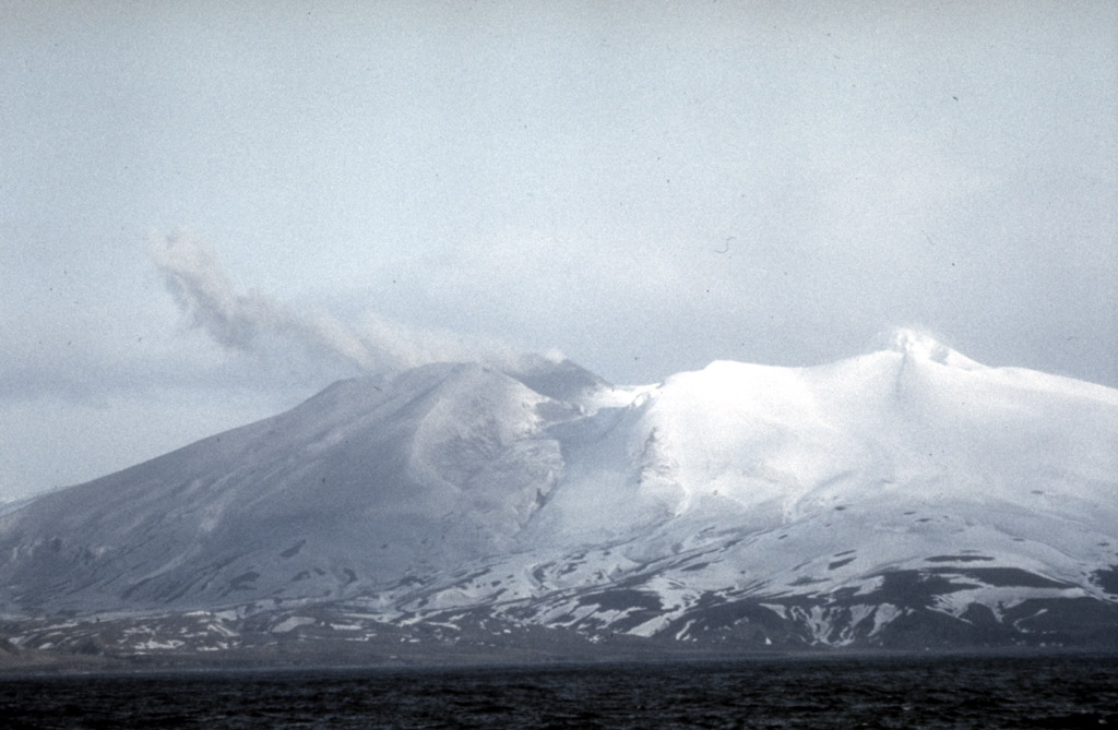
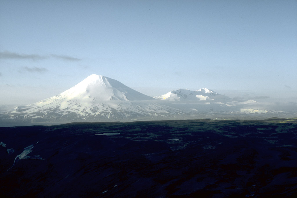
63. Pavlof (2,519-m [8,264 ft]-high, right) and Pavlof
Sister (2,143-m [7,031 ft]-high, left) are a pair of
symmetrical stratovolcanoes on the Alaska Peninsula. Pavlof
Volcano is one of the most active of Alaska's volcanoes
with nearly 40 historical eruptions. View is to the
northwest. Photograph by T. Miller, U.S. Geological Survey,
July, 1975.

64. Pavlof Volcano on the Alaska Peninsula is one of the
most active of Alaska's volcanoes with nearly 40 historical
eruptions. Photograph by S. McNutt, Lamont-Doherty
Geological Observatory, 1979.
65. Pavlof Volcano on the Alaska Peninsula is one of the
most active of Alaska's volcanoes with nearly 40 historical
eruptions. Photograph by S. McNutt, Lamont-Doherty
Geological Observatory, 1979.
Back to top
67. View, looking northeast, of 1,436-m (4,711 ft)-high
Mount Emmons, a postcaldera stratovolcano within the Emmons
Lake caldera on the Alaska Peninsula. The most recent of
several caldera-forming eruptions at Emmons Lake occurred
more than 10,000 years ago. No historical eruptions have
occurred at Emmons Lake. Photograph by T. Miller, U.S.
Geological Survey, July, 1987.
Back to top

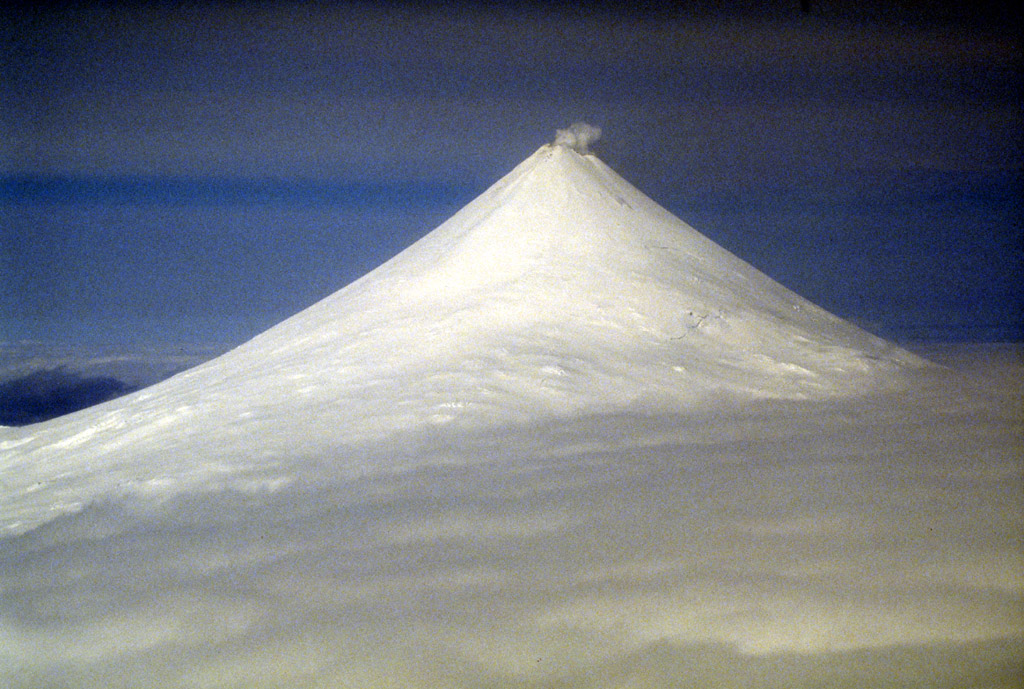
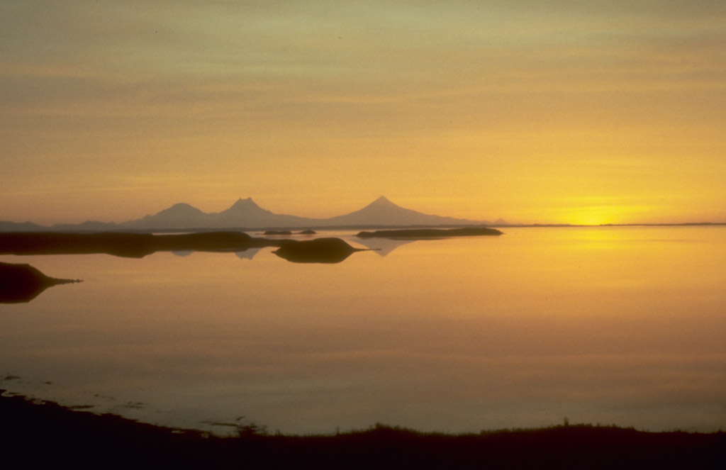
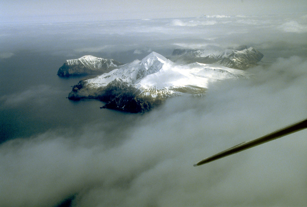
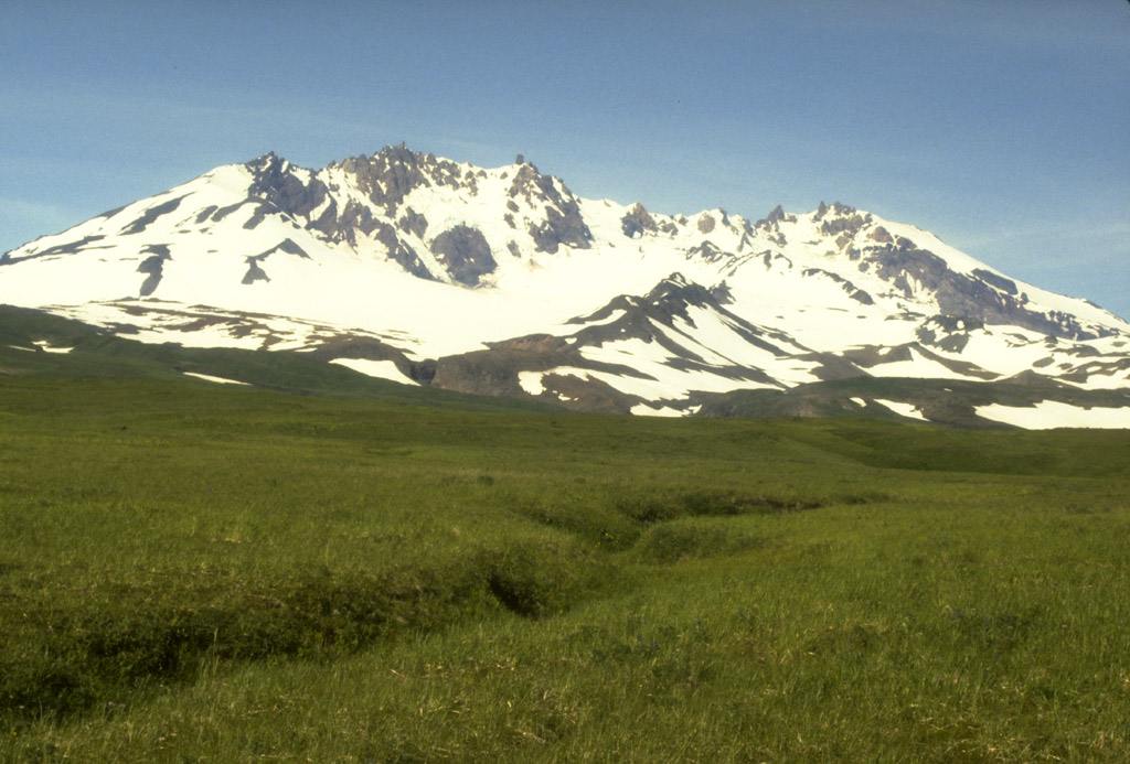
71. Sunset view to the southwest silhouetting Roundtop,
Isanotski, and Shishaldin volcanoes on Unimak Island in the
eastern Aleutian Islands. Photograph by J. Davies,
Geophysical Institute, University of Alaska Fairbanks,
August, 1983.
Back to top

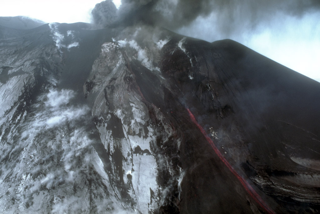
74. View, looking west, of the east flank of Westdahl
volcano located on the southwest part of Unimak Island in
the eastern Aleutian Islands (top to right). Dark, blocky
lava flows are from the 1991 to 1992 eruption; note wisps
of steam scattered across the lava flow surface. Photograph
by C. Dau, U.S. Fish and Wildlife Service, March 12, 1992.
Back to top
77. Aerial view of Akutan volcano that forms the west part
of Akutan Island in the eastern Aleutian Islands. The
volcano's summit is truncated by a 2-km-wide (1.2 mi)
caldera that contains a cinder cone that has been the site
of frequent historical eruptions. View is to the southeast.
Photograph by C. Nye, Alaska Division of Geological and
Geophysical Surveys, May 10, 1994.
78. Aerial view of Akutan volcano that forms the west part
of Akutan Island in the eastern Aleutian Islands. The
volcano's summit is truncated by a 2-km-wide (1.2 mi)
caldera that contains a cinder cone that has been the site
of frequent historical eruptions. View is to the southwest.
Photograph by C. Nye, Alaska Division of Geological and
Geophysical Surveys, May 10, 1994.
Back to top
80. Aerial view of the Point Kadin vents, a series of post-
glacial explosion pits and small cinder cones that occur
along a fracture zone northwest of the summit of Makushin
Volcano, a 2,036-m (6,680 ft)-high stratovolcano in the
northern part of Unalaska Island in the eastern Aleutian
Islands. Photograph by C. Nye, Alaska Division of
Geological and Geophysical Surveys, May 10, 1994.
Back to top
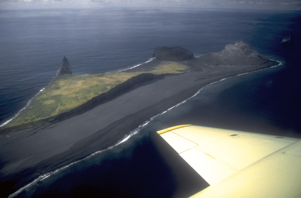
82. Aerial view, looking west, of the new lava dome (150 m
[492 ft] high) erupted in 1992 at Bogoslof Island, which is
the summit of a largely submarine stratovolcano located in
the Bering Sea 50 km (31 mi) behind the main Aleutian
volcanic arc. The island is about 1.5x0.6 km (1x.4 mi) and,
due to energetic wave action and frequent eruptive
activity, it has changed shape dramatically since first
mapped in the late 1700's. Photograph by T. Miller, U.S.
Geological Survey, May 10, 1994.
83. Aerial view, looking south, of Bogoslof Island, which
is the summit of a largely submarine stratovolcano located
in the Bering Sea 50 km (31 mi) behind the main Aleutian
volcanic arc. The island is about 1.5x0.6 km (1x.4 mi) and,
due to energetic wave action and frequent eruptive
activity, it has changed shape dramatically since first
mapped in the late 1700's. Its most recent eruption, in
1992, produced the conical, rubbly lava dome (150 m [492
ft] high)and offshore spire at bottom center. Photograph by
T. Keith, U.S. Geological Survey, May 10, 1994.
Back to top

85. View of the steaming cinder cone that marks the site of
the most recent eruptive activity at Okmok caldera, a 9.3-
km (5.8 mi)-diameter circular crater that truncates the top
of a large shield volcano on the northeastern part of Umnak
Island in the eastern Aleutian Islands. Eruptions from this
cone in 1945 and 1958 produced lava flows that extruded
onto the caldera floor. Photograph by C. Nye, Alaska
Division of Geological and Geophysical Surveys, September,
1980.
86. Aerial view looking north of Okmok caldera, a 9.3-km-
diameter (5.8 mi) circular crater that truncates the top of
a large shield volcano on the northeastern part of Umnak
Island in the eastern Aleutian Islands. Photograph by J.
Reeder. Alaska Division of Geological and Geophysical
Surveys, date unknown.
Back to top
88. View, looking north, of Mount Recheshnoi, a deeply
dissected, 1,984-m (6,510 ft)-high stratovolcano on central
Umnak Island in the eastern Aleutian Islands. Unlike
Vsevidof volcano, its neighbor to the west, Recheshnoi
volcano has had no documented historical eruptions.
Photograph by C. Nye, Alaska Division of Geological and
Geophysical Surveys, August, 1985.
89. View of an active fumarole near Russian Bay on Mount
Recheshnoi, a deeply dissected, 1,984-m (6,510 ft)-high
stratovolcano on central Umnak Island in the eastern
Aleutian Islands. Photograph by C. Nye, Alaska Division of
Geological and Geophysical Surveys, August, 1985.
Back to top
91. View, looking north, of symmetrical Vsevidof volcano, a
historically active, 2,149-m (7,050 ft)-high stratovolcano
on central Umnak Island in the eastern Aleutian Islands.
Photograph by C. Nye, Alaska Division of Geological and
Geophysical Surveys, August, 1985.

92. View, looking north, of symmetrical Vsevidof volcano, a
historically active, 2,149-m (7,050 ft)-high stratovolcano
on central Umnak Island in the eastern Aleutian Islands.
Photograph by C. Nye, Alaska Division of Geological and
Geophysical Surveys, August, 1985.
93. View, looking north, of symmetrical Vsevidof volcano, a
historically active, 2149-m (7,050 ft)-high stratovolcano
on central Umnak Island in the eastern Aleutian Islands.
Photograph by C. Nye, Alaska Division of Geological and
Geophysical Surveys, August, 1985.
Back to top