
Each red number represents an area that includes approximately 30 photographs. The onshore shaded relief image was calculated from USGS 30-meter DEM (digital elevation model) data.
Click on red number, for example, 8, for enlarged map (max. 50 kb).
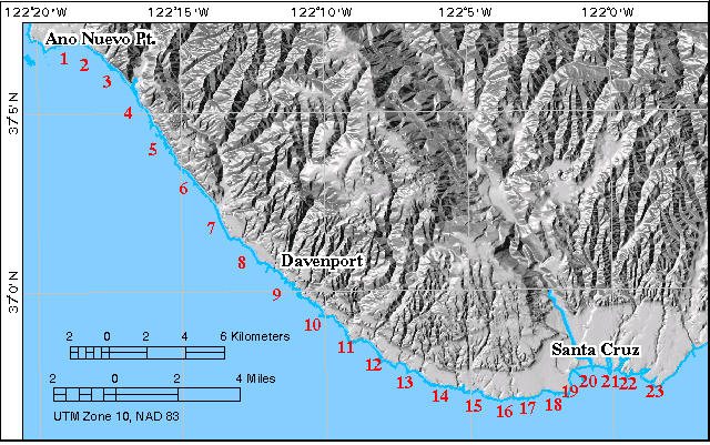
Chezar, Henry, and Wong, Florence, 2000, Año Nuevo to Santa Cruz, California - a photographic tour of the coastline: U.S. Geological Survey Digital Data Series DDS-61; 1 CD-ROM.