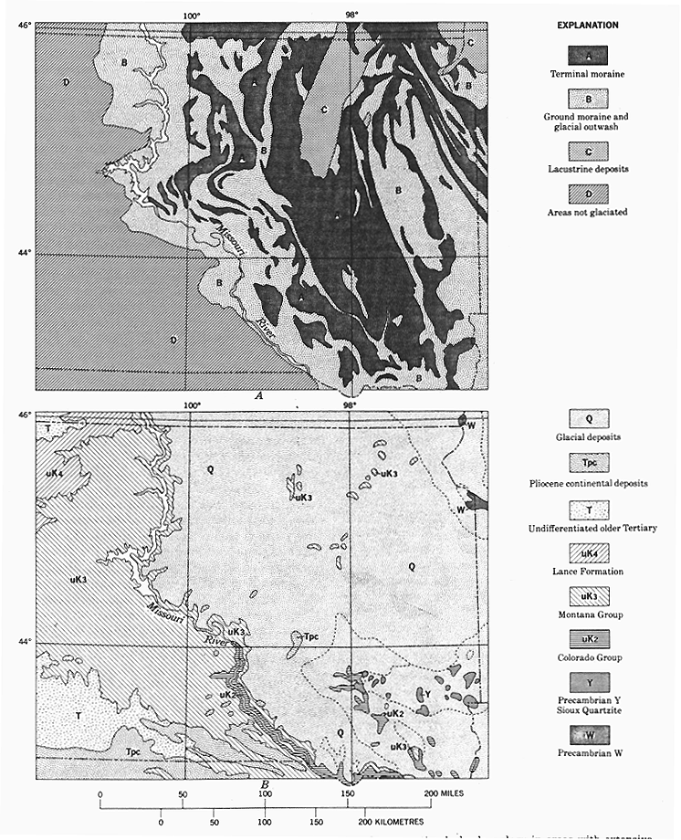
FIGURE 11.--Maps of eastern South Dakota, to illustrate problems of
representing bedrock geology in areas with extensive cover
of surficial deposits. A, Surficial, or Quaternary glacial
deposits, generalized from Flint (1959). B, Bedrock geology
as shown on Geologic Map of the United States. Outcrops of
bedrock east of Missouri River are from Geologic Map of
South Dakota of 1953; contacts elsewhere, shown by dotted
lines, are those shown on the Geologic Map of the United
States and are subcrop representations based on subsurface
data.