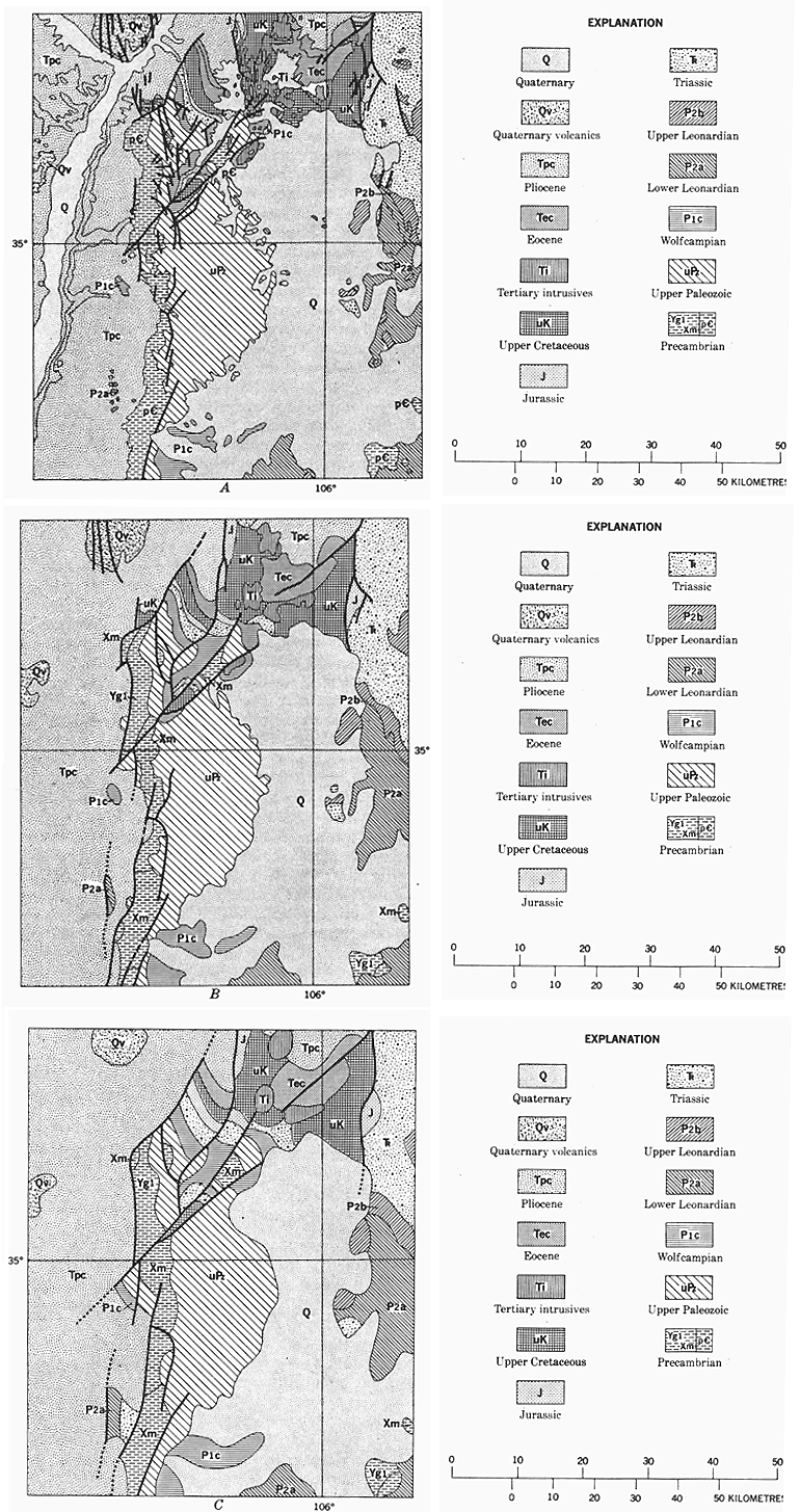
Figure 8.--Geologic maps of the Sandia Mountains, N.M., to illustrate
the process of generalizing data for the Geologic Map of the
United States. A, Representation of the area on the primary
source, the Geologic Map of New Mexico of 1965; original
scale 1:500,000. B, The area when generalized, somewhat revised,
and replotted on a scale of 1:1,000,000. C, The area as shown on
the Geologic Map of the United States, a further generalization
from B; original scale 1:2,500,000. The representation in C
appears crude by comparison with A and B, but contains the
maximum detail possible for publication scale.