Data Series 848
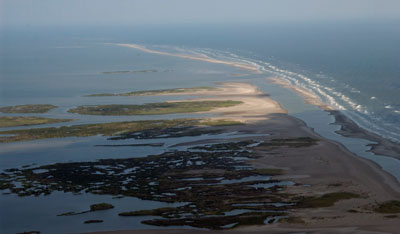
SummaryAs part of the Barrier Island Evolution Research project, scientists from the U.S. Geological Survey St. Petersburg Coastal and Marine Science Center conducted nearshore geophysical surveys off the northern Chandeleur Islands, Louisiana, in June of 2011. The overall objectives of the study are to better understand barrier-island geomorphic evolution, particularly storm-related depositional and erosional processes that shape the islands over annual to interannual timescales (1-5 years). Collection of geophysical data will allow us to identify relationships between the geologic history of the island and its present day morphology and sediment distribution. This mapping effort was the first in a series of three planned surveys in this area. High resolution geophysical data collected in each of three consecutive years along this rapidly changing barrier-island system will provide a unique time-series dataset that will significantly further the analyses and geomorphological interpretations of this and other coastal systems, improving our understanding of coastal response and evolution over short time scales (1-5 years). This data series includes the bathymetric data that were collected during two cruises (USGS Field Activity Numbers 11BIM01 and 11BIM02) aboard the Research Vessel (R/V) SurveyCat and the R/V TwinVee along the northern portion of the Chandeleur Islands, Breton National Wildlife Refuge, Louisiana. Data were acquired with the following equipment: a Systems Engineering and Assessment, Ltd., SWATHplus interferometric sonar (234 kilohertz), an EdgeTech 424 (4-24 kHz) chirp sub-bottom profiling system, and a Marimatech E-SEA Sound 206 (200 kHz) echosounder. This report serves as an archive of processed interferometric swath and single-beam bathymetry data. Geographic Iinformation System data products include a 50-meter cell-size interpolated bathymetry grid surface, trackline maps, and point data files. Additional files include error analysis maps, Field Activity Collection System logs, and formal Federal Geographic Data Committee metadata. |
First posted September 12, 2014
For additional information, contact: Part or all of this report is presented in Portable Document Format (PDF). For best results viewing and printing PDF documents, it is recommended that you download the documents to your computer and open them with Adobe Reader. PDF documents opened from your browser may not display or print as intended. Download the latest version of Adobe Reader, free of charge. More information about viewing, downloading, and printing report files can be found here. |
DeWitt, N.T., Pfeiffer, W.R., Bernier, J.C., Buster, N.A., Miselis, J.L., Flocks, J.G., Reynolds, B.J., Wiese, D.S., and Kelso, K.W., 2014, Coastal bathymetry data collected in 2011 from the Chandeleur Islands, Louisiana (version 2.0, July 21, 2015): U.S. Geological Survey Data Series 848, 1 DVD, available at https://dx.doi.org/10.3133/ds848.
ISSN 2327-638X (online)
Abstract
Introduction
Survey Overview and Acquisition
Data Processing
Error Analysis
Survey Products
Data Downloads
Field Activity Logs
Acronyms
References Cited

![]() U.S. Department of the Interior |
U.S. Geological Survey
U.S. Department of the Interior |
U.S. Geological Survey
URL: http://pubsdata.usgs.gov/pubs/ds/0848/index.html
Page Contact Information: GS Pubs Web Contact
Page Last Modified: Monday, 28-Nov-2016 19:35:56 EST
