Data Series 894

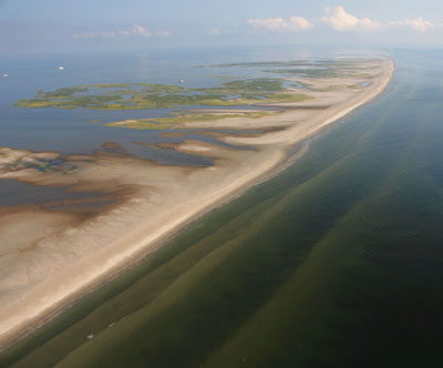
SummaryAs part of the Barrier Island Evolution Research project, scientists from the U.S. Geological Survey St. Petersburg Coastal and Marine Science Center collected sediment samples from the northern Chandeleur Islands in July 2013. The overall objective of this project, which integrates geophysical (bathymetric, seismic, and topographic) and sedimentologic data, is to better understand the depositional and erosional processes that drive the morphologic evolution of barrier islands over annual to interannual timescales (1 to 5 years). Between June 2010 and April 2011, in response to the Deepwater Horizon oil spill, the State of Louisiana constructed a sand berm extending more than 14 kilometers along the northern Chandeleur Islands platform. The construction of the berm provided a unique opportunity to investigate how this new sediment source will interact with and affect the morphologic evolution of the barrier-island system. Data collected from this study will be used to describe differences in the physical characteristics and spatial distribution of sediments both along the axis of the berm and also along transects across the berm and onto the adjacent barrier island. Comparison of these data with data from previous sampling efforts will provide information about sediment interactions and movement between the berm and the natural island platform, improving our understanding of short-term morphologic change and processes in this barrier-island system. This data series serves as an archive of sediment data collected in July 2013 from the Chandeleur Islands sand berm and adjacent barrier-island environments. Data products include descriptive core logs, core photographs and x-radiographs, results of sediment grain-size analyses, sample location maps, and Geographic Information System data files with accompanying formal Federal Geographic Data Committee metadata. |
First posted December 1, 2014 For additional information contact: Part or all of this report is presented in Portable Document Format (PDF); the latest version of Adobe Reader or similar software is required to view it. Download the latest version of Adobe Reader, free of charge. |
Buster, N.A., Kelso, K.W., Bernier, J.C., Flocks, J.G., Miselis, J.L., and DeWitt, N.T., 2016, Sediment data collected in 2013 from the northern Chandeleur Islands, Louisiana (ver. 1.1, February 2016): U.S. Geological Survey Data Series 894, https://dx.doi.org/10.3133/ds894.
ISSN 2327–638X (online)
Abstract
Introduction
Field Data Collection
Laboratory Methods and Analysis
Data Products and Downloads
Field Activity Logs
Abbreviations
References Cited