 Abstract Abstract
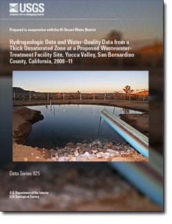
The Hi-Desert Water District, in the community of Yucca Valley, California, is considering constructing a wastewater-treatment facility and using the reclaimed water to recharge the aquifer system through surface spreading. The Hi-Desert Water District is concerned with possible effects of this recharge on water quality in the underlying groundwater system; therefore, an unsaturated-zone monitoring site was constructed by the U.S. Geological Survey (USGS) to characterize the unsaturated zone, monitor a pilot-scale recharge test, and, ultimately, to monitor the flow of reclaimed water to the water table once the treatment facility is constructed.
In June and July 2008, a borehole (YVUZ-5) was drilled by the USGS through the unsaturated zone in the vicinity of the proposed wastewater-treatment facility site by using an overburden drilling method. In addition to a variety of unsaturated-zone instrumentation, an observation well screened near the water table was installed in the borehole. The drilling procedures, lithologic and geophysical data, construction details, physical properties of unsaturated alluvial deposits, and instrumentation installed in YVUZ-5 are described in this report. Core material was analyzed for bulk-density, porosity, effective porosity, volumetric water content, residual water content, saturation, effective saturation, matric-potential, and saturated hydraulic conductivity. Concentrations of soluble anions, including bromide, chloride, fluoride, sulfate, nitrate, nitrite, phosphate, and orthophosphate, in unsaturated-zone sediment and dissolved in unsaturated-zone water were determined by analyzing water extracted from drill-cutting material. A 0.1-acre pilot-scale infiltration pond was constructed in the vicinity of YVUZ-5. Water was applied to the pond over a period of about 8 months and allowed to infiltrate into the underlying unsaturated zone. Data were collected on chemical and isotopic composition of the groundwater, unsaturated-zone water, and infiltration pond water before, during, and after infiltration of water from the constructed pond. Selected drill cuttings and core samples collected during drilling were analyzed for the presence or absence of denitrifying and nitrate-reducing bacteria.
Water levels in the observation well ranged from about 367 to 370 feet below land surface during the period of the study. Measured saturated hydraulic conductivity of core material ranged from 2.1 to 11.0 feet per day. Average vertical infiltration rates in the pilot-scale infiltration pond ranged from 0.7 to 2.4 feet per day. Both denitrifying and nitrate-reducing bacteria were present in drill cutting material in most probable numbers ranging from below detection limits to 2,400,000 for denitrifying and to 93,000 for nitrate-reducing bacteria.
|
First posted June 9, 2015
Part or all of this report is presented in Portable Document Format (PDF). For best results viewing and printing PDF documents, it is recommended that you download the documents to your computer and open them with Adobe Reader. PDF documents opened from your browser may not display or print as intended. Download the latest version of Adobe Reader, free of charge. More information about viewing, downloading, and printing report files can be found here.
|

