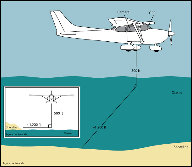
Skip Links

USGS - science for a changing world

Data Series 953

Figure 2. Acquisition Geometry


Home | Abbreviations | Contents | Photos and Maps | Navigation Data | Logs | Metadata | Citation Page


Figure 2. Acquisition geometry for 2014 Baseline aerial survey   Figure 2.

The aircraft was flown at a constant altitude of 500 feet (ft) and about 1,200 ft offshore.

Best attempts were made to keep the same relative distance between the aircraft and the shoreline in order to keep a constant field of view.


Home | Abbreviations | Contents | Photos and Maps | Navigation Data | Logs | Metadata | Citation Page

Accessibility FOIA Privacy Policies and Notices

Take Pride in America logo USA.gov logo U.S. Department of the Interior | U.S. Geological Survey
URL: http://pubsdata.usgs.gov/pubs/ds/0953/html/ds953_fig2.html
Page Contact Information: GS Pubs Web Contact
Page Last Modified: Monday, 28-Nov-2016 20:42:36 EST