Data Series 100
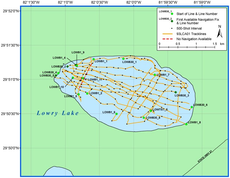
Lowry Lake Map
Click on a trackline name to view the seismic profile.
NOTE: Navigation is missing for the end of lines LOW830_4 and LOW91_5.
Full Survey Area | Kingsley Lake | Orange Lake | Lowry Lake

![]() U.S. Department of the Interior |
U.S. Geological Survey
U.S. Department of the Interior |
U.S. Geological Survey
URL: https://pubsdata.usgs.gov/pubs/ds/100/html/map_low.htm
Page Contact Information: Publishing Services
Page Last Modified: Monday, 28-Nov-2016 13:04:50 EST
