Data Series 1029
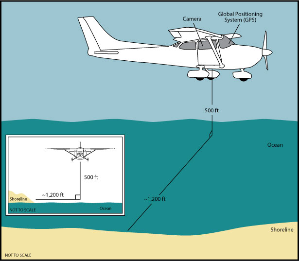 |
Figure 2. Acquisition Geometry. The Cessna 182 was flown at a constant altitude of 500 feet (ft) and approximately 1,200 ft offshore. Best attempts were made to keep the same relative distance between the aircraft and the shoreline to maintain a constant field of view. |

![]() U.S. Department of the Interior |
U.S. Geological Survey
U.S. Department of the Interior |
U.S. Geological Survey
URL: http://pubsdata.usgs.gov/pubs/ds/1029/html/ds1029_fig2.html
Page Contact Information: GS Pubs Web Contact
Page Last Modified: Wednesday, 14-Dec-2016 12:43:30 EST
