Skip Links

Data Series 1029

Cape Lookout Inset Map


Home | Abbreviations | Contents | Photographs and Maps | Navigation Data | Logs | Metadata | Citation Page


Click on a segment name to view the contact sheet.
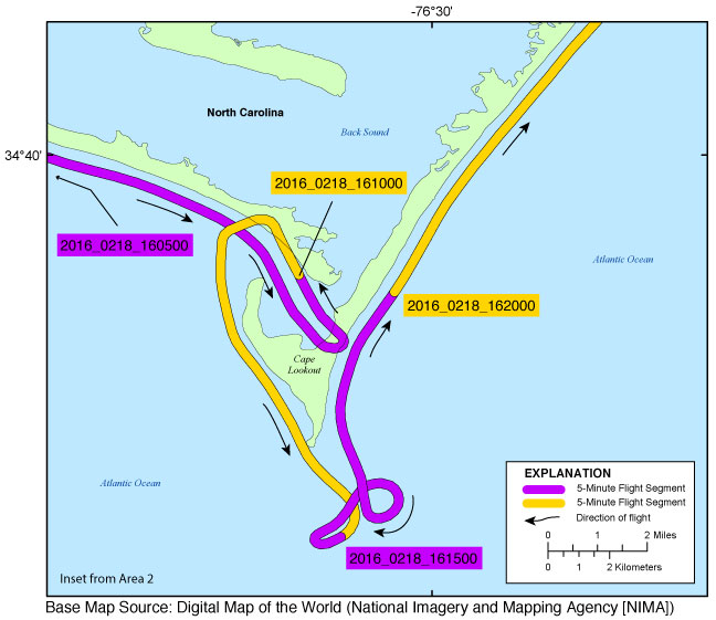
Cape Lookout inset map ds1029_2016_0218_160500 ds1029_2016_0218_161000 ds1029_2016_0218_161500 ds1029_2016_0218_162000
Figure 4. Cape Lookout inset map (Area 2). Map showing the flight path of the Winter 2016 coastal oblique aerial survey of Cape Lookout, North Carolina, on February 18, 2016. Purple and yellow lines correspond to 5-minute flight segments that link to contact sheets of associated photograph thumbnails. Click on the 5-minute segment name to view each contact sheet.


Full Survey Area | 2016-316-FA: Area 1 | 2016-316-FA: Area 2 | 2016-316-FA: Area 3 | 2016-316-FA: Area 4

Cape Lookout Inset Map | Hatteras Inset Map | Rodanthe Inset Map | Pea Island Inset Map | Chincoteague National Wildlife Refuge Inset Map

Home | Abbreviations | Contents | Photographs and Maps | Navigation Data | Logs | Metadata | Citation Page