Data Series 1044
U.S. Department of the Interior
U.S. Geological Survey
Publications are available from USGS Information Services, Box 25286, Federal Center, Denver, CO 80225-0046 (telephone: 1-888-ASK-USGS, e-mail: infoservices@usgs.gov).
|
Abstract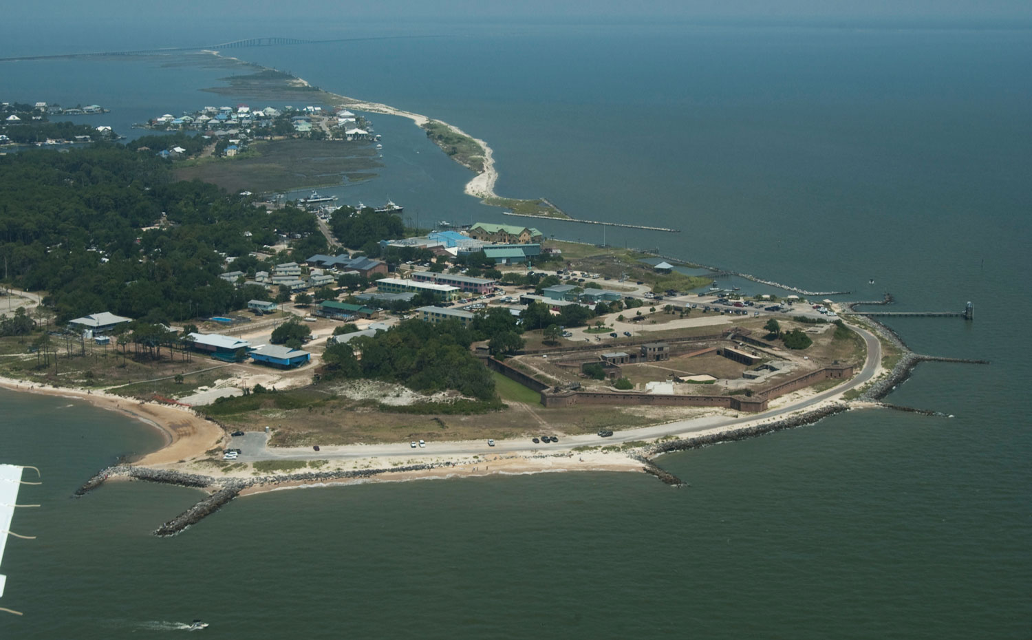 Fort Gaines, Dauphin Island, Alabama [Click to enlarge] The U.S. Geological Survey (USGS), as part of the National Assessment of Storm-Induced Coastal Change Hazards project, conducts baseline and storm-response photography missions to document and understand the changes in vulnerability of the Nation's coasts to extreme storms. On June 9, 2011, the USGS conducted an oblique aerial photographic survey from Dauphin Island, Alabama, to Breton Island, Louisiana, aboard a Beechcraft BE90 King Air (aircraft) at an altitude of 500 feet (ft) (152 meters (m)) and approximately 1,200 ft (366 m) offshore. This mission was conducted to collect baseline data for assessing incremental changes in the beach and nearshore area and can be used to assess future coastal change. The photographs in this report are Joint Photographic Experts Group (JPEG) images. These photographs document the state of the barrier islands and other coastal features at the time of the survey. AcknowledgmentsFunding and support for this study were provided by the USGS Coastal and Marine Geology Program (CMGP). The author wishes to thank pilot, Mitch Bobowski, for his assistance in data collection. This report benefited from the comments and reviews of Alexandra Fredericks and Patricia (Soupy) Dalyander with the U.S. Geological Survey. Information StatementThis report was prepared by an agency of the United States Government. Although these data were processed successfully on a computer system at the U.S Geological Survey (USGS), no warranty expressed or implied is made regarding the display or utility of the data on any other system, nor shall the act of distribution imply any such warranty. The USGS shall not be held liable for improper or incorrect use of the data described and (or) contained herein. Reference herein to any specific commercial product, process, or service by trade name, trademark, manufacturer, or otherwise does not constitute or imply its endorsement, recommendation, or favoring by the United States Government or any agency thereof. Suggested CitationMorgan, K.L.M., 2017, Baseline coastal oblique aerial photographs collected from Dauphin Island, Alabama, to Breton Island, Louisiana, June 9, 2011: U.S. Geological Survey Data Series 1044, https://doi.org/10.3133/ds1044. ContactKaren L.M. Morgan |

![]() U.S. Department of the Interior |
U.S. Geological Survey
U.S. Department of the Interior |
U.S. Geological Survey
URL: http://pubsdata.usgs.gov/pubs/ds/1044/index.html
Page Contact Information: GS Pubs Web Contact
Page Last Modified: Tuesday, 28-Mar-2017 15:14:21 EDT
