USGS - science for a changing world

Data Series 1044

Baseline Coastal Oblique Aerial Photographs Collected from Dauphin Island, Alabama, to Breton Island, Louisiana, June 9, 2011

Skip Links

Citation Page
Abstract
Introduction
Photographs and Maps
Navigation Data
Logs
Metadata
Abbreviations
Reference Cited
 

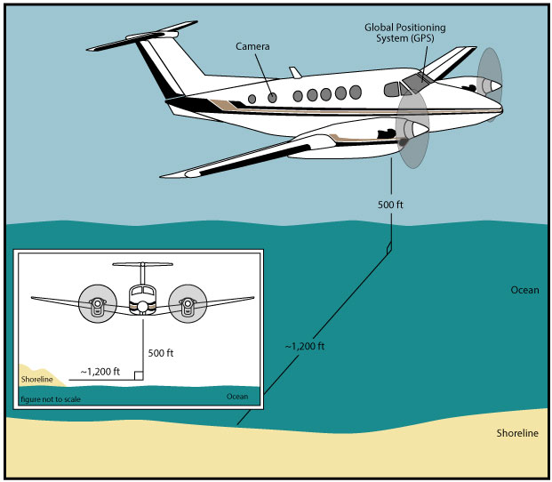
Acquisition Geometry


Figure 2. Acquisition geometry for baseline aerial survey   Figure 2. Diagram of the survey flight acquisition geometry. The Beechcraft BE90 King Air was flown at a constant altitude of 500 feet (ft) and approximately 1,200 ft offshore. An effort was made to keep the same distance between the aircraft and the shoreline to maintain a constant field of view.

Accessibility FOIA Privacy Policies and Notices

Take Pride in America logo USA.gov logo U.S. Department of the Interior | U.S. Geological Survey
URL: http://pubsdata.usgs.gov/pubs/ds/1044/html/ds1044_fig2.html
Page Contact Information: GS Pubs Web Contact
Page Last Modified: Thursday, 23-Mar-2017 14:57:27 EDT