Data Series 1077
| Abstract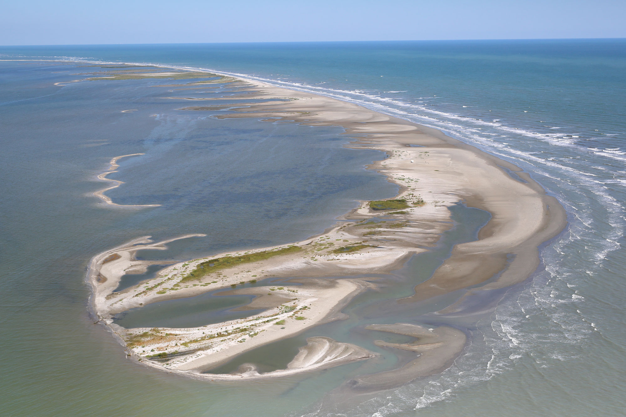 Oblique aerial photograph looking northeast toward the northern Chandeleur Islands. Photograph was taken on September 18, 2015, by Amy Hartsfield, Amy & Company, Inc. (Morgan, 2016). [Click image to enlarge.] As part of the Barrier Island Evolution Research project, scientists from the U.S. Geological Survey (USGS) St. Petersburg Coastal and Marine Science Center conducted a nearshore geophysical survey around the northern Chandeleur Islands, Louisiana, in September 2015. The objective of the project is to improve the understanding of barrier island geomorphic evolution, particularly storm-related depositional and erosional processes that shape the islands over annual to interannual time scales (1–5 years). Collecting geophysical data can help researchers identify relations between the geologic history of the islands and their present day morphology and sediment distribution. High-resolution geophysical data collected along this rapidly changing barrier island system can provide a unique time-series dataset to further the analyses and geomorphological interpretations of this and other coastal systems, improving our understanding of coastal response and evolution over medium-term time scales (months to years). Subbottom profile data were collected in September 2015 offshore of the northern Chandeleur Islands, during USGS Field Activity Number 2015-331-FA. Data products, including raw digital chirp subbottom data, processed subbottom profile images, survey trackline map, navigation files, geographic information system data files and formal Federal Geographic Data Committee metadata, and Field Activity Collection System and operation logs are available for download. AcknowledgmentsFunding for this study was provided by the USGS Coastal and Marine Geology Program. The authors would like to thank Kyle Kelso (USGS) for his assistance in data collection and piloting the research vessel (R/V) Sallenger and Betsy Boynton for her assistance with the report web design. We also thank Noreen Buster, Kyle Kelso, and Xan Fredericks (USGS) for conducting scientific, editorial, and metadata reviews that improved the content and presentation of the report. Information StatementAlthough these data have been processed successfully on a computer system at the U.S. Geological Survey (USGS), no warranty expressed or implied is made regarding the display or utility of the data on any other system or for general or scientific purposes, nor shall the act of distribution constitute any such warranty. The USGS or the U.S. Government shall not be held liable for improper or incorrect use of the data described and (or) contained herein. Any use of trade, firm, or product names is for descriptive purposes only and does not imply endorsement by the U.S. Government. Suggested CitationForde, A.S., DeWitt, N.T., Fredericks, J.J., and Miselis, J.L., 2018, Chirp subbottom profile data collected in 2015 from the northern Chandeleur Islands, Louisiana: U.S. Geological Survey Data Series 1077, https://doi.org/10.3133/ds1077. ContactArnell S. FordeU.S. Geological Survey St. Petersburg Coastal and Marine Science Center 600 4th Street South St. Petersburg, FL 33701 (727) 502-8000 aforde@usgs.gov |
|||||||||

![]() U.S. Department of the Interior |
U.S. Geological Survey
U.S. Department of the Interior |
U.S. Geological Survey
URL: http://pubsdata.usgs.gov/pubs/ds/1077/index.html
Page Contact Information: GS Pubs Web Contact
Page Last Modified: Thursday, 01-Feb-2018 08:58:47 EST
