
U.S. Geological Survey Data Series 114
2004 - Online Version 1.0
U.S. Geological Survey Data Series 114
2004 - Online Version 1.0
Estimates of sea surface temperature (SST) from ocean cores reveal a warm phase of the Pliocene between about 3.3 and 3.0 Mega-annum’s (Ma). Pollen records from land based cores and sections, although not as well dated, also show evidence for a warmer climate at about the same time. Increased greenhouse forcing and altered ocean heat transport is the leading candidates for the underlying cause of Pliocene global warmth. However, despite being a period of global warmth, there exists considerable variability within this interval. Two new SST reconstructions have been created to provide a climatological error bar for warm peak phases of the Pliocene. These data represent the maximum and minimum possible warming recorded within the 3.3 to 3.0 Ma interval.
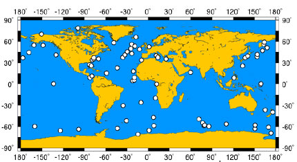
Map showing data localities used in this reconstruction.
This 12-page report is provided in Adobe PDF format. The data are provided separately below as Microsoft® Excel files.
Data Series 114 [735-KB PDF file]
Download a free copy of Adobe Reader.
The MAX and MIN SST reconstructions are presented in the same manner as the PRISM2 reconstruction. The data are arranged in a matrix of 90 rows by 180 columns, representing a 2°x2° grid of the Earth. Each cell in the 2°x2° global grid designated as water is given a SST in degrees Celsius. Cells designated as land are given the code 999. Sea-ice is designated with SST set to -1.8°C. The MAX and MIN reconstructions exist as two Microsoft® Excel files, each containing one matrix for each month of the year, arranged as worksheets. Readers are urged to consult Dowsett et al. (1999) for more details.
Max SST reconstruction data [2.3 MB Excel file]
Min SST reconstruction data [2.2 MB Excel file]
Send questions or comments about this report to the author, Harry Dowsett at hdowsett@usgs.gov.
[an error occurred while processing this directive]