Data Series 93
The archived trace data are in standard Society of Exploration Geophysicists (SEG) SEG-Y format (Barry and others, 1975) and may be downloaded and processed with commercial or public domain software such as Seismic Unix (SU). Examples of SU processing scripts and in-house (USGS) software for viewing SEG-Y files (Zihlman, 1992) are also provided. Processed profile images, trackline maps, navigation files, and formal metadata may be viewed with a web browser. Scanned handwritten logbooks and Field Activity Collection System (FACS) logs may be viewed with Adobe Reader.
The boomer is an acoustic energy source that consists of capacitors charged to a high voltage and then discharged through a transducer in the water. The transducer is towed on a sled at the sea surface and when discharged emits a short acoustic pulse, or shot, that propagates through the water and sediment column. The acoustic energy is reflected at density boundaries (such as the seafloor or sediment layers beneath the seafloor), detected by the receiver, and recorded by a PC-based seismic acquisition system. This process is repeated at timed intervals (e.g., 0.25 s) and recorded for specific intervals of time (e.g., 100 ms). In this way, a two-dimensional vertical image of the shallow geologic structure beneath the ship track is produced.
Huntec power supplies provided 60-135 joules (J) per shot for 94CCT01 and 35-100 J per shot for 95CCT01. Reflected energy was received by an ITI ST-5 streamer and recorded by Triton Elics Delph Seismic acquisition software. The streamer contains 10 hydrophones evenly spaced over a length of 6 m, all of which were used for 95CCT01. It is unknown which hydrophones were used for 94CCT01. For parts of 94CCT01 and all of 95CCT01 the streamer was positioned parallel to the boomer sled and laterally separated from it by about 7 m. Changes in 94CCT01 acquisition geometry occurred several times and are recorded in the operations logbook included with this archive (Data Series 93). The sample frequency of the data was 10 kHz for 94CCT01 and 12 kHz for 95CCT01. Trace length for all tracklines was 100 ms. Based on survey speeds of 3.5 - 4 knots and a shot rate of every 0.25 s, shot spacing was about 0.5 m. The original trace files for 94CCT01 lines SL627_1, SL628_6, SL629_13, and SL630_15 and 95CCT01 lines TEXSB_3 - TEXSB_11 were divided into two or more trace files (e.g., SL627_1 became SL627_1a and SL627_1b) because the original total number of traces exceeded the maximum allowed by the processing system. Only the first 7,500 of 44,873 shots were recoverable from the original digital file for 94CCT01 line SL629_12.
The unprocessed seismic data were stored in SEG-Y format, which is a standard digital format that can be read and manipulated by most seismic processing software packages (Barry and others, 1975). The SEG-Y file format includes a 3,200-byte descriptive header that contains detailed information regarding the data acquisition and processing parameters. All data presented here are stored in SEG-Y, integer, Motorola format. The SEG-Y formatted trace files have a .TRA extension. Additional recording parameters for each trace file can also be found in the .PAR file associated with each .TRA file. However, the .PAR and .PLN files included here are only needed to process or display the data with Triton Elics Delph Seismic software. The original trace files were recorded in nonstandard ELICS format and later converted to SEG-Y format using Triton Elics software.
Also included on these discs are example Seismic Unix scripts that allow the user to strip off navigation fixes from the SEG-Y headers, along with a fix for every 500 shots, and produce a filtered and gained GIF image of each profile. These images can then be displayed using a variety of shareware programs such as ImageMagick (Unix, Linux) or a web browser.
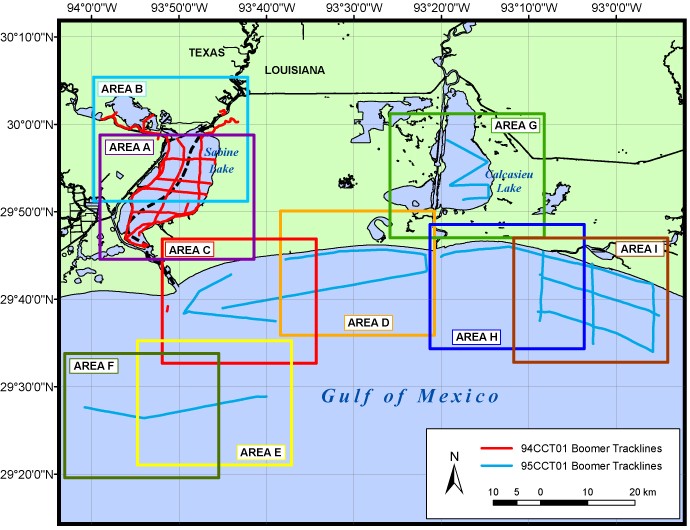
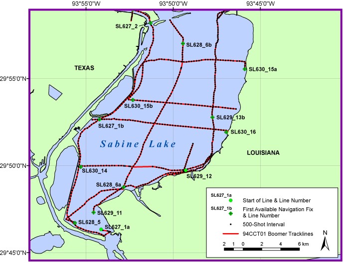
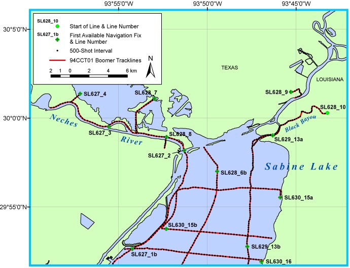
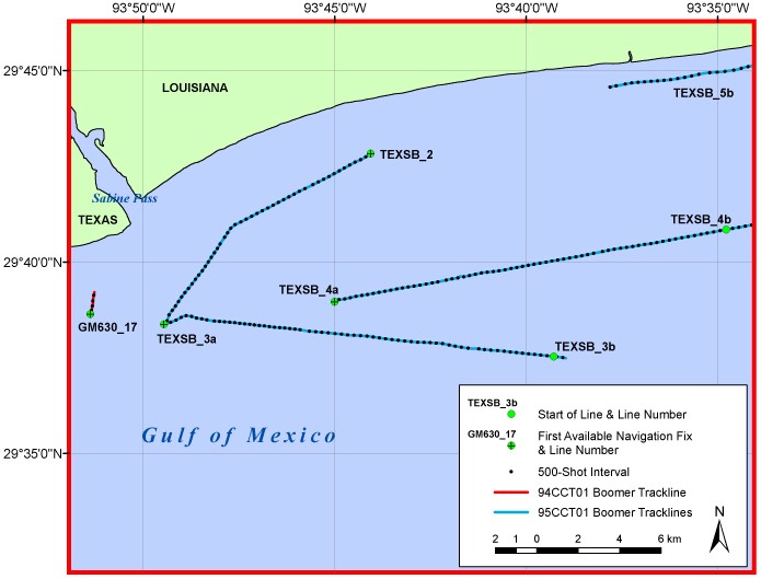
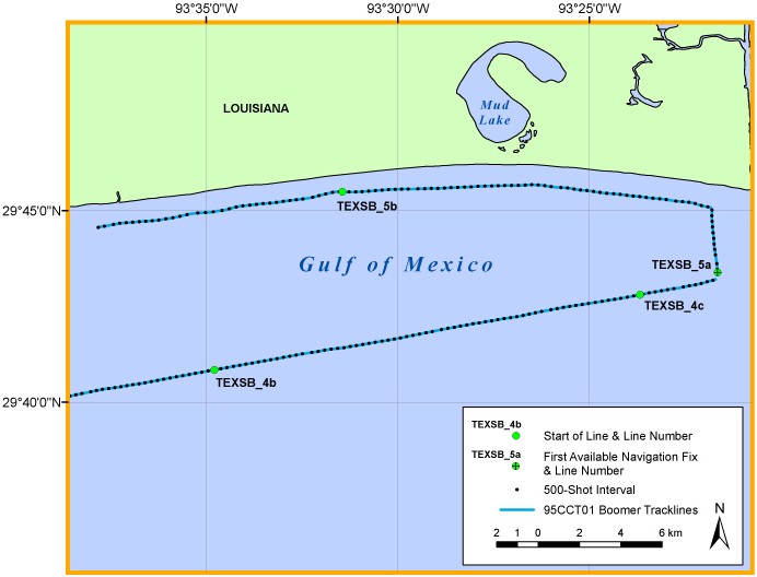
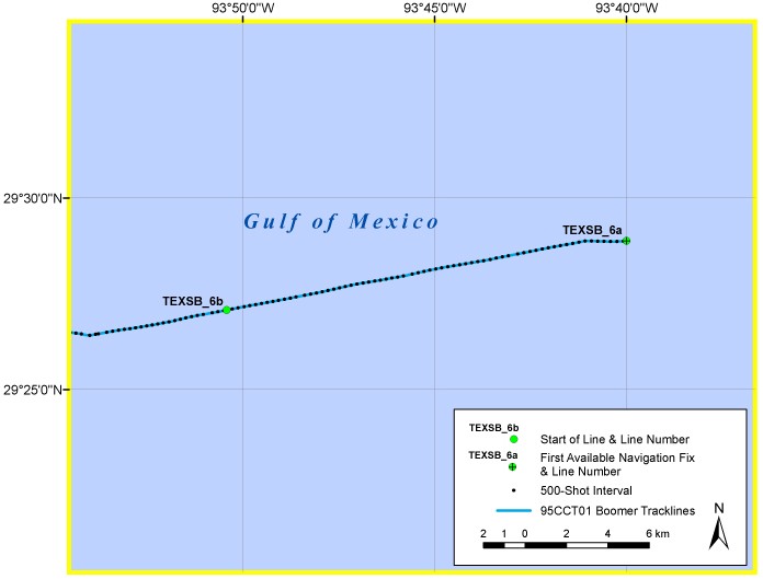
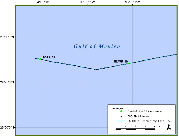
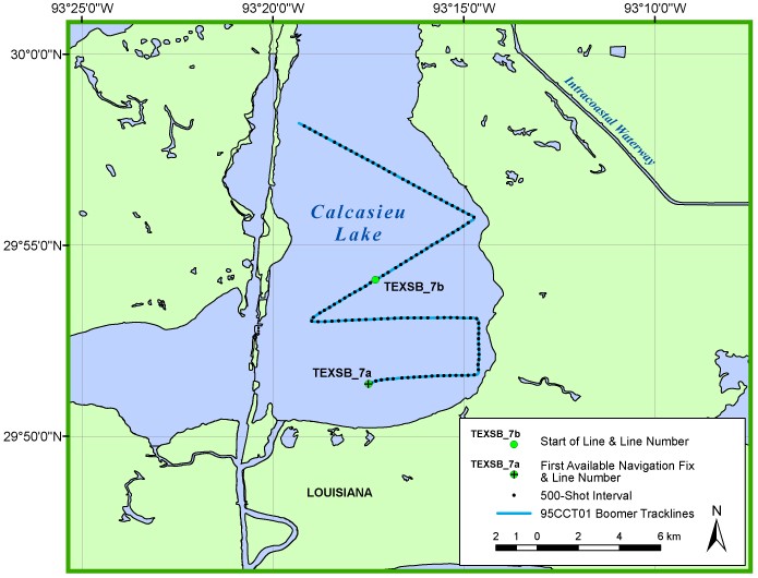
For both cruises, GPS navigation was provided to the acquisition system by a Trimble Nav Graphics GPS receiver, whose accuracy is within 15 m. This was done about every 60 s for 95CCT01. The fix interval for 94CCT01 varied between 10 and 60 s. The data required some editing to remove or correct spurious data points and fix incorrectly recorded dates. The edited results were used to generate the trackline maps presented here. The navigation data have not been corrected to reflect any offset between the shotpoint and GPS antenna. This offset was 20 m for 95CCT01 and is unknown for 94CCT01. Position fixes for every 500 shots and for the start of lines are also provided as an aid for registering of the data after plotting. All navigation files are stored as ASCII text files. Navigation data are not available for the start of several 94CCT01 and 95CCT01 lines. No navigation was recorded for 95CCT01 line TEXSB_1.
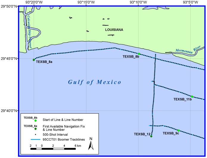
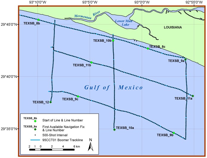
The trackline maps provided in this archive are set in geographic coordinates, NAD83 (unprojected). They were created using ESRI GIS software ArcView 3.2 and 8.1, exported to Adobe Illustrator for further editing, and saved in JPEG format. These JPEG images are viewable with a web browser. Also included are ArcView map documents and shapefiles used to create the trackline maps presented here. The map documents, created with ArcView 8.1, are compatible with ArcGIS 8.1 (Windows). The shapefiles, created with ArcView 3.2, may be viewed with other versions of ArcView or public domain software ArcExplorer 2.0 (Windows) and 4.0 (Windows, Mac OS X, Unix, Linux), available from the ESRI website at <http://www.esri.com/software/arcexplorer/>.
FACS logs and scanned versions of the handwritten logbooks are provided as PDF files.
Although all data and software published on this DVD have been used by the USGS, no warranty, expressed or implied, is made by the USGS as to the accuracy of the data and related materials and (or) the functioning of the software. The act of distribution shall not constitute any such warranty, and no responsibility is assumed by the USGS in the use of these data, software, or related materials.

![]() U.S. Department of the Interior |
U.S. Geological Survey
U.S. Department of the Interior |
U.S. Geological Survey
URL: pubsdata.usgs.gov /pubs/ds/2004/93/html/METADATA.HTM
Page Contact Information: Publishing Services
Page Last Modified: Monday, 28-Nov-2016 12:12:02 EST
