Reid, Jane A. , Reid, Jamey M. , Jenkins, Chris J. , Zimmermann, Mark, Williams, S. Jeffress , and Field, Michael E. , 2006, Seabed facies data (combined components) for the continental margin of the U.S. Pacific Coast (California, Oregon, Washington) from usSEABED (pac_fac.txt):.This is part of the following larger work.Online Links:
- <https://pubs.usgs.gov/ds/2006/182/data/pac_fac.zip>
- <https://pubs.usgs.gov/ds/2006/182/data_cata.html>
Reid, Jane A. , Reid, Jamey M. , Jenkins, Chris J. , Zimmermann, Mark, Williams, S. Jeffress , and Field, Michael E. , 2006, usSEABED: Pacific Coast Offshore Surficial-Sediment Data Release: Data Series 182, U.S. Geological Survey, Coastal and Marine Geology Program, Pacific Science Center, Santa Cruz, CA.Online Links:
This is a Vector data set. It contains the following vector data types (SDTS terminology):
Horizontal positions are specified in geographic coordinates, that is, latitude and longitude. Latitudes are given to the nearest 0.00001. Longitudes are given to the nearest 0.00001. Latitude and longitude values are specified in Decimal degrees.
The horizontal datum used is North American Datum of 1983.
The ellipsoid used is Geodetic Reference System 80.
The semi-major axis of the ellipsoid used is 6378137.000000.
The flattening of the ellipsoid used is 1/298.257222.
Sequential unique whole numbers that are automatically generated.
Location information in decimal degrees
Location information in decimal degrees
Water depth of sample in meters
Subsample location information in meters
Subsample location information in meters
Unique sequential numeric key to SRC file
Unique sequential numeric key to information about the same site in other usSEABED data files
Unique sequential numeric key to information about the same sample or subsample in other usSEABED data files
| Value | Definition |
|---|---|
| AGE | Sample Age |
| BIO | Biota |
| COL | Color of sample |
| LTH | Lithologic description |
| PET | Petrographic analysis |
| SFT | Seafloor type description |
| TXR | Textural data and statistics |
Result of filters based on fuzzy set theory determining degree of membership (0-100) for samples that include those terms which denote a specific feldspar, heavy mineral, mafic, mica, quartz, or defined terrigenous component; see table 5 in the data publication (Larger_Work_Citation) for list of trigger terms under each component mentioned.
Result of filters based on fuzzy set theory determining degree of membership (0-100) for samples that include those terms which denote a specific carbonate, calcareous crust, calcite, dolomite, limestone, or siderite component; see table 5 in the data publication (Larger_Work_Citation) for list of trigger terms under each component mentioned.
Result of filters based on fuzzy set theory determining degree of membership (0-100) for samples that include those terms which denote a specific igneous rock, andesite, basalt, gabbro, ultramafic, or granite component; see table 5 in the data publication (Larger_Work_Citation) for list of trigger terms under each component mentioned.
Result of filters based on fuzzy set theory determining degree of membership (0-100) for samples that include those terms which denote a specific volcanic rock (volrck and vol_rck), basalt, pumice, volcanic glass, or volcanic sediment; see table 5 in the data publication (Larger_Work_Citation) for list of trigger terms under each component mentioned.
Result of filters based on fuzzy set theory determining degree of membership (0-100) for samples that include those terms which denote a generic metamorphic rock (met), and/ or blueschist, gneiss, greenschist, schist, and slate; see table 5 in the data publication (Larger_Work_Citation) for list of trigger terms under each component mentioned.
Result of filters based on fuzzy set theory determining degree of membership (0-100) for samples that include those terms which denote a mineralized component, including barite, metalliferous, phosphorite, pyrite, or sulfide; see table 5 in the data publication (Larger_Work_Citation) for list of trigger terms under each component mentioned.
Result of filters based on fuzzy set theory determining degree of membership (0-100) for samples that include those terms which denote an authigenic iron/manganese component, including manganese crust, manganese nodule, manganese oxide, or ferruginous mineral; see table 5 in the data publication (Larger_Work_Citation) for list of trigger terms under each component mentioned.
Result of filters based on fuzzy set theory determining degree of membership (0-100) for samples that include those terms which denote a calcareous ooze, siliceous ooze, or other ooze component; see table 5 in the data publication (Larger_Work_Citation) for list of trigger terms under each component mentioned.
Result of filters based on fuzzy set theory determining degree of membership (0-100) for samples that include those terms which denote a organic carbon, bitumin, coal, or peat component; see table 5 in the data publication (Larger_Work_Citation) for list of trigger terms under each component mentioned.
Result of filters based on fuzzy set theory determining degree of membership (0-100) for samples that include those terms which denote geochemical signal or component, including gas, hydrogen sulfide, hydrate, methane, odor, or oil; see table 5 in the data publication (Larger_Work_Citation) for list of trigger terms under each component mentioned.
Result of filters based on fuzzy set theory determining degree of membership (0-100) for samples that include those terms which denote a foraminifera, benthic foraminifera, planktonic foraminifera, large foraminifera, or arenaceous foraminifera component; see table 5 in the data publication (Larger_Work_Citation) for list of trigger terms under each component mentioned.
Result of filters based on fuzzy set theory determining degree of membership (0-100) for samples that include those terms which denote another calcareous pelagic component, including nannofossils, pteropods, or calcareous ooze; see table 5 in the data publication (Larger_Work_Citation) for list of trigger terms under each component mentioned.
Result of filters based on fuzzy set theory determining degree of membership (0-100) for samples that include those terms which denote a diatom, radiolaria, or siliceous ooze component; see table 5 in the data publication (Larger_Work_Citation) for list of trigger terms under each component mentioned.
Result of filters based on fuzzy set theory determining degree of membership (0-100) for samples that include those terms which denote a shell or shell debris component; see table 5 in the data publication (Larger_Work_Citation) for list of trigger terms under each component mentioned.
Result of filters based on fuzzy set theory determining degree of membership (0-100) for samples that include those terms which denote a coral, coral reef, coral debris, or solitary coral component; see table 5 in the data publication (Larger_Work_Citation) for list of trigger terms under each component mentioned.
Result of filters based on fuzzy set theory determining degree of membership (0-100) for samples that include those terms which denote a hard plant component such as calcareous algae, coralline algae, or Halimeda; see table 5 in the data publication (Larger_Work_Citation) for list of trigger terms under each component mentioned.
Output as a word-based description that may involve numerics. This field will need to be selected against when GIS mappings of the bulk sedient characters are being mapped. Only blank entries should be included in such a mapping.
We thank the contributors of the data and the following interns for their assistance in data entry, coding, and testing, and/or assistance with source metadata: K. Halimeda Kilbourne, Carolynn Box, Tara Kneeshaw, Jennifer Mendonca, April Villagomez, Monica Iglecia, and Adam Jackson.
831-427-4727 (voice)
jareid@usgs.gov
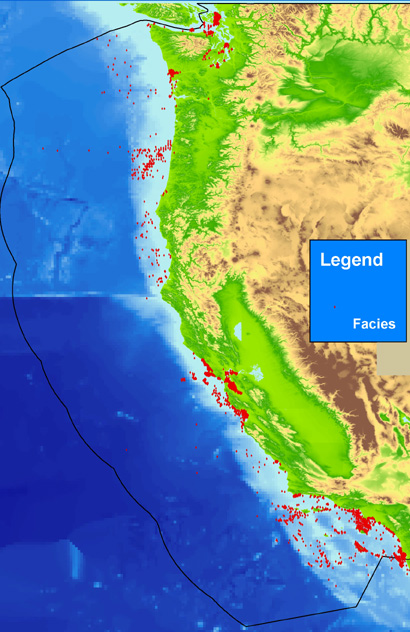
The facies layer can be used to investigate the known information about a particular area of the sea floor. These data are intended for science researchers, policy makers, students, and the general public. The data can be used with geographic information systems (GIS) software to display geologic and oceanographic information.
Various, Unknown, See Data Sources page (<https://pubs.usgs.gov/2006/ds/182.pac_sources.html> and links therein) or the relationally linked file PAC_SRC.txt (<https://pubs.usgs.gov/ds/2006/182/data/pac_src.txt>), and links provided therein, within this publication for the specific sources and associated metadata.: Various, Various.
Person who carried out this activity:
831.427.4727 (voice)
jareid@usgs.gov
Accuracy of each attribute is dependent on the accuracy of the original source description and the values calculated by the mining software, dbSEABED. Values are based on filters using fuzzy set theory and represent a measure of truth about the attribute.
Locational accuracy is dependent on both the accuracy of the navigational technique and the level of detail about the location as recorded in the individual data sources, and may vary widely (ie.g., from 0.005 km (differential GPS) in the more recent surveys to greater than 2 km based on radar, Loran, or dead reckoning in the older surveys. Users of the data should note the metadata written about the original sources and use their own criteria for assessing the accuracy of the locations.
Depth determinations, both water depth and subsample depth, are dependent on the accuracy of the depth determination technique and the level of detail noted in the original source. Users of the data should note the metadata written about the original sources and use their own criteria for assessing the accuracy of the locations.
Additional useable data may exist in this area; the authors appreciate any information and leads.
Data in the usSEABED data collection are based on the observations and analyses of others, filtered through a unifying and mining software. Each source report varies in type of information/data recorded and format. Only those observations that are recorded can be filtered and mined; only presence (not absences) of information can be noted.
Are there legal restrictions on access or use of the data?
- Access_Constraints: None
- Use_Constraints:
- Public domain data from the U.S. Government are freely redistributable with the proper metadata and source attribution. Please recognize the U.S. Geological Survey (USGS) as the source of this information.
831.427.4727 (voice)
jareid@usgs.gov
USGS Data Series 182 (data downloadable through the web)
Although this data set has been used by the U.S. Geological Survey (USGS), no warranty, expressed or implied, is made by the USGS as to the accuracy of the data and/or related materials. The act of distribution shall not constitute any such warranty, and no responsibility is assumed by the USGS in the use of these data or related materials. Trade, firm, or product names and other references to non-USGS products and services are provided for information only and do not constitute endorsement or warranty, express or implied, by the USGS, USDOI, or U.S. Government, as to their suitability, content, usefulness, functioning, completeness, or accuracy.
| Data format: | Text file containing data input to usSEABED. Fields are comma separated values. First record of file contains field names. in format ASCII text Size: 2.17 MB |
|---|---|
| Network links: |
<https://pubs.usgs.gov/ds/2006/182/data/PAC_FAC.txt> <https://pubs.usgs.gov/ds/2006/182/data_cata.html> |
| Data format: | The SHP file contains the geospatial data. The SHX file contains the index of the geospatial data. The DBF file contains the attribute data in dBASE format. The PRJ file contains the coordinate system information (optional). The AVL file contains the legend information (optional). The SBN and SBX files contain the spatial index of the geospatial data (optional). in format SHP ESRI Shapefile |
|---|---|
| Network links: |
<https://pubs.usgs.gov/ds/2006/182/data/pac_fac.zip> <https://pubs.usgs.gov/ds/2006/182/data_cata.html> |
None; these data are provided as comma-delimited text files useable in most softwares. Additionally, these data are available in Environmental Systems Research Institute (ESRI) shapefile format. The user must have ArcGIS® or ArcView® 3.0 or greater software to read and process the data file. In lieu of ArcView® or ArcGIS®, the user may utilize another GIS application package capable of importing the data. A free data viewer, ArcExplorer®, capable of displaying the data is available from ESRI at <http://www.esri.com>.
831-427-4727 (voice)
jareid@usgs.gov