Data Series 282
U.S. GEOLOGICAL SURVEY
Data Series 282
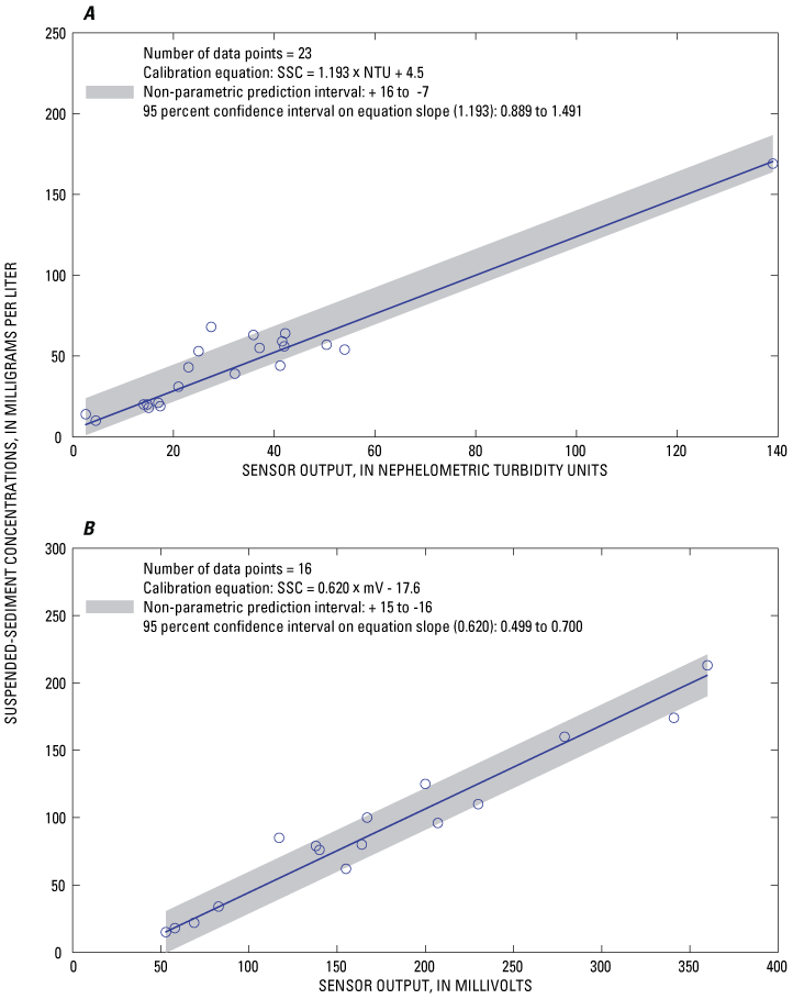
Figure 26. Graphs showing calibration of near-bottom optical sensors, October 1–March 30 and April 20 –September 30 at Channel Marker 17, South San Francisco Bay, California, water year 2005.

![]() U.S. Department of the Interior | U.S. Geological Survey
U.S. Department of the Interior | U.S. Geological Survey
Persistent URL: https://pubs.water.usgs.gov/ds282
Page Contact Information: Publications Team
Page Last Modified: Monday, 28-Nov-2016 12:30:20 EST
