U.S. Geological Survey Data Series 296
1ETI, St. Petersburg, FL 33701.
2U.S. Geological Survey, St. Petersburg, FL 33701.
3University of Texas at Austin - Bureau of Economic Geology, Austin, TX 78712.
U.S. Department of the Interior
U.S. Geological Survey
Florida Integrated Science Center - St. Petersburg
Publications are available from USGS Information Services, Box 25286, Federal Center, Denver, CO 80225-0046 (telephone 1-888-ASK-USGS; e-mail: infoservices@usgs.gov).
Page Contents: |
||||
 |
||||
This DVD publication was prepared by an agency of the United States Government. Although these data have been processed successfully on a computer system at the U.S. Geological Survey, no warranty expressed or implied is made regarding the display or utility of the data on any other system, or for general or scientific purposes, nor shall the act of distribution imply any such warranty. The U.S. Geological Survey shall not be held liable for improper or incorrect use of the data described and (or) contained herein. Reference herein to any specific commercial product, process, or service by trade name, trademark, manufacturer, or otherwise does not constitute or imply its endorsement, recommendation, or favoring by the United States Government or any agency thereof.
This disc is readable on any computing platform that has standard DVD driver software installed. The minimum software requirements are a Web browser, Adobe Reader, and a text editor. If you cannot fully access the information on this page, please contact USGS Information Services at infoservices@usgs.gov or 1-888-ASK-USGS.
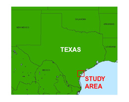
In July of 1996, the U.S. Geological Survey (USGS) conducted geophysical surveys to investigate the shallow geologic framework from Nueces Bay to Copano Bay, Texas, as part of the USGS Coastal Change and Transport (CCT) study. This report serves as an archive of unprocessed digital and digitized analog boomer seismic reflection data, trackline maps, navigation files, GIS files, cruise log, and formal FGDC metadata. Filtered and gained digital images of the seismic profiles are also provided. Refer to the Acronyms page for expansion of acronyms and abbreviations used in this report.
The archived trace data are in standard Society of Exploration Geophysicists (SEG) SEG-Y format (Barry and others, 1975) and may be downloaded and processed with commercial or public domain software such as Seismic Unix (SU). Example SU processing scripts and USGS software for viewing the SEG-Y files (Zihlman, 1992) are also provided. Note: The web version of this archive does not contain the SEG-Y trace files. These files are very large and would require extremely long download times. To obtain the complete DVD archive, contact USGS Information at 1-888-ASK-USGS or infoservices@usgs.gov.
The original trace files for lines tx711_04, tx711_05, tx712_13, tx712_14, tx713_18, tx713_19, tx713_20, tx713_22, tx714_25, tx714_27, tx716_39, and tx716_42 were divided into two or more trace files each (for example, tx711_04 became tx711_04a and tx711_04b) because the original total number of traces exceeded the maximum allowed by the processing software.
The USGS Florida Integrated Science Center (FISC) - St. Petersburg assigns a unique identifier to each cruise or field activity. For example, 96CCT02 tells us the data were collected in 1996 for the Coastal Change and Transport (CCT) study and the data were collected during the second field activity for that study in that calendar year. Refer to http://walrus.wr.usgs.gov/infobank/programs/html/definition/activity.html for a detailed description of the method used to assign the field activity ID.
The boomer plate is an acoustic energy source that consists of capacitors charged to a high voltage and discharged through a transducer in the water. The transducer is towed on a sled on the surface waters and when discharged emits a short acoustic pulse, or shot, that propagates through the water and sediment column. The acoustic energy is reflected at density boundaries (such as the seafloor or sediment layers beneath the seafloor), detected by the receiver, and recorded by a PC-based seismic acquisition system. This process is repeated at timed intervals (for example, 0.5 s) and recorded for specific intervals of time (for example, 100 ms). In this way, a two-dimensional vertical image of the shallow geologic structure beneath the ship track is produced. Figure 1 displays acquisition geometry for this cruise, and table 1 is a summary of acquisition parameters. Refer to the FACS equipment log (12 KB PDF) for details about the acquisition equipment used. Scanned images of the handwritten cruise logbook (522 KB) are also provided as a PDF file.
The unprocessed seismic data are stored in SEG-Y format (Barry and others, 1975). For a detailed description of the data format, refer to http://www.seg.org/publications/tech-stand. See the How To Download SEG-Y Data page for download instructions. The printable profiles provided here are GIF images that were filtered and gained using Seismic Unix software. Refer to the Software page for details about the processing and examples of the processing scripts.
The data were originally recorded on magneto-optical (MO) discs and plotted daily in an analog format as paper printouts. Examination of the data, after the cruise, showed that only 10 (tx715_29 - tx715_38) of the 44 lines collected could be recovered from the discs. To rescue the remaining 34 tracklines (with the exception of lines tx710_12 and tx713_24, which were deleted in the field), the paper records were scanned as TIFF images and converted to SEG-Y files (complete with time stamps, shotpoints, and navigation) using Chesapeake Technology, Inc. (CTI) ImageToSEGY software. NOTE: Because these records were originally printouts that were later digitally scanned, handwritten and plotter-generated annotations as well as handdrawn interpretations can be seen in both the processed GIF printable profiles and high resolution scanned TIFF images included with this archive.
Navigation fixes for the converted lines were only available at 5-minute intervals because the navigation is plotted on the paper record using this increment. ImageToSEGY, nevertheless, creates an interpolated point for every shot it created from the scanned image; therefore, the shot numbers printed on the new, converted records do not match the original shots printed out on the older analog paper records.
The printable profiles can be viewed from the Profiles page or from links located on the Location Map page. Links to the scanned TIFF images of the paper records can also be found on the Profiles page. Detailed information about the navigation system used can be found in table 1 and the FACS equipment log (12 KB PDF). To view the trackline maps and navigation files, and for more information about these items, see the Navigation page.
The Disc Contents page is a diagram of the location of all files and folders contained on this disc and provides links to these files and folders.
To access the information contained on this disc, use a Web browser to open the file index.html. This report is divided into five sections: Navigation Data and Maps, Seismic Profiles, Field Activity Logs, Metadata, and Software. Links at the top and bottom of each page provide access to these sections. This report contains links to the USGS and collaborators or other resources that are accessible only if access to the Internet is available while viewing these documents.
Funding and (or) support for this study was provided by the USGS Coastal and Marine Geology Program. This document was improved by the reviews of Charlene Sullivan (ETI) and Nick Ferina (USGS) at the FISC - St. Petersburg, Florida.
Barry, R.M., Cavers, D.A., and Kneale, C.W., 1975, Recommended standards for digital tape formats: Geophysics, v. 40, no. 2, p. 344-352. Also available online at http://www.seg.org/publications/tech-stand.
Zihlman, F.N., 1992, DUMPSEGY V1.0: A program to examine the contents of SEG-Y disk-image seismic data: U.S. Geological Survey Open-File Report 92-590, 28 p.

![]() U.S. Department of the Interior |
U.S. Geological Survey
U.S. Department of the Interior |
U.S. Geological Survey
URL: pubsdata.usgs.gov/pubs/ds/296/index.html
Page Contact Information: Publishing Services
Page Last Modified: Monday, 28-Nov-2016 12:48:07 EST