Multibeam Sonar Mapping and Modeling of a Submerged Bryophyte Mat in Crater Lake, Oregon

Metadata also available as

Frequently-anticipated questions:


What does this data set describe?

Title:
Multibeam Sonar Mapping and Modeling of a Submerged Bryophyte Mat in Crater Lake, Oregon
Abstract:
ESRI GRID format data of Crater Lake OR Bathymetric Positional Index (BPI) calculated from 2000 multibeam bathymetry data.
Supplemental_Information:
Information for USGS Coastal and Marine Geology related activities are online at <http://walrus.wr.usgs.gov/infobank/n/n106or/html/n-1-06-or.meta.html>

  1. How should this data set be cited?

    United States Geological Survey, 2008, Multibeam Sonar Mapping and Modeling of a Submerged Bryophyte Mat in Crater Lake, Oregon:.

    Online Links:

    This is part of the following larger work.

    Dartnell, Peter, Collier, Robert, Buktenica, Mark, Jessup, Steven, Girdner, Scott, and Triezenberg, Peter, 2008, Multibeam Sonar Mapping and Modeling of a Submerged Bryophyte Mat in Crater Lake, Oregon: Data Series 366, U.S. Geological Survey, Coastal and Marine Geology Program, Western Coastal and Marine Geology, Menlo Park, CA.

    Online Links:

  2. What geographic area does the data set cover?

    West_Bounding_Coordinate: -122.16555054
    East_Bounding_Coordinate: -122.0498355
    North_Bounding_Coordinate: 42.97851439
    South_Bounding_Coordinate: 42.90490823

  3. What does it look like?

    <https://pubs.usgs.gov/ds/366/images/bpi.jpg> (JPEG)
    Illustration of Bathymetric Positional Index calculated from 2000 multibeam bathymetry data set.

  4. Does the data set describe conditions during a particular time period?

    Beginning_Date: 06-Aug-2004
    Ending_Date: 02-Apr-2008
    Currentness_Reference: ground condition

  5. What is the general form of this data set?

    Geospatial_Data_Presentation_Form: Raster

  6. How does the data set represent geographic features?

    1. How are geographic features stored in the data set?

      This is a Raster data set. It contains the following raster data types:

      • Dimensions, type Grid Cell

    2. What coordinate system is used to represent geographic features?

      Grid_Coordinate_System_Name: Universal Transverse Mercator
      Universal_Transverse_Mercator:
      UTM_Zone_Number: 10
      Transverse_Mercator:
      Scale_Factor_at_Central_Meridian: 0.9996
      Longitude_of_Central_Meridian: -123.00000
      Latitude_of_Projection_Origin: 0.00000
      False_Easting: 500000.0
      False_Northing: 0.00

      Planar coordinates are encoded using coordinate pair
      Abscissae (x-coordinates) are specified to the nearest 2.0
      Ordinates (y-coordinates) are specified to the nearest 2.0
      Planar coordinates are specified in Meters

      The horizontal datum used is WGS84.
      The ellipsoid used is WGS84.
      The semi-major axis of the ellipsoid used is 6378137.00 meters.
      The flattening of the ellipsoid used is 1/0.003352811.

  7. How does the data set describe geographic features?

    Entity_and_Attribute_Overview:
    BPI15 is an ESRI GRID file with the following attributes: Cell Size = 2.000 Data Type: Integer Number of Rows = 4137 Number of Columns = 4677
    BOUNDARY Xmin = 568119.572 Xmax = 577473.572 Ymin = 4750592.815 Ymax = 4758866.815

    Entity_and_Attribute_Detail_Citation: none


Who produced the data set?

  1. Who are the originators of the data set? (may include formal authors, digital compilers, and editors)

  2. Who also contributed to the data set?

  3. To whom should users address questions about the data?

    Peter Dartnell
    U.S. Geological Survey, Coastal and Marine Geology
    Physical Scientist
    345 Middlefield Rd MS-999
    Menlo Park, CA 94025-3561
    USA

    (650) 329-5460 (voice)
    (650) 329-5411 (FAX)
    pdartnell@usgs.gov


Why was the data set created?

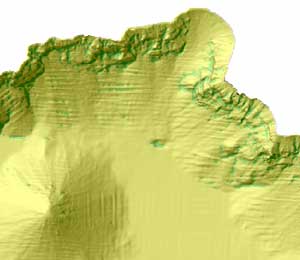
These data are intended for science researchers, students, policy makers, and the general public. The data can be used with geographic information systems (GIS) or other software to display Bathymetric Positional Index in Crater Lake, OR.


How was the data set created?

  1. From what previous works were the data drawn?

    dds-72 (source 1 of 1)
    U.S. Geological Survey, 200103, 2000 Multibeam Sonar Survey of Crater Lake Oregon: Data, GIS, Images, and Movies: U.S. Geological Survey, Menlo Park, CA.

    Online Links:

    Type_of_Source_Media: online
    Source_Contribution: base material

  2. How were the data generated, processed, and modified?

    Date: 2006 (process 1 of 1)
    The Bathymetric Positional Index was calculated from the 2000 multibeam bathymetry data using ESRI GRID map algebra and the following formula, BPI = int((bathymetry - focalmean(bathymetry, annulus, irad, orad)) + 0.5), where: int = GIS integer function, focalmean = GIS area function, annulus = processing neighborhood comprised of one smaller circle within a larger circle (donut shape), irad = inner radius of annulus in cells, and orad = outer radius or annulus in cells.

    Person who carried out this activity:

    Peter Dartnell
    U.S. Geological Survey, Coastal and Marine Geology
    Physical Scientist
    345 Middlefield Rd MS-999
    Menlo Park, CA 94025-3561
    USA

    (650) 329-5460 (voice)
    (650) 329-5411 (FAX)
    pdartnell@usgs.gov

  3. What similar or related data should the user be aware of?


How reliable are the data; what problems remain in the data set?

  1. How well have the observations been checked?

    Not applicable for raster data.

  2. How accurate are the geographic locations?

    0.5 meters

  3. How accurate are the heights or depths?

    0.05 percent of the water depth.

  4. Where are the gaps in the data? What is missing?

    Complete

  5. How consistent are the relationships among the observations, including topology?

    Unspecified


How can someone get a copy of the data set?

Are there legal restrictions on access or use of the data?

Access_Constraints: None
Use_Constraints:

Please recognize the U.S. Geological Survey (USGS), the National Park Service (NPS), Oregon State University (OSU), and Southern Oregon University (SOU) as the source of this information. USGS-authored or produced data and information are in the public domain.

  1. Who distributes the data set? (Distributor 1 of 1)

    U.S. Geological Survey, Information Services
    345 Middlefield Rd MS-532
    Menlo Park, CA 94025-3561
    USA

    (650) 329-4309 (voice)

  2. What's the catalog number I need to order this data set?

    N-1-06-OR data sets

  3. What legal disclaimers am I supposed to read?


    These data not intended for navigational purposes.
    Although these data have been used by the U.S. Geological Survey, U.S. Department of the Interior, these data and information are provided with the understanding that they are not guaranteed to be usable, timely, accurate, or complete. Users are cautioned to consider carefully the provisional nature of these data and information before using them for decisions that concern personal or public safety or the conduct of business that involves substantial monetary or operational consequences. Conclusions drawn from, or actions undertaken on the basis of, such data and information are the sole responsibility of the user.

    Neither the U.S. Government nor any agency thereof, nor any of their employees, contractors, or subcontractors, make any warranty, express or implied, nor assume any legal liability or responsibility for the accuracy, completeness, or usefulness of any data, software, information, apparatus, product, or process disclosed, nor represent that its use would not infringe on privately owned rights.

    Trade, firm, or product names and other references to non-USGS products and services are provided for information only and do not constitute endorsement or warranty, express or implied, by the USGS, USDOI, or U.S. Government, as to their suitability, content, usefulness, functioning, completeness, or accuracy.


  4. How can I download or order the data?


Who wrote the metadata?

Dates:
Last modified: 07-Apr-2008
Metadata author:
Peter Dartnell
U.S. Geological Survey, Coastal and Marine Geology
Physical Scientist
345 Middlefield Rd MS-999
Menlo Park, CA 94025-3561
USA

(650) 329-5460 (voice)
(650) 329-5411 (FAX)
pdartnell@usgs.gov

Metadata standard:
Content Standard for Digital Geospatial Metadata ("CSDGM version 2") (FGDC-STD-001-1998)


Generated by mp version 2.9.2 on Tue Jun 10 15:04:49 2008