USGS - science for a changing world
Minerals Management Service

U.S. Geological Survey Data Series 370

92ER4 Map B


Home | Acronyms | Contents | Navigation | Profiles | Logs | Metadata | GIS


Click on a trackline number to view the scanned GIF image of the seismic profile.
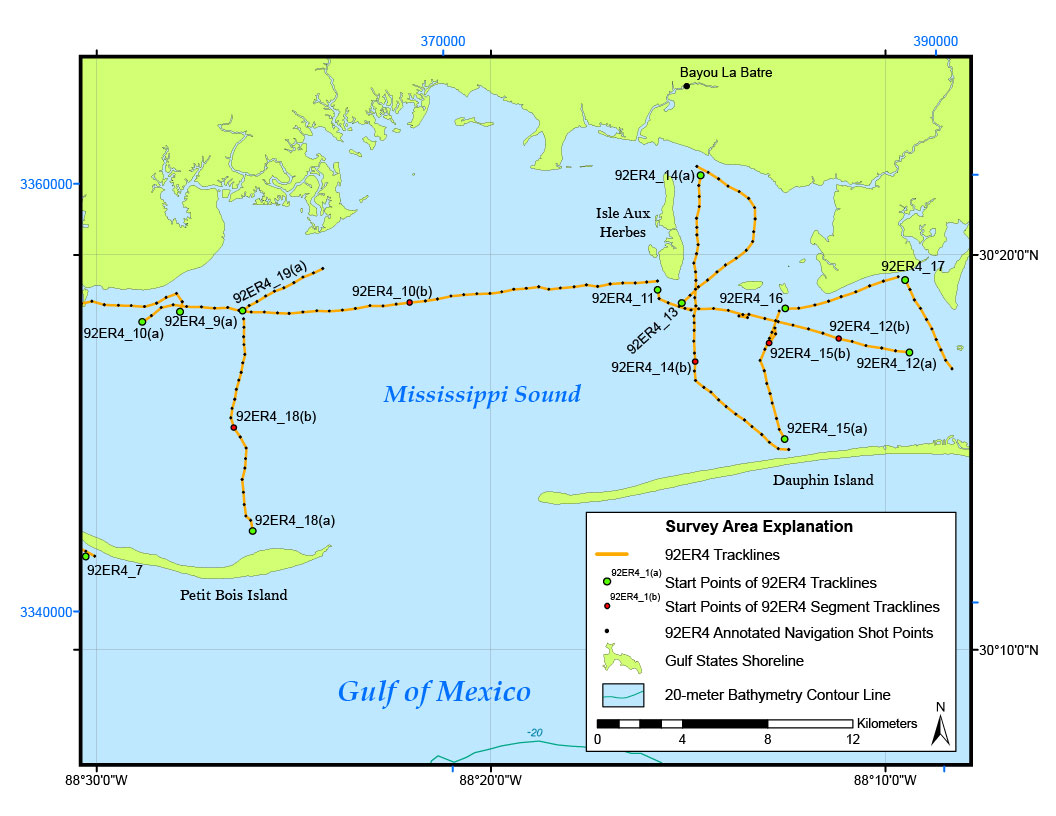
 92ER4 Map B with annotated navigation shots and tracklines92ER4_13 printable profile92ER4_19(a) printable profile92ER4_17 printable profile92ER4_12(a) printable profile92ER4_12(b) printable profile92ER4_11 printable profile92ER4_14(b) printable profile92ER4_15(b) printable profile92ER4_15(a) printable profile92ER4_16 printable profile92ER4_14(a) printable profile92ER4_7 printable profile92ER4_18(a) printable profile92ER4_10(b) printable profile92ER4_18(b) printable profile92ER4_9(a) printable profile92ER4_10(a) printable profile


92ER4 Location Map | 92ER4 Map A| 92ER4 Map B


Home | Acronyms | Contents | Navigation | Profiles | Logs | Metadata | GIS

Accessibility FOIA Privacy Policies and Notices

Take Pride in America logo FirstGov logo U.S. Department of the Interior | U.S. Geological Survey
URL: https://pubsdata.usgs.gov/pubs/ds/370/html/92ER4_B.html
Page Contact Information: Publishing Services
Page Last Modified: Monday, 28-Nov-2016 13:30:58 EST