Data Series 393
|
|
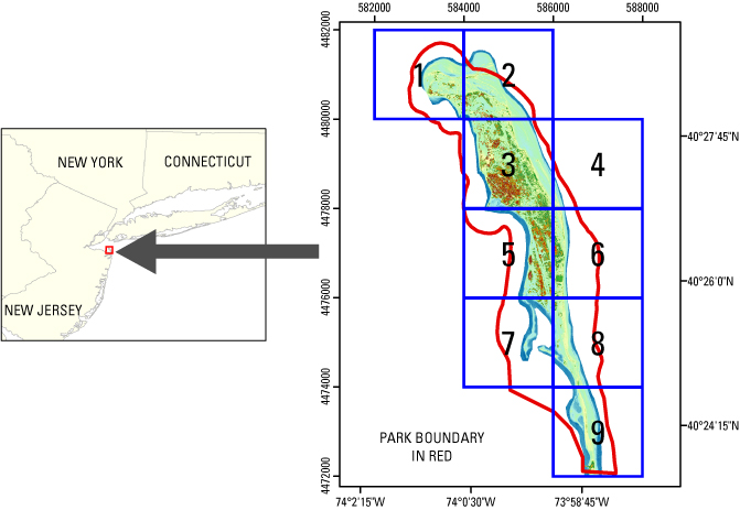
EAARL Coastal Topography–Sandy Hook 2007Amar Nayegandhi,1 John C. Brock,2 C. Wayne Wright,3 Sara Stevens,4 Xan Yates,1 and Jamie M. Bonisteel1 1Jacobs Technology Inc., St. Petersburg, FL; 2U.S. Geological Survey, Coastal and Marine Geology Program, Reston, VA; 3U.S. Geological Survey, Florida Integrated Science Center, St. Petersburg, FL; 4National Park Service, Northeast Coastal and Barrier Network, Kingston, RI. This DVD contains Lidar-derived bare earth (BE) and first surface (FS) topography GIS datasets of the Gateway National Recreation Area's Sandy Hook Unit in New Jersey. These datasets were acquired on May 16, 2007. Click on a tile number (1-9) to view the corresponding images and links to each data directory.
|

![]() U.S. Department of the
Interior | U.S. Geological Survey
U.S. Department of the
Interior | U.S. Geological Survey
URL: https://pubsdata.usgs.gov/pubs/ds/393/index.html
Page Contact Information: Feedback
Maintained by: Publishing Service Center
Page Last Modified: Monday, 28-Nov-2016 13:06:16 EST