Data Series 395

LIDAR Illustration

Home

Purpose Link

Metadata Link

Collaborators Link

Acronyms Link

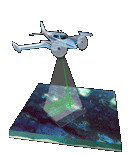
EAARL Submerged Topography–U.S. Virgin Islands 2003

Amar Nayegandhi,1 John C. Brock,2 C. Wayne Wright,3 Matt Patterson,4 Xan Yates,1 and Jamie M. Bonisteel1

1Jacobs Technology Inc., St. Petersburg, FL; 2U.S. Geological Survey, Coastal and Marine Geology Program, Reston, VA; 3U.S. Geological Survey, Florida Integrated Science Center, St. Petersburg, FL; 4National Park Service, South Florida-Caribbean Network, Miami, FL.


This DVD contains Lidar-derived submerged topography GIS datasets of a portion of the U.S. Virgin Islands. These datasets were acquired on April 21, 23, and 30, May 2, and June 14 and 17, 2003.

UTM Map of the U.S. Virgin Islands 2003

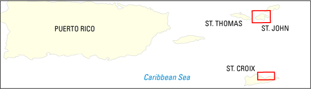
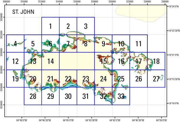
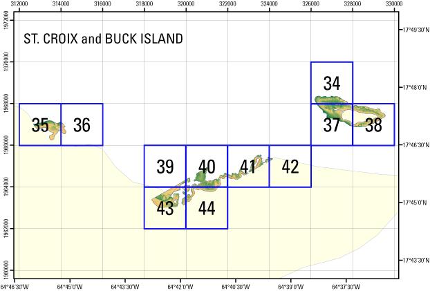
Click on a tile number (1-44) to view the corresponding images and links to each data directory.


UTM Map of St. John, U.S. Virgin Islands 2003 Tile e324_n2028_20Tile e322_n2028_20Tile e320_n2026_20Tile e318_n2026_20Tile e320_n2030_20Tile e318_n2030_20Tile e312_n2026_20Tile e310_n2026_20Tile e312_n2028_20Tile e310_n2028_20Tile e308_n2028_20Tile e312_n2030_20Tile e320_n2032_20Tile e318_n2032_20Tile e316_n2032_20Tile e314_n2032_20Tile e312_n2032_20Tile e310_n2032_20Tile e308_n2032_20Tile e316_n2034_20Tile e314_n2034_20Tile e312_n2034_20Tile e322_n2032_20Tile e308_n2030_20Tile e310_n2030_20Tile e322_n2030_20Tile e324_n2030_20Tile e320_n2028_20Tile e318_n2028_20Tile e316_n2028_20Tile e314_n2028_20Tile e316_n2026_20Tile e314_n2026_20

  • St. John Mosaic GeoTIFF DEM .tif File

    PLEASE NOTE: GeoTIFF files can only be viewed using software capable of reading georeferenced 32-bit floating point format imagery, such as Global Mapper or ESRI ArcMap, and must use the WGS84 UTM Zone 20 projection.


UTM Map of St. Croix and Buck Island, U.S. Virgin Islands 2003 Tile e320_n1966_20Tile e320_n1964_20Tile e318_n1964_20Tile e328_n1968_20Tile e314_n1968_20Tile e312_n1968_20Tile e326_n1970_20Tile e326_n1968_20Tile e324_n1966_20Tile e322_n1966_20Tile e318_n1966_20

  • St. Croix and Buck Island Mosaic GeoTIFF DEM .tif File

    PLEASE NOTE: GeoTIFF files can only be viewed using software capable of reading georeferenced 32-bit floating point format imagery, such as Global Mapper or ESRI ArcMap, and must use the WGS84 UTM Zone 20 projection.


Accessibility FOIA Privacy Policies and Notices

Take Pride in America home page USA Gov LinkU.S. Department of the Interior | U.S. Geological Survey
URL: https://pubsdata.usgs.gov/pubs/ds/395/index.html
Page Contact Information: Feedback
Maintained by: Publishing Service Center
Page Last Modified: Monday, 28-Nov-2016 13:14:43 EST