Data Series 412
U.S. GEOLOGICAL SURVEY
Data Series 412
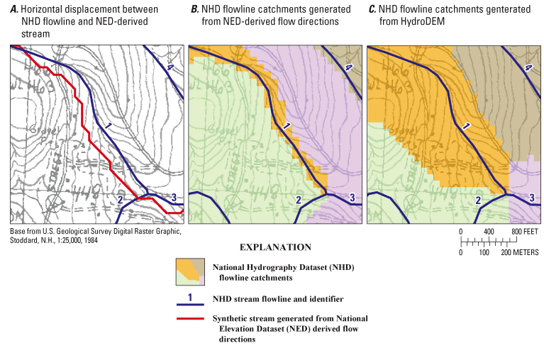
Figure 3. Stream locations determined by (A) differences in drainage between the NHD and flow paths of a NED-derived stream, (B) resultant NHD catchment delineations using unmodified NED digital elevation model (DEM) data, and (C) resultant NHD catchment delineations using the HydroDEM. (Modified from C.M. Johnston, U.S. Geological Survey, written commun., 2008.)

![]() U.S. Department of the Interior | U.S. Geological Survey
U.S. Department of the Interior | U.S. Geological Survey
URL: http://pubsdata.usgs.gov/pubs/ds/412/figure3.html
Page Contact Information: Contact USGS
Page Last Modified: Monday, 28-Nov-2016 14:15:57 EST
