Data Series 417
|
|
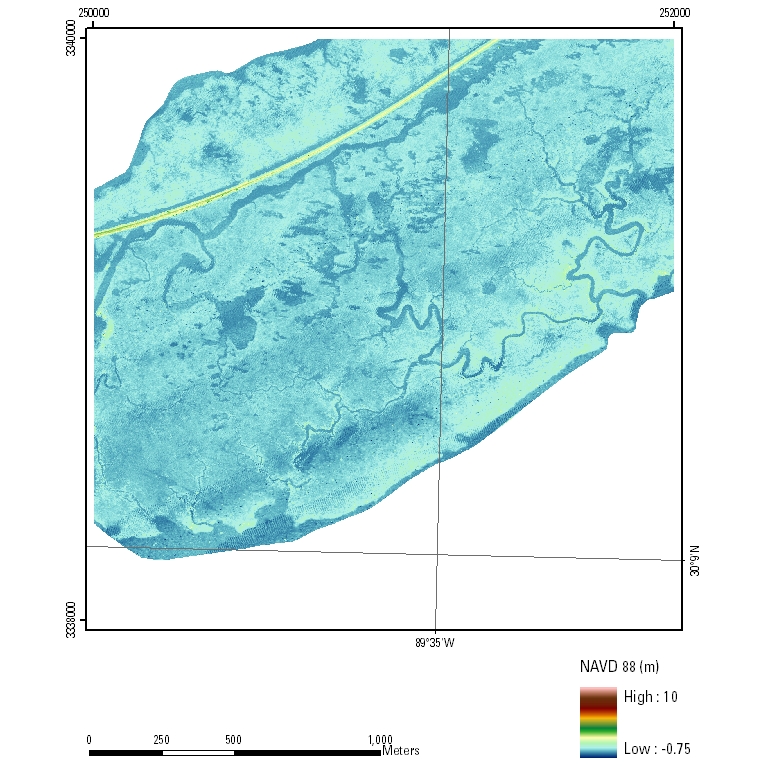
EAARL Coastal Topography–Pearl River Delta 2008: First SurfaceUTM Tile e250_n3340_16
PLEASE NOTE: GeoTIFF files can only be viewed using software capable of reading georeferenced 32-bit floating point format imagery, such as Global Mapper or ESRI ArcMap. |

![]() U.S. Department of the
Interior | U.S. Geological Survey
U.S. Department of the
Interior | U.S. Geological Survey
URL:
Page Contact Information: Feedback
Page Last Modified: