U.S. Geological Survey Data Series 420
| Item | Details | Trackline Map – UTM Zone 17 |
|---|---|---|
| Minimum Northing Minimum Latitude |
3185922.3 28 47.7669' N |
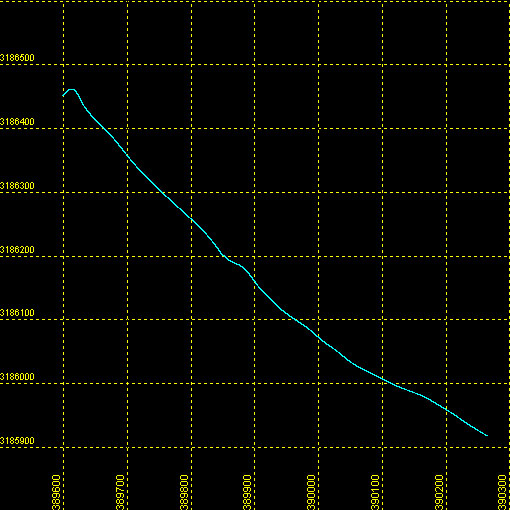 |
| Maximum Northing Maximum Latitude |
3186455.5 28 48.0590' N |
|
| Minimum Easting Minimum Longitude |
389591.6 082 07.8782' W |
|
| Maximum Easting Maximum Longitude |
390269.7 082 07.4645' W |
|Back|

![]() U.S. Department of the Interior |
U.S. Geological Survey
U.S. Department of the Interior |
U.S. Geological Survey
URL: DVD/maps/linenav/chirp/08c02_nav.html
Page Contact Information: Feedback
Page Last Modified: March 26, 2009 15:25 EST
