U.S. Geological Survey Data Series 421
| Item | Details | Trackline Map &ndash UTM Zone 17 |
|---|---|---|
| Minimum Northing Minimum Latitude |
3156333.5 28 31.9297' N |
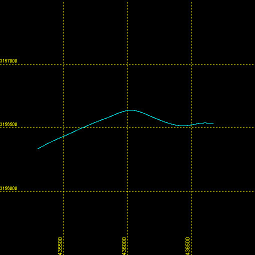 |
| Maximum Northing Maximum Latitude |
3156635.6 28 32.0975' N |
|
| Minimum Easting Minimum Longitude |
435292.2 081 39.6832' W |
|
| Maximum Easting Maximum Longitude |
436677.6 081 38.8346' W |
|Back|

![]() U.S. Department of the Interior |
U.S. Geological Survey
U.S. Department of the Interior |
U.S. Geological Survey
URL: DVD/maps/linenav/08b111_nav.html
Page Contact Information: Feedback
Page Last Modified: March 26, 2009 17:37 EST
