U.S. Geological Survey Data Series 421
| Navigation Statistics | ||
| Item | Description | Details |
| Minimum Northing Minimum Latitude |
3154141.3 28 30.7484' N |
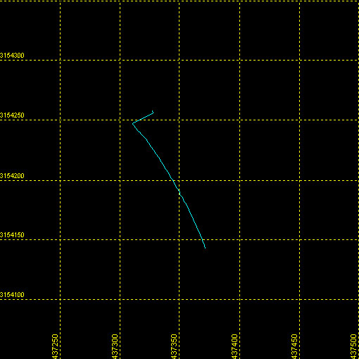 |
| Maximum Northing Maximum Latitude |
3154257.5 28 30.8116' N |
|
| Minimum Easting Minimum Longitude |
437309.6 081 38.4389' W |
|
| Maximum Easting Maximum Longitude |
437372.0 081 38.4010' W |
|
|Back|

![]() U.S. Department of the Interior |
U.S. Geological Survey
U.S. Department of the Interior |
U.S. Geological Survey
URL: DVD/maps/linenav/08b133_nav.html
Page Contact Information: Feedback
Page Last Modified: March 26, 2009 17:37 EST
