U.S. Geological Survey Data Series 421
| Item | Details | Trackline Map &ndash UTM Zone 17 |
|---|---|---|
| Minimum Northing Minimum Latitude |
3186836.5 28 48.4382' N |
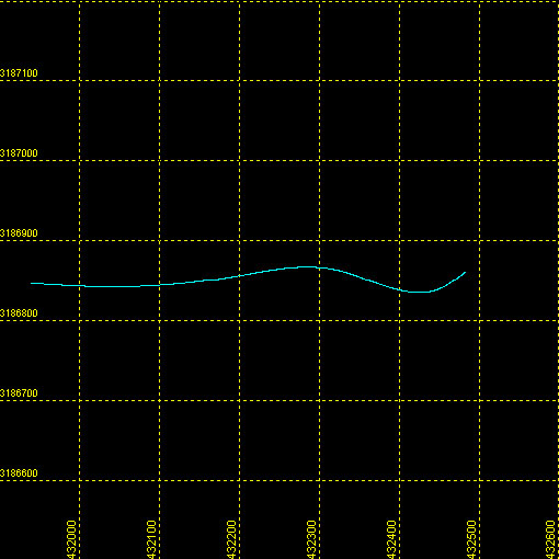 |
| Maximum Northing Maximum Latitude |
3186865.6 28 48.4557' N |
|
| Minimum Easting Minimum Longitude |
431938.2 081 41.8493' W |
|
| Maximum Easting Maximum Longitude |
432484.2 081 41.5136' W |
|Back|

![]() U.S. Department of the Interior |
U.S. Geological Survey
U.S. Department of the Interior |
U.S. Geological Survey
URL: DVD/maps/linenav/08b50_nav.html
Page Contact Information: Feedback
Page Last Modified: March 26, 2009 17:37 EST
